Category:Wisbech St Mary
Jump to navigation
Jump to search

village in the United Kingdom  | |||||
| Upload media | |||||
| Instance of | |||||
|---|---|---|---|---|---|
| Location | Fenland, Cambridgeshire, East of England, England | ||||
 | |||||
Subcategories
This category has the following 6 subcategories, out of 6 total.
G
M
T
W
Media in category "Wisbech St Mary"
The following 200 files are in this category, out of 504 total.
(previous page) (next page)-
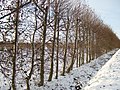
 "The railway field" - geograph.org.uk - 1658128.jpg 640 × 480; 65 KB
-
 A bit of heavy pruning on Station Road - geograph.org.uk - 3118761.jpg 2,848 × 2,136; 3.16 MB
-
 A display of chainsaws - geograph.org.uk - 2494669.jpg 640 × 480; 129 KB
-
 A gap in the trees - geograph.org.uk - 1627404.jpg 640 × 480; 112 KB
-
 A grass track off Willock Lane - geograph.org.uk - 1550286.jpg 640 × 480; 81 KB
-
 A strong footbridge - geograph.org.uk - 1658300.jpg 640 × 480; 150 KB
-
 A tree-lined ditch - geograph.org.uk - 1627498.jpg 640 × 480; 157 KB
-
 A young orchard off Bevis Lane - geograph.org.uk - 1549834.jpg 640 × 480; 112 KB
-
 A47 crossing the River Nene at Guyhirn - geograph.org.uk - 4924244.jpg 800 × 592; 153 KB
-
 A47 eastbound - geograph.org.uk - 5446392.jpg 640 × 480; 54 KB
-
 A47 eastbound - geograph.org.uk - 5446396.jpg 640 × 480; 41 KB
-
 A47 Fen Road leaving Guyhirn - geograph.org.uk - 5128415.jpg 640 × 481; 44 KB
-
 A47 heading east at Thorney Toll - geograph.org.uk - 2919992.jpg 640 × 480; 39 KB
-
 A47 lay-by - geograph.org.uk - 5446382.jpg 640 × 480; 49 KB
-
 A47 lay-by - geograph.org.uk - 5585057.jpg 640 × 480; 64 KB
-
 A47 Main Road in Thorney Toll - geograph.org.uk - 4927888.jpg 800 × 472; 78 KB
-
 A47 near Bishops Farm - geograph.org.uk - 5128433.jpg 640 × 480; 57 KB
-
 A47 Thorney Road near Hall's Farm - geograph.org.uk - 5128422.jpg 640 × 481; 38 KB
-
 A47 Wisbech Road at Thorney Toll - geograph.org.uk - 4926784.jpg 800 × 536; 103 KB
-

-
 A47 Wisbech Road towards Thorney Toll - geograph.org.uk - 4926780.jpg 800 × 584; 141 KB
-
 A47eastbound - geograph.org.uk - 5446376.jpg 640 × 474; 42 KB
-
 A47eastbound - geograph.org.uk - 5446378.jpg 640 × 480; 43 KB
-
 A47eastbound - geograph.org.uk - 5446379.jpg 640 × 480; 38 KB
-
 A47eastbound - geograph.org.uk - 5446380.jpg 640 × 472; 40 KB
-
 A47eastbound - geograph.org.uk - 5446381.jpg 640 × 480; 39 KB
-
 Acer in Autumn sunshine - geograph.org.uk - 4716718.jpg 4,608 × 3,456; 6.09 MB
-
 Across the fields to the remains of Murrow West station - geograph.org.uk - 3791631.jpg 2,392 × 1,396; 2.64 MB
-
 Adventurers' Land near Guyhirn - geograph.org.uk - 2377797.jpg 2,848 × 2,136; 3 MB
-
 Aerobatic display - geograph.org.uk - 2494656.jpg 640 × 480; 53 KB
-
 After the sugar beet harvest on Mouth Lane near Guyhirn - geograph.org.uk - 6010927.jpg 3,704 × 2,931; 1.97 MB
-
 Agricultural dealers, College Lodge - geograph.org.uk - 3984114.jpg 640 × 480; 72 KB
-
 Agricultural land off Gull Drove, Guyhirn - geograph.org.uk - 2368633.jpg 2,848 × 2,136; 3.04 MB
-
 Almost finished - geograph.org.uk - 1658535.jpg 640 × 480; 86 KB
-
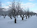 Apple orchard in mid winter - geograph.org.uk - 1658412.jpg 640 × 480; 92 KB
-
 Bank of The River Nene near Wisbech - geograph.org.uk - 1505221.jpg 640 × 480; 114 KB
-
 Bare field by College Lodge - geograph.org.uk - 2257415.jpg 1,600 × 1,200; 1,024 KB
-
 Barn conversion - geograph.org.uk - 4847593.jpg 4,320 × 3,240; 5.43 MB
-
 Bayford House - geograph.org.uk - 3144725.jpg 1,024 × 677; 123 KB
-

-
 Bevis Lane - geograph.org.uk - 1817946.jpg 640 × 480; 141 KB
-
 Bishops Farm - geograph.org.uk - 3144325.jpg 640 × 469; 56 KB
-
 Bishopsland Drain - geograph.org.uk - 3144314.jpg 640 × 480; 100 KB
-
 Bishopsland Drain - geograph.org.uk - 3144329.jpg 640 × 480; 113 KB
-
 Black and blue - geograph.org.uk - 1657978.jpg 640 × 480; 113 KB
-
 Black Drove - geograph.org.uk - 3984808.jpg 640 × 480; 63 KB
-
 Black Drove heading south - geograph.org.uk - 3144317.jpg 640 × 480; 52 KB
-
 Black Drove heading south - geograph.org.uk - 3144323.jpg 640 × 480; 52 KB
-
 Black Drove near Guyhirn - geograph.org.uk - 2368644.jpg 2,848 × 2,136; 3.04 MB
-
 Black Drove, Tholomas Drove - geograph.org.uk - 2257687.jpg 1,600 × 1,365; 1.85 MB
-
 Blue and yellow makes green - geograph.org.uk - 2368620.jpg 2,848 × 2,136; 3.04 MB
-
 BP Filling station - geograph.org.uk - 5446367.jpg 640 × 474; 40 KB
-
 Brick bridge, New Drove, Wisbech St Mary - geograph.org.uk - 1439077.jpg 640 × 480; 119 KB
-
 Bridge to farmland - geograph.org.uk - 1938176.jpg 2,848 × 2,136; 3.13 MB
-
 Bridge to the Orchard Walk - geograph.org.uk - 1817925.jpg 480 × 640; 194 KB
-
 Building materials for Sayer's Crescent, Wisbech St Mary - geograph.org.uk - 4190941.jpg 2,848 × 2,136; 2.91 MB
-
 Building plots, Station Road, Wisbech St Mary - geograph.org.uk - 4191046.jpg 2,848 × 2,136; 3.02 MB
-
 Building site, Sayer's Crescent, Wisbech St Mary - geograph.org.uk - 4190933.jpg 2,848 × 2,136; 2.93 MB
-
 Buildings at Station Farm, Wisbech St Mary - geograph.org.uk - 5595754.jpg 4,320 × 3,240; 3.79 MB
-
 Bungalow and garages near Inham Hall - geograph.org.uk - 2812067.jpg 4,320 × 3,240; 5.44 MB
-
 Cant's Dove looking towards Guyhirn - geograph.org.uk - 2368649.jpg 2,848 × 2,136; 2.96 MB
-
 Cold Harbour Corner - geograph.org.uk - 5724895.jpg 640 × 480; 92 KB
-
 Combine at work on Plash Drove - geograph.org.uk - 4131596.jpg 4,320 × 3,240; 5.42 MB
-
 Common Right Barns - geograph.org.uk - 3599382.jpg 2,592 × 1,944; 1.28 MB
-
 Common Right Farm - geograph.org.uk - 3599371.jpg 2,592 × 1,944; 1.25 MB
-
 Completed houses, Sayer's Crescent, Wisbech St Mary - geograph.org.uk - 4191041.jpg 2,813 × 1,837; 2.58 MB
-
 Copse off Folly's Drove - geograph.org.uk - 2257576.jpg 1,600 × 1,200; 1.35 MB
-
 Coronation Cottages, 1902 - geograph.org.uk - 3594361.jpg 2,592 × 1,944; 1.3 MB
-
 Counter Drain next to the River Nene - geograph.org.uk - 4926707.jpg 800 × 600; 132 KB
-
 Counter Drain next to the River Nene - geograph.org.uk - 4926719.jpg 800 × 563; 143 KB
-
 Country Side, Tholomas Drove - geograph.org.uk - 2257679.jpg 1,600 × 1,200; 851 KB
-
 Crane on building site at Sayer's Crescent, Wisbech St Mary - geograph.org.uk - 4190906.jpg 2,848 × 2,136; 2.91 MB
-
 Crop field near Oaklands - geograph.org.uk - 3984813.jpg 640 × 480; 104 KB
-
 Crop field north off Thorney Road - geograph.org.uk - 3144719.jpg 640 × 480; 73 KB
-
 Crop field of Plash Drove - geograph.org.uk - 3984103.jpg 640 × 480; 105 KB
-

-
 Crop field, Bunker's Hill - geograph.org.uk - 3984089.jpg 640 × 480; 91 KB
-

-
 Crop of Maize on Calves Field near Guyhirn - geograph.org.uk - 4712210.jpg 4,266 × 3,168; 5.18 MB
-
 Crop of maize west of Guyhirn - geograph.org.uk - 2599585.jpg 4,320 × 3,240; 5.91 MB
-
 Cross Guns Road south of Thorney Toll - geograph.org.uk - 1934373.jpg 2,848 × 2,136; 2.99 MB
-
 Dairy farm and wind farm - geograph.org.uk - 2599796.jpg 2,882 × 2,160; 2.78 MB
-
 Damien, a Ruppell's Griffon Vulture - geograph.org.uk - 2496792.jpg 640 × 480; 102 KB
-
 Delamore's Nurseries - geograph.org.uk - 296985.jpg 640 × 427; 51 KB
-
 Dike and farmland, Cant's Drove near Guyhirn - geograph.org.uk - 2368675.jpg 2,848 × 2,136; 3.14 MB
-
 Distant cattle - geograph.org.uk - 1550125.jpg 640 × 480; 111 KB
-
 Disused pumping station Crooked Bank - geograph.org.uk - 170579.jpg 640 × 480; 90 KB
-
 Ditch, Black Drove near Guyhirn - geograph.org.uk - 2368639.jpg 2,848 × 2,136; 3.03 MB
-
 Down from the brink - geograph.org.uk - 1550116.jpg 640 × 480; 100 KB
-
 Drain - geograph.org.uk - 3758366.jpg 800 × 536; 153 KB
-
 Drain across Adventurers' Land west of Guyhirn - geograph.org.uk - 2599470.jpg 4,320 × 3,240; 5.79 MB
-
 Drain beside Seadyke Bank - geograph.org.uk - 3983742.jpg 640 × 480; 109 KB
-
 Drain off Gull Drove - geograph.org.uk - 3144294.jpg 640 × 480; 69 KB
-
 Drain off Plash Drove - geograph.org.uk - 2257634.jpg 1,600 × 1,200; 1.13 MB
-
 Drain off the A47 - geograph.org.uk - 3144730.jpg 640 × 480; 99 KB
-
 Drain off Willock Lane - geograph.org.uk - 3984811.jpg 640 × 480; 96 KB
-
 Drain over Rummer's Field - geograph.org.uk - 6163315.jpg 3,933 × 2,949; 1.29 MB
-
 Driveway, Inham Hall - geograph.org.uk - 3984071.jpg 640 × 480; 102 KB
-
 Dry dike on Cant's Drove near Guyhirn - geograph.org.uk - 2368682.jpg 2,848 × 2,136; 3.05 MB
-
 Elm Tree Farmhouse along Parnall Road - geograph.org.uk - 4926774.jpg 800 × 543; 107 KB
-
 Empty buildings at Station Farm in Wisbech St Mary - geograph.org.uk - 5595763.jpg 4,320 × 3,240; 4.04 MB
-
 Entrance to Guyhirn - geograph.org.uk - 5446385.jpg 640 × 474; 42 KB
-
 Entrance to Inham Hall, Wisbech St Mary - geograph.org.uk - 2812055.jpg 4,320 × 3,240; 5.45 MB
-
 Fallen trees - geograph.org.uk - 1658270.jpg 640 × 480; 141 KB
-
 Fancy a walk^ - geograph.org.uk - 1549860.jpg 640 × 480; 84 KB
-
 Farm building on New Drove - geograph.org.uk - 3984818.jpg 640 × 480; 64 KB
-
 Farm building, Pear Tree Farm - geograph.org.uk - 3144709.jpg 640 × 458; 53 KB
-

-
 Farm Shop, Guyhirn Gull - geograph.org.uk - 3144287.jpg 640 × 379; 52 KB
-
 Farm track off North Bank - geograph.org.uk - 3984832.jpg 640 × 480; 84 KB
-

-

-
 Farmland and trees, Guyhirn Gull - geograph.org.uk - 3144280.jpg 640 × 480; 106 KB
-
 Farmland and woodland in Wisbech St Mary - geograph.org.uk - 5304225.jpg 4,320 × 3,240; 3.41 MB
-
 Farmland below the River Nene - geograph.org.uk - 5724888.jpg 640 × 480; 125 KB
-
 Farmland below the River Nene - geograph.org.uk - 5724889.jpg 640 × 480; 101 KB
-
 Farmland below the River Nene - geograph.org.uk - 5724890.jpg 640 × 480; 110 KB
-
 Farmland below the River Nene - geograph.org.uk - 5724891.jpg 640 × 480; 107 KB
-
 Farmland below the River Nene - geograph.org.uk - 5724894.jpg 640 × 480; 105 KB
-
 Farmland near the River Nene - geograph.org.uk - 3984837.jpg 640 × 480; 92 KB
-
 Farmland north of the A47 - geograph.org.uk - 3144735.jpg 640 × 480; 81 KB
-
 Farmland off Black Drove - geograph.org.uk - 3144322.jpg 640 × 480; 47 KB
-
 Farmland off Gull Bank - geograph.org.uk - 3144274.jpg 640 × 480; 85 KB
-
 Farmland off Long Drove - geograph.org.uk - 3144250.jpg 640 × 480; 80 KB
-
 Farmland off Murrow Bank - geograph.org.uk - 3144270.jpg 640 × 480; 73 KB
-
 Farmland off New Drove - geograph.org.uk - 3984821.jpg 640 × 480; 46 KB
-
 Farmland off North Bank - geograph.org.uk - 3984848.jpg 640 × 480; 51 KB
-
 Farmland off Plash Drove - geograph.org.uk - 3984106.jpg 640 × 480; 76 KB
-
 Farmland on Gull Drove, Guyhirn - geograph.org.uk - 2368595.jpg 2,848 × 2,136; 3.25 MB
-
 Farmland on Long Drove near Murrow - geograph.org.uk - 2368686.jpg 2,848 × 2,136; 3.06 MB
-
 Farmland, Alley Farm - geograph.org.uk - 3144236.jpg 640 × 480; 80 KB
-
 Farmland, Bishop Lands - geograph.org.uk - 2919986.jpg 640 × 480; 56 KB
-
 Farmland, Hundreds Farm - geograph.org.uk - 3144306.jpg 640 × 480; 97 KB
-
 Farmland, Murrow - geograph.org.uk - 3144263.jpg 640 × 480; 39 KB
-
 Farmland, Pear Tree Farm - geograph.org.uk - 3144711.jpg 640 × 480; 61 KB
-
 Farmland, The Gables - geograph.org.uk - 3144310.jpg 640 × 480; 64 KB
-
 Farmland, The Oaks Farm - geograph.org.uk - 3144258.jpg 640 × 480; 63 KB
-
 Farmland, Turf Fen Bridge - geograph.org.uk - 3144229.jpg 640 × 480; 72 KB
-
 Farmland, Wisbech High Fen - geograph.org.uk - 3144299.jpg 640 × 480; 51 KB
-
 Fen Road (A47) heading east - geograph.org.uk - 3144736.jpg 640 × 480; 65 KB
-
 Fen Road, Guyhirn - geograph.org.uk - 6025524.jpg 1,762 × 1,002; 719 KB
-

-
 Fenland sunset at Thorney Toll - geograph.org.uk - 4286867.jpg 4,320 × 3,240; 4.66 MB
-
 Fenland vista from Rummer's Lane - geograph.org.uk - 1817918.jpg 640 × 480; 201 KB
-
 Field at Cold Harbour Corner - geograph.org.uk - 1817915.jpg 640 × 480; 205 KB
-
 Fields north of Mouth Lane - geograph.org.uk - 1817902.jpg 640 × 480; 139 KB
-
 Fields north of Mouth Lane - geograph.org.uk - 1817905.jpg 640 × 480; 199 KB
-
 Fishery east of Murrow, aerial 2016 - geograph.org.uk - 4963391.jpg 640 × 427; 54 KB
-
 Fishing Pond - geograph.org.uk - 3983749.jpg 640 × 480; 81 KB
-
 Floodbank off Seadyke Bank - geograph.org.uk - 3983746.jpg 640 × 480; 101 KB
-
 Folly's Drove - geograph.org.uk - 1938222.jpg 2,848 × 2,136; 3.04 MB
-
 Folly's Drove - geograph.org.uk - 2257572.jpg 1,600 × 1,200; 1.28 MB
-
 Folly's Drove - geograph.org.uk - 2257592.jpg 1,600 × 1,200; 1.27 MB
-
 Folly's Drove and maize crops near Guyhirn - geograph.org.uk - 4712234.jpg 4,320 × 3,240; 5.42 MB
-
 Footbridge - geograph.org.uk - 1658183.jpg 640 × 480; 151 KB
-
 Footpath to Rummers Lane - geograph.org.uk - 1658188.jpg 640 × 480; 65 KB
-
 Footpath to Tholomas Drove - geograph.org.uk - 2257454.jpg 1,600 × 1,200; 1.01 MB
-
 Footpath to Tholomas Drove - geograph.org.uk - 3984090.jpg 640 × 480; 69 KB
-
 Footprints in the snow - geograph.org.uk - 1658193.jpg 640 × 480; 90 KB
-
 Former car park at The Sunset Rooms, Wisbech St Mary - geograph.org.uk - 4873402.jpg 4,320 × 3,240; 5.86 MB
-

-
 Former railway embankment between Murrow and Guyhirn - geograph.org.uk - 1937931.jpg 2,848 × 2,136; 3.08 MB
-

-
 Frozen drain - geograph.org.uk - 1658155.jpg 640 × 480; 93 KB
-
 Frozen pond - geograph.org.uk - 1657966.jpg 640 × 480; 123 KB
-
 Frozen souls - geograph.org.uk - 1657895.jpg 640 × 480; 103 KB
-
 Fruit trees, Mannings Farm - geograph.org.uk - 3983841.jpg 640 × 480; 76 KB
-
 G.B. Mushrooms - geograph.org.uk - 2258381.jpg 1,600 × 1,200; 536 KB
-

-
 Gate next to the Counter Drain - geograph.org.uk - 4926710.jpg 800 × 600; 126 KB
-
 Gated farm track near Thorney Toll - geograph.org.uk - 2377587.jpg 2,848 × 2,136; 3.18 MB
-
 Golden willow - geograph.org.uk - 1657946.jpg 640 × 480; 97 KB
-

-
 Grass area off Plash Drove - geograph.org.uk - 2257649.jpg 1,600 × 1,200; 771 KB
-
 Grazing land north of the River Nene - geograph.org.uk - 5466347.jpg 4,320 × 3,240; 2.91 MB
-
 Grazing off Seadyke Bank - geograph.org.uk - 3983744.jpg 640 × 480; 79 KB
-
 Grow your own gas ^ - geograph.org.uk - 4712857.jpg 4,320 × 3,240; 5.6 MB
-
 Grubbed up orchard - geograph.org.uk - 3186093.jpg 1,600 × 1,200; 1.22 MB
-
 Gull Bank (B1187) - geograph.org.uk - 3144278.jpg 640 × 480; 53 KB
-
 Gull Bank (B1187) - geograph.org.uk - 3144282.jpg 640 × 480; 65 KB
-
 Gull Bank (B1187) - geograph.org.uk - 3144289.jpg 640 × 480; 65 KB
-
 Gull Bank - geograph.org.uk - 2257612.jpg 1,600 × 1,200; 1.24 MB
-
 Gull Drove - geograph.org.uk - 3144301.jpg 640 × 480; 60 KB
-
 Gull Drove - geograph.org.uk - 3144308.jpg 640 × 480; 57 KB
-
 Gull Drove, Guyhirn - geograph.org.uk - 2368585.jpg 2,848 × 2,136; 3.05 MB
-
 Gull Road, Guyhirn - geograph.org.uk - 2258390.jpg 1,600 × 1,200; 573 KB
-
 Guyhirn - entrance to Hillcrest Drive - geograph.org.uk - 1817887.jpg 640 × 480; 144 KB
-
 Guyhirn - High Road - geograph.org.uk - 1817879.jpg 640 × 480; 171 KB
-

-
 Guyhirn - High Road, looking southwest - geograph.org.uk - 1817885.jpg 640 × 480; 139 KB
-
 Guyhirn Church - geograph.org.uk - 3986592.jpg 640 × 540; 89 KB
-
 Guyhirn Gull - geograph.org.uk - 2258378.jpg 1,600 × 1,200; 569 KB
-

-
 Guyhirn Mooring - geograph.org.uk - 2282535.jpg 800 × 600; 221 KB
-
 Guyhirn Village Sign - geograph.org.uk - 2234073.jpg 800 × 600; 102 KB
-
 Guyhirn Wash and the River Nene - geograph.org.uk - 2599737.jpg 4,320 × 3,240; 5.66 MB
-
 Guyhirn Wash from the north bank of the River Nene - geograph.org.uk - 2599495.jpg 4,320 × 3,240; 5.73 MB
-
 High Road in Guyhirn - geograph.org.uk - 4924261.jpg 800 × 578; 119 KB
-
 High Road, Bunker's Hill - geograph.org.uk - 3984085.jpg 640 × 480; 80 KB
-
 High Road, Guyhirn - geograph.org.uk - 2255134.jpg 1,600 × 1,200; 808 KB


_heading_east_-_geograph.org.uk_-_3144736.jpg)


_-_geograph.org.uk_-_3144278.jpg)
_-_geograph.org.uk_-_3144282.jpg)
_-_geograph.org.uk_-_3144289.jpg)


