Category:Wortham, Suffolk
Naar navigatie springen
Naar zoeken springen
Suffolk  | |||||
| Media uploaden | |||||
| Is een | |||||
|---|---|---|---|---|---|
| Locatie | Mid Suffolk, Suffolk, East of England, Engeland | ||||
 | |||||
Ondercategorieën
Deze categorie bevat de volgende 4 subcategorieën, van de 4 in totaal.
Media in categorie "Wortham, Suffolk"
Deze categorie bevat de volgende 200 bestanden, van in totaal 273.
(vorige pagina) (volgende pagina)-
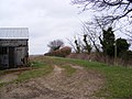
 A farm track near to Wortham parish church - geograph.org.uk - 2418445.jpg 3.648 × 2.736; 1,35 MB
-
 A sandy track through Wortham Ling - geograph.org.uk - 1770270.jpg 640 × 480; 124 kB
-
 A stand of birches in Wortham Ling - geograph.org.uk - 1770227.jpg 640 × 436; 84 kB
-
 A143 Bury Road - geograph.org.uk - 3423025.jpg 3.072 × 2.304; 1,23 MB
-
 A143 Bury Road, Great Green - geograph.org.uk - 4381228.jpg 3.072 × 2.304; 1,8 MB
-
 A143 Bury Road, Great Green - geograph.org.uk - 4381234.jpg 3.072 × 2.304; 1,89 MB
-
 A143 Bury Road, Wortham - geograph.org.uk - 3423032.jpg 3.072 × 2.304; 1,25 MB
-
 A143 Bury Road, Wortham - geograph.org.uk - 4364512.jpg 3.072 × 2.304; 2,71 MB
-
 A143 Bury Road, Wortham - geograph.org.uk - 4364526.jpg 3.072 × 2.304; 2,29 MB
-
 A143 Bury Road, Wortham - geograph.org.uk - 4364539.jpg 3.072 × 2.304; 1,84 MB
-
 A143 Bury Road, Wortham - geograph.org.uk - 4370476.jpg 3.072 × 2.304; 2,33 MB
-
 A143 Bury Road, Wortham - geograph.org.uk - 4381269.jpg 3.072 × 2.304; 1,76 MB
-
 A143 Bury Road, Wortham - geograph.org.uk - 4381287.jpg 3.072 × 2.304; 1,86 MB
-
 A143 Bury Road, Wortham - geograph.org.uk - 4381297.jpg 3.072 × 2.304; 1,72 MB
-
 A143 Old Bury Road, Wortham - geograph.org.uk - 4363406.jpg 3.072 × 2.304; 1,85 MB
-
 A143 Old Bury Road, Wortham - geograph.org.uk - 4363409.jpg 3.072 × 2.304; 1,89 MB
-
 A143 Old Bury Road, Wortham - geograph.org.uk - 4363411.jpg 3.072 × 2.304; 1,82 MB
-
 A143 Old Bury Road, Wortham - geograph.org.uk - 4363419.jpg 3.072 × 2.304; 1,68 MB
-
 A143 Old Bury Road, Wortham - geograph.org.uk - 4364764.jpg 3.072 × 2.304; 1,71 MB
-
 Access road to Hall Farm, Wortham - geograph.org.uk - 2043885.jpg 640 × 480; 178 kB
-
 Angles Way footpath - geograph.org.uk - 4267680.jpg 2.304 × 3.072; 1,73 MB
-
 Angles Way footpath and The Ling Postbox - geograph.org.uk - 3421112.jpg 2.304 × 3.072; 1,46 MB
-
 Angles Way footpath sign - geograph.org.uk - 3421101.jpg 2.304 × 3.072; 1,35 MB
-
 Anglia Autoflow Ltd sign - geograph.org.uk - 4503721.jpg 3.072 × 2.304; 1,85 MB
-
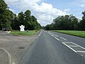
 Beacon at Long Green - geograph.org.uk - 3423000.jpg 3.072 × 2.304; 1,24 MB
-
 Bridge on Low Road - geograph.org.uk - 3424858.jpg 3.072 × 2.304; 1,62 MB
-
 Bridge over the Waveney - geograph.org.uk - 2111534.jpg 1.600 × 1.200; 1,18 MB
-
 Bugg's Road - geograph.org.uk - 4678189.jpg 640 × 480; 102 kB
-
 Bury Road (A143) - geograph.org.uk - 4678190.jpg 640 × 480; 85 kB
-
 Bury Road (A143) - geograph.org.uk - 4678197.jpg 640 × 480; 94 kB
-
 Bury Road (A143) - geograph.org.uk - 4678210.jpg 640 × 480; 125 kB
-
 Bury Road (A143) - geograph.org.uk - 4796187.jpg 640 × 480; 79 kB
-
 Bury Road (A143) - geograph.org.uk - 4796191.jpg 640 × 480; 80 kB
-
 Bury Road (A143) - geograph.org.uk - 4796196.jpg 640 × 480; 82 kB
-
 Chapel Lane sign - geograph.org.uk - 4381276.jpg 3.072 × 2.304; 1,89 MB
-
 Chapel Lane, Wortham - geograph.org.uk - 4381278.jpg 3.072 × 2.304; 1,89 MB
-
 Church Lane - geograph.org.uk - 1462411.jpg 480 × 640; 106 kB
-
 Church Road - geograph.org.uk - 3421497.jpg 3.072 × 2.304; 1,27 MB
-
 Church Road - geograph.org.uk - 3423029.jpg 3.072 × 2.304; 1,51 MB
-
 Church Road at Wortham - geograph.org.uk - 2418400.jpg 3.648 × 2.736; 1,41 MB
-
 Church Road, Wortham - geograph.org.uk - 3422982.jpg 3.072 × 1.682; 834 kB
-
 Church Road, Wortham - geograph.org.uk - 4370478.jpg 3.072 × 2.304; 2,35 MB
-
 Common at Wortham Ling - geograph.org.uk - 3421012.jpg 3.072 × 2.304; 1,29 MB
-
 Common at Wortham Ling - geograph.org.uk - 4262758.jpg 3.072 × 2.304; 2 MB
-
 Cottage in Wortham - geograph.org.uk - 2043881.jpg 640 × 480; 225 kB
-
 Cut Mark Wortham St Marys Church - geograph.org.uk - 5669642.jpg 2.231 × 2.231; 3,84 MB
-
 Dam Lane Dam Lane - geograph.org.uk - 1585357.jpg 640 × 480; 150 kB
-
 Dogs meet in the Ling - geograph.org.uk - 1770332.jpg 555 × 640; 165 kB
-
 Doit Bridge on The Doit - geograph.org.uk - 3425059.jpg 3.072 × 2.304; 1,35 MB
-
 Entering Magpie Green - geograph.org.uk - 1708277.jpg 1.600 × 1.200; 462 kB
-
 Entering Wortham on the A143 Bury Road - geograph.org.uk - 4364519.jpg 3.007 × 2.253; 3,86 MB
-
 Entering Wortham on the A143 Bury Road - geograph.org.uk - 4381258.jpg 3.072 × 2.304; 1,79 MB
-
 Entrance to Anglia Autoflow Ltd - geograph.org.uk - 4503745.jpg 3.072 × 2.304; 1,83 MB
-
 Entrance to Hall Farm - geograph.org.uk - 3421948.jpg 3.072 × 2.304; 1,39 MB
-
 Entrance to Hall Farm, Wortham - geograph.org.uk - 2043754.jpg 640 × 480; 67 kB
-
 Entrance to Willow Corner Community Centre - geograph.org.uk - 3423158.jpg 3.072 × 2.304; 1,4 MB
-
 Farmland off Lion Road - geograph.org.uk - 4796199.jpg 640 × 480; 97 kB
-
 Field entrance and Tithe War Monument - geograph.org.uk - 3422661.jpg 3.072 × 2.304; 1,23 MB
-
 Field entrance off Magpie Hill - geograph.org.uk - 3422682.jpg 3.072 × 2.304; 1,34 MB
-
 Field south of Bury Road (A143) - geograph.org.uk - 4678209.jpg 640 × 480; 65 kB
-
 Footpath off Magpie Hill - geograph.org.uk - 3422642.jpg 2.304 × 3.072; 1,47 MB
-
 Footpath off Magpie Hill - geograph.org.uk - 3422649.jpg 3.072 × 2.304; 1,36 MB
-
 Footpath off Redgrave Road - geograph.org.uk - 3422894.jpg 3.072 × 2.304; 1,26 MB
-
 Footpath sign off Union Lane - geograph.org.uk - 4503758.jpg 2.137 × 2.841; 5,07 MB
-
 Footpath to Angles Way - geograph.org.uk - 3421218.jpg 3.072 × 2.304; 1,44 MB
-
 Footpath to Ling Road - geograph.org.uk - 3421217.jpg 2.872 × 2.158; 2,2 MB
-
 Footpath to Ling Road - geograph.org.uk - 3421257.jpg 3.072 × 2.304; 1,28 MB
-
 Footpath to Ling Road - geograph.org.uk - 3421258.jpg 3.072 × 2.304; 1,23 MB
-
 Footpath to Long Green - geograph.org.uk - 4796188.jpg 640 × 480; 99 kB
-
 Footpath to Low Road - geograph.org.uk - 3422939.jpg 3.072 × 2.304; 1,39 MB
-
 Footpath to Magpie Green - geograph.org.uk - 3424634.jpg 2.304 × 3.072; 1,5 MB
-
 Footpath to Magpie Hill - geograph.org.uk - 3424652.jpg 2.857 × 2.305; 1,38 MB
-
 Footpath to Marsh Lane - geograph.org.uk - 3421244.jpg 3.072 × 2.304; 1,33 MB
-
 Footpath to Marsh Lane - geograph.org.uk - 3421261.jpg 3.072 × 2.304; 1,27 MB
-
 Footpath to Marsh Lane - geograph.org.uk - 3421312.jpg 2.753 × 1.864; 1,68 MB
-
 Footpath to Marsh Lane - geograph.org.uk - 3421314.jpg 2.304 × 3.072; 1,34 MB
-
 Footpath to Rectory Road - geograph.org.uk - 3421346.jpg 2.304 × 3.072; 1,53 MB
-
 Footpath to Rectory Road - geograph.org.uk - 3421976.jpg 3.072 × 2.304; 1,53 MB
-
 Footpath to Redgrave Road - geograph.org.uk - 4371163.jpg 3.072 × 2.304; 1,79 MB
-
 Footpath to Wash Lane - geograph.org.uk - 3422925.jpg 3.072 × 2.304; 1,5 MB
-
 Former Primitive Methodist Chapel - geograph.org.uk - 384225.jpg 640 × 431; 113 kB
-
 Green off Union Lane - geograph.org.uk - 4503733.jpg 3.072 × 2.304; 1,82 MB
-
 Hall Farm sign - geograph.org.uk - 3421987.jpg 3.072 × 2.304; 1,62 MB
-
 Harts Lane - geograph.org.uk - 1708093.jpg 1.600 × 1.200; 597 kB
-
 Heading east on Bury Road - geograph.org.uk - 4796197.jpg 640 × 480; 95 kB
-
 Heath at Wortham Ling - geograph.org.uk - 3421007.jpg 3.072 × 2.304; 1,23 MB
-
 Heath off The Doit - geograph.org.uk - 3425044.jpg 3.072 × 2.304; 1,23 MB
-
 Heath off Union Lane - geograph.org.uk - 4503698.jpg 3.072 × 2.304; 1,96 MB
-
 Heathland and houses at Wortham Ling - geograph.org.uk - 1462682.jpg 640 × 480; 84 kB
-
 Houses on the A143 at Wortham - geograph.org.uk - 2043764.jpg 640 × 480; 48 kB
-
 Ivy House Farm - geograph.org.uk - 1710395.jpg 1.600 × 1.200; 712 kB
-
 Ivy House Farm, Wortham, Suffolk - geograph.org.uk - 2043730.jpg 640 × 480; 68 kB
-

-
 Lane near Magpie Green - geograph.org.uk - 1462416.jpg 640 × 480; 132 kB
-
 Lane near Wortham Church - geograph.org.uk - 1462404.jpg 640 × 480; 106 kB
-
 Lane to The Grove and Magpie Green - geograph.org.uk - 1462434.jpg 640 × 480; 104 kB
-

-
 Ling Road and footpath to Magpie Hill - geograph.org.uk - 3424651.jpg 3.072 × 2.304; 1,2 MB
-
 Ling Road junction - geograph.org.uk - 3425158.jpg 3.072 × 2.223; 1,33 MB
-
 Ling Road junction - geograph.org.uk - 4263010.jpg 3.072 × 2.304; 1,69 MB
-
 Ling Road, Wortham Ling - geograph.org.uk - 3421067.jpg 2.914 × 2.189; 1 MB
-
 Ling Road, Wortham Ling - geograph.org.uk - 3424644.jpg 3.072 × 2.304; 1,23 MB
-
 Ling Road, Wortham Ling - geograph.org.uk - 3424645.jpg 3.072 × 2.304; 1,24 MB
-
 Ling Road, Wortham Ling - geograph.org.uk - 3424647.jpg 3.072 × 2.304; 1,31 MB
-
 Ling Road, Wortham Ling - geograph.org.uk - 3425152.jpg 3.072 × 2.304; 1,23 MB
-
 Ling Road, Wortham Ling - geograph.org.uk - 3425159.jpg 3.072 × 2.304; 1,25 MB
-
 Ling Road, Wortham Ling - geograph.org.uk - 4262760.jpg 3.072 × 2.304; 1,81 MB
-
 Lion Road - geograph.org.uk - 4796201.jpg 640 × 480; 84 kB
-
 Lion Road, Wortham - geograph.org.uk - 4363401.jpg 3.072 × 2.247; 2,43 MB
-
 Lion Road, Wortham - geograph.org.uk - 4363420.jpg 3.072 × 2.304; 3,18 MB
-
 Lion Road, Wortham - geograph.org.uk - 4364536.jpg 3.072 × 2.304; 1,92 MB
-
 Lion Road, Wortham - geograph.org.uk - 4364538.jpg 3.072 × 2.304; 3,68 MB
-
 Long Green, Wortham - geograph.org.uk - 3422984.jpg 3.072 × 2.304; 1,21 MB
-
 Long Green, Wortham - geograph.org.uk - 3422994.jpg 3.072 × 2.304; 1,21 MB
-
 Long Green, Wortham - geograph.org.uk - 3423004.jpg 3.072 × 2.304; 1,34 MB
-
 Long Green, Wortham - geograph.org.uk - 4371133.jpg 3.072 × 2.304; 1,8 MB
-
 Long Green, Wortham - geograph.org.uk - 4371140.jpg 3.072 × 2.252; 1,89 MB
-
 Looking towards Long Green - geograph.org.uk - 3423020.jpg 3.072 × 2.304; 1,25 MB
-
 Low Road - geograph.org.uk - 3424653.jpg 3.072 × 2.304; 1,41 MB
-
 Low Road - geograph.org.uk - 3424921.jpg 3.072 × 2.304; 1,22 MB
-
 Low Water Lane, Wortham - geograph.org.uk - 4267866.jpg 3.072 × 2.304; 1,91 MB
-
 Low Water Lane, Wortham Ling - geograph.org.uk - 4503737.jpg 3.072 × 2.304; 1,84 MB
-
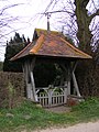 Lych Gate of St.Mary the Virgin Church - geograph.org.uk - 3421577.jpg 2.304 × 3.072; 1,52 MB
-
 Lych Gate of St.Mary the Virgin Church - geograph.org.uk - 3421928.jpg 2.304 × 3.072; 1,36 MB
-
 Magpie Green, Wortham - geograph.org.uk - 4371145.jpg 3.072 × 2.304; 1,71 MB
-
 Magpie Hill - geograph.org.uk - 3421501.jpg 3.072 × 2.304; 1,32 MB
-
 Magpie Hill - geograph.org.uk - 3422683.jpg 3.072 × 2.304; 1,25 MB
-
 Magpie Hill ^ footpath - geograph.org.uk - 3422639.jpg 3.072 × 2.304; 1,45 MB
-
 Marsh Lane, Wortham - geograph.org.uk - 4267741.jpg 3.072 × 2.304; 1,91 MB
-
 Mellis Road, Wortham - geograph.org.uk - 4381302.jpg 2.935 × 2.199; 3,66 MB
-
 Mellis Road, Wortham - geograph.org.uk - 4381373.jpg 3.072 × 2.304; 1,97 MB
-
 Mill Lane footpath to Low Road - geograph.org.uk - 3422950.jpg 3.072 × 2.304; 1,43 MB
-
 Mill Lane footpath to Redgrave Road - geograph.org.uk - 3424654.jpg 3.072 × 2.304; 1,19 MB
-
 Millway Lane - geograph.org.uk - 3421251.jpg 3.072 × 2.304; 1,46 MB
-
 Millway Lane ^ the footpath to Marsh Lane - geograph.org.uk - 3421241.jpg 3.072 × 2.304; 1,34 MB
-
 Millway Lane, Wortham - geograph.org.uk - 4267694.jpg 3.072 × 2.304; 1,8 MB
-
 Millway Lane, Wortham - geograph.org.uk - 4267780.jpg 3.072 × 2.304; 1,9 MB
-
 Millway Lane, Wortham - geograph.org.uk - 4267806.jpg 3.072 × 2.304; 1,74 MB
-
 Millway Lane, Wortham - geograph.org.uk - 4267834.jpg 3.072 × 2.304; 2,74 MB
-
 Millway Lane, Wortham - geograph.org.uk - 4267862.jpg 3.072 × 2.304; 1,78 MB
-
 Millway Lane, Wortham - geograph.org.uk - 4267957.jpg 2.983 × 2.241; 3,26 MB
-
 Muddy Path - geograph.org.uk - 1708513.jpg 1.600 × 1.200; 698 kB
-
 Near Wortham Church - geograph.org.uk - 1462396.jpg 640 × 441; 102 kB
-
 New housing off Bury Road (A143) - geograph.org.uk - 4678198.jpg 640 × 480; 82 kB
-
 Notice Board of St.Mary the Virgin Church, Wortham - geograph.org.uk - 3421937.jpg 3.072 × 2.304; 1,38 MB
-
 Old barn by Redgrave Road - geograph.org.uk - 1462453.jpg 640 × 480; 89 kB
-
 Old Dick junction on Rectory Road - geograph.org.uk - 3421021.jpg 3.072 × 2.304; 1,23 MB
-
 Old Gateway - geograph.org.uk - 1708560.jpg 1.600 × 1.200; 555 kB
-

-
 Open farmland towards Norfolk - geograph.org.uk - 1462443.jpg 640 × 480; 96 kB
-
 Pavilion at Willow Corner - geograph.org.uk - 3423117.jpg 3.072 × 2.304; 1,27 MB
-
 Pavilion at Willow Corner - geograph.org.uk - 3423127.jpg 3.072 × 2.304; 1,44 MB
-
 Pavilion at Willow Corner - geograph.org.uk - 3423148.jpg 3.072 × 2.304; 1,26 MB
-
 Pheasants - geograph.org.uk - 2370777.jpg 1.000 × 667; 204 kB
-
 Plaque on the Tithe War Monument - geograph.org.uk - 3422669.jpg 3.072 × 2.304; 1,64 MB
-
 Playing In The Mist - geograph.org.uk - 1710357.jpg 1.600 × 1.200; 326 kB
-
 Post Office Long Green Edward V Postbox - geograph.org.uk - 4364547.jpg 2.304 × 3.072; 2,71 MB
-
 Post Office Long Green Edward V Postbox - geograph.org.uk - 4364549.jpg 2.304 × 3.072; 2,19 MB
-
 Post Office Long Green Edward VII Postbox - geograph.org.uk - 4364550.jpg 2.304 × 3.072; 2,19 MB
-
 Rash's Crescent Sign - geograph.org.uk - 3421132.jpg 3.072 × 2.304; 1,46 MB
-
 Rash's Crescent, Wortham Ling - geograph.org.uk - 3421137.jpg 3.072 × 2.304; 1,36 MB
-
 Rectory Road - geograph.org.uk - 3421224.jpg 3.072 × 2.304; 1,42 MB
-
 Rectory Road - geograph.org.uk - 3421293.jpg 3.072 × 2.304; 1,44 MB
-
 Rectory Road ^ footpaths to Ling Road ^ Angles Way - geograph.org.uk - 3421209.jpg 3.072 × 2.304; 1,29 MB
-
 Rectory Road ^ Old Dick junction - geograph.org.uk - 3421092.jpg 3.072 × 2.304; 1,32 MB
-
 Rectory Road, Wortham Ling - geograph.org.uk - 3421090.jpg 3.072 × 2.304; 1,34 MB
-
 Rectory Road, Wortham Ling - geograph.org.uk - 3421103.jpg 3.072 × 2.304; 1,22 MB
-
 Rectory Road, Wortham Ling - geograph.org.uk - 3421130.jpg 3.072 × 2.304; 1,38 MB
-
 Rectory Road, Wortham Ling - geograph.org.uk - 3424639.jpg 3.072 × 2.109; 999 kB
-
 Rectory Road, Wortham Ling - geograph.org.uk - 3424642.jpg 3.072 × 2.304; 1,25 MB
-
 Recycling Facility at Willow Corner - geograph.org.uk - 3423176.jpg 3.072 × 2.304; 1,52 MB
-
 Redgrave Road ^ entrance to The Grove - geograph.org.uk - 3422959.jpg 3.072 × 2.304; 1,34 MB
-
 Redgrave Road ^ footpath - geograph.org.uk - 3422892.jpg 3.072 × 2.304; 1,28 MB
-
 Redgrave Road ^ footpath - geograph.org.uk - 3422905.jpg 3.072 × 2.304; 1,43 MB
-
 Redgrave Road ^ footpath to Wash Lane - geograph.org.uk - 3422921.jpg 3.072 × 2.304; 1,37 MB
-
 River Waveney - geograph.org.uk - 2111525.jpg 1.600 × 1.200; 1,6 MB
-
 Road heading west, Long Green - geograph.org.uk - 4678207.jpg 640 × 480; 77 kB
-
 Road Junction - geograph.org.uk - 1708069.jpg 1.600 × 1.200; 467 kB
-
 Road Sign - geograph.org.uk - 1710595.jpg 1.200 × 1.600; 636 kB
-
 Road to the A143 Bury Road - geograph.org.uk - 4364746.jpg 3.072 × 2.304; 1,8 MB
-
 Road to the A143 Bury Road - geograph.org.uk - 4364750.jpg 2.304 × 3.072; 3,22 MB
-
 Roadsign and Church Road - geograph.org.uk - 3421563.jpg 2.304 × 3.072; 1,39 MB
-
 Roadsign on Ling Road - geograph.org.uk - 3424649.jpg 2.304 × 3.072; 1,21 MB
-
 Roadsign on Ling Road - geograph.org.uk - 4263004.jpg 2.304 × 3.072; 1,7 MB
-
 Roadsign on Lion Road - geograph.org.uk - 4364534.jpg 3.072 × 2.304; 3,09 MB
-
 Roadsign on Magpie Green - geograph.org.uk - 4371152.jpg 2.265 × 3.011; 3,09 MB
-
 Roadsign on Magpie Green - geograph.org.uk - 4371269.jpg 2.228 × 2.962; 2,82 MB
-
 Roadsign on Millway Lane - geograph.org.uk - 3421234.jpg 2.304 × 3.072; 1,37 MB
-
 Roadsign on Rectory Road - geograph.org.uk - 3421039.jpg 2.304 × 3.072; 1,27 MB
-
 Roadsign on the A143 Bury Road - geograph.org.uk - 4381292.jpg 3.072 × 2.304; 1,96 MB
-
 Roadsign on Wigwam Hill - geograph.org.uk - 3421370.jpg 2.304 × 3.072; 1,41 MB
-
 Roadsign ^ Angles Way footpath sign - geograph.org.uk - 3424650.jpg 2.144 × 3.069; 1,08 MB
-
 Roadsigns on Church Road - geograph.org.uk - 3422993.jpg 2.147 × 2.866; 901 kB
-
 Roadsigns on Church Road - geograph.org.uk - 3423042.jpg 2.304 × 3.072; 1,45 MB
-
 Roadsigns on the A143 Bury Road - geograph.org.uk - 3423040.jpg 2.304 × 3.072; 1,67 MB
-
 Roadsigns on the A143 Bury Road - geograph.org.uk - 4364529.jpg 2.304 × 3.072; 1,99 MB
-
 Roadsigns on the A143 Old Bury Road - geograph.org.uk - 4363407.jpg 2.216 × 2.947; 3,72 MB
-
 Roadsigns on the A143 Old Bury Road - geograph.org.uk - 4363417.jpg 2.253 × 2.995; 5,42 MB
-
 Rogers Corner - geograph.org.uk - 1708139.jpg 1.600 × 1.200; 517 kB
-
 Shepherds Lane, Great Green - geograph.org.uk - 4381247.jpg 3.072 × 2.304; 1,9 MB


_-_geograph.org.uk_-_4678190.jpg)
_-_geograph.org.uk_-_4678197.jpg)
_-_geograph.org.uk_-_4678210.jpg)
_-_geograph.org.uk_-_4796187.jpg)
_-_geograph.org.uk_-_4796191.jpg)
_-_geograph.org.uk_-_4796196.jpg)


_-_geograph.org.uk_-_4678209.jpg)


_-_geograph.org.uk_-_4678198.jpg)


_-_geograph.org.uk_-_2152028.jpg)


