Category:Yamato, Kanagawa
Zur Navigation springen
Zur Suche springen


Ort in der Präfektur Kanagawa, Japan     | |||||
| Medium hochladen | |||||
| Ist ein(e) |
| ||||
|---|---|---|---|---|---|
| Ort |
| ||||
| Gesetzgebende Körperschaft | |||||
| Rechtsform |
| ||||
| Datum der Gründung, Erstellung, Entstehung, Erbauung |
| ||||
| Einwohnerzahl |
| ||||
| Fläche |
| ||||
| Ersetzt |
| ||||
| offizielle Website | |||||
 | |||||
Unterkategorien
Es werden 8 von insgesamt 8 Unterkategorien in dieser Kategorie angezeigt:
In Klammern die Anzahl der enthaltenen Kategorien (K), Seiten (S), Dateien (D)
+
B
G
- Government of Yamato (5 D)
I
- Izuminomori (21 D)
K
- Kashiwagi Gakuen High School (3 D)
N
S
- Shimotsuruma-juku (17 D)
T
Medien in der Kategorie „Yamato, Kanagawa“
Folgende 76 Dateien sind in dieser Kategorie, von 76 insgesamt.
-
 Yamato in Kanagawa Prefecture Ja.svg 582 × 431; 10 KB
-
 Yamato in Kanagawa Prefecture.png 1.281 × 801; 41 KB
-
 Aqueduct bridge, Sakai river between Yamato and Machida - Apr 30, 2011.jpg 1.024 × 768; 192 KB
-
 Atsugi Air Group Line 01.jpg 4.320 × 3.240; 3,08 MB
-
 Atsugi Air Group Line 02.jpg 4.320 × 3.240; 4,04 MB
-
 Atsugi Air Group Line 03.jpg 4.018 × 3.014; 4,21 MB
-
 Atsugi Air Group Line 04.jpg 4.320 × 3.240; 3,98 MB
-
 Atsugi Air Group Line 05.jpg 4.320 × 3.240; 4,07 MB
-
 Atsugi Air Group Line 06.jpg 4.320 × 3.240; 5,75 MB
-
 Atsugi Air Group Line 07.jpg 4.320 × 3.240; 4,3 MB
-
 Atsugi Air Group Line 08.jpg 3.884 × 2.914; 3,82 MB
-
 Atsugi Air Group Line 09.jpg 4.181 × 3.135; 2,83 MB
-
 Atsugi Air Group Line 10.jpg 4.223 × 3.167; 3 MB
-
 Atsugi Air Group Line 11.jpg 4.319 × 3.239; 2,87 MB
-
 Atsugi Air Group Line 12.jpg 4.223 × 3.167; 2,22 MB
-
 Atsugi Air Group Line 13.jpg 4.223 × 3.167; 3,64 MB
-
 Atsugi Air Group Line 14.jpg 4.223 × 3.167; 2,78 MB
-
 Atsugi Air Group Line 15.jpg 4.320 × 3.240; 4,41 MB
-
 Atsugi airfield aerial photograph.jpg 681 × 1.210; 1,13 MB
-
 Hakone-soba.JPG 1.600 × 1.200; 850 KB
-
 Japanese Manhole Covers (10925291525).jpg 320 × 240; 26 KB
-
 Japanese Manhole Covers (10925291565).jpg 320 × 240; 24 KB
-
 Japanese Manhole Covers (10925426394).jpg 320 × 240; 29 KB
-
 Japanese Manhole Covers (10925426434).jpg 320 × 240; 28 KB
-
 Japanese Manhole Covers (10925574223).jpg 320 × 240; 24 KB
-
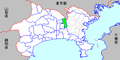 Map kanagawa yamato city p01-01.png 420 × 210; 8 KB
-
 Nadeshiko-no-Michi 01.jpg 4.320 × 3.240; 3,66 MB
-
 Nadeshiko-no-Michi 02.jpg 4.320 × 3.240; 4,25 MB
-
 Pastoral landscape of morning - panoramio.jpg 3.648 × 2.736; 3,64 MB
-
 Population distribution of Yamato, Kanagawa, Japan.svg 512 × 256; 22 KB
-
 Radio Calisthenics at Yamato city 2019.jpg 3.888 × 2.916; 10,19 MB
-
 Rape blossoms and Honeybee - panoramio.jpg 3.648 × 2.736; 4,41 MB
-
 Sagami Country Club, Yamato Kanagawa Aerial photograph.2019.jpg 3.049 × 2.287; 2,93 MB
-
 Scarecrow - panoramio.jpg 3.648 × 2.736; 3,38 MB
-
 Seciriahs.jpg 1.616 × 1.212; 171 KB
-
 Seciriayouchien.jpg 1.616 × 1.212; 141 KB
-
 Senbon Sakura, Yamato, Kanagawa 01.jpg 3.146 × 2.244; 3,41 MB
-
 Senbon Sakura, Yamato, Kanagawa 02.jpg 2.510 × 1.795; 2,08 MB
-
 Shinkansen set-off base lighting electric power branch - plate.jpg 4.000 × 3.000; 2,93 MB
-
 Tokaido Shinkansen culvert cradle (former Hikiji river diversion tunnel).jpg 4.000 × 3.000; 2,91 MB
-
 Tokaido Shinkansen Hikijigawa bridge 01.jpg 4.000 × 3.000; 2,85 MB
-
 Tokaido Shinkansen Hikijigawa bridge 02.jpg 4.000 × 3.000; 2,87 MB
-
 Tokaido Shinkansen maintenanceworkers stair - Wada.jpg 3.000 × 4.000; 2,82 MB
-
 Tokaido Shinkansen Motokouza set-off workshop.jpg 4.000 × 3.000; 2,87 MB
-
 Tokaido Shinkansen Sakaigawa Bridge.jpg 3.264 × 2.448; 1,87 MB
-
 Tokaido Shinkansen Sangenniwa Signal relay box.jpg 4.000 × 3.000; 2,85 MB
-
 Tsuruma map.png 1.051 × 1.102; 375 KB
-

-

-

-

-
 Yamato Sports Center Stadium, Kanagawa, Japan. 2010-09-20.jpg 3.648 × 2.736; 1,83 MB
-
 Yamato Stadium.JPG 2.048 × 1.536; 2,34 MB
-
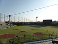 Yamato Stadium1.JPG 2.048 × 1.536; 1,89 MB
-
 Yamato Stadium2.JPG 2.048 × 1.536; 2,22 MB
-
 Yamatominamihighschool.jpg 3.648 × 2.736; 7,55 MB
-
 Yutorinomori -01.jpg 3.878 × 1.910; 1,38 MB
-
 三軒庭Bv.jpg 4.000 × 3.000; 2,8 MB
-
 下鶴間ふるさと館, Japanese Classic House - panoramio.jpg 1.280 × 1.920; 1,74 MB
-
 原福田Bo.jpg 4.000 × 3.000; 2,92 MB
-
 地図-神奈川県大和市-2006.png 420 × 210; 8 KB
-
 境川 鶴間1号橋下, Sakai Riv. - panoramio.jpg 1.500 × 1.000; 1,42 MB
-
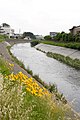 境川 鶴間橋際, Sakai Riv. - panoramio.jpg 2.007 × 3.010; 2,65 MB
-
 境川にかかる水管橋, Water pipeline over Sakai riv - panoramio.jpg 3.456 × 2.304; 1,18 MB
-
 大和市議会会派勢力図(2023年).svg 360 × 185; 3 KB
-
 大和市議会会派構成図(2019年5月10日).svg 360 × 185; 2 KB
-
 大和市議会議会会派勢力図修正版(2023年).svg 360 × 185; 3 KB
-
 大塚供養塔 大和市桜森 Feb 28, 2009.jpg 768 × 1.024; 178 KB
-
 小田急桜ヶ丘駅東側 神奈川県大和市福田 Jan 14, 2013.jpg 2.448 × 3.264; 2,48 MB
-
 引地川公園 - panoramio (1).jpg 3.393 × 2.544; 3,04 MB
-
 引地川公園 - panoramio.jpg 3.393 × 2.544; 3,21 MB
-
 引地川公園ゆとりの森 - panoramio (1).jpg 3.648 × 2.736; 3,95 MB
-
 引地川公園ゆとりの森 - panoramio (2).jpg 3.648 × 2.736; 3,9 MB
-
 引地川公園ゆとりの森 - panoramio.jpg 3.648 × 2.736; 3,9 MB
-
 引地川公園ゆとりの森 から厚木基地 - panoramio.jpg 3.648 × 2.736; 3,9 MB
-
 水管橋, Water Pipe Bridge - panoramio.jpg 3.456 × 2.304; 1,53 MB


.jpg)
.jpg)
.jpg)
.jpg)
.jpg)


.jpg)


.svg)
.svg)
.svg)


.jpg)

.jpg)
.jpg)


