Category:Yamhill County, Oregon
Sari la navigare
Sari la căutare
Counties of Oregon: Baker · Benton · Clackamas · Clatsop · Columbia · Coos · Crook · Curry · Deschutes · Douglas · Gilliam · Grant · Harney · Hood River · Jackson · Jefferson · Josephine · Klamath · Lake · Lane · Lincoln · Linn · Malheur · Marion · Morrow · Multnomah · Polk · Sherman · Tillamook · Umatilla · Union · Wallowa · Wasco · Washington · Wheeler · Yamhill
comitat din Statele Unite ale Americii   | |||||
| Încarcă multimedia | |||||
| Este un/o | |||||
|---|---|---|---|---|---|
| Locul actual | Oregon, SUA | ||||
| Capitală | |||||
| Înființare |
| ||||
| Populație |
| ||||
| Suprafață |
| ||||
| site oficial | |||||
 | |||||
Subcategorii
Această categorie conține următoarele 29 de subcategorii, dintr-un total de 29.
A
- George Abernethy (5 F)
B
C
- Carlton, Oregon (16 F)
- Chehalem Mountains (4 F)
D
- Dundee, Oregon (26 F)
E
- Eola-Amity Hills AVA (13 F)
L
M
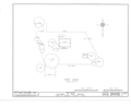
- Maps of Yamhill County, Oregon (11 F)
N
P
S
T
W
- Wheatland Ferry (12 F)
- Willamina, Oregon (33 F)
Y
Fișiere media din categoria „Yamhill County, Oregon”
Următoarele 105 fișiere se află în această categorie, dintr-un total de 105.
-
 Art in a yard near Amity (21312272654).jpg 2.048x1.536; 1,88 MB
-
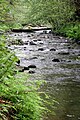
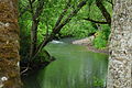 Baker Creek at Ed Grenfell County Park - Oregon.JPG 3.872x2.592; 4,27 MB
-
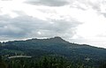 Bald Peak of the Chehalem Mountains in Oregon.JPG 3.201x2.064; 1,89 MB
-
 Barn south of Forest Grove, Oregon (6111173863).jpg 1.824x1.368; 844 KB
-
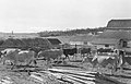
 Bean pickers, 1946 (5765466295).jpg 3.060x1.975; 618 KB
-
 Bellevue Oregon school building side.JPG 2.458x1.802; 1,54 MB
-
 Bellevue Oregon school building.JPG 1.817x1.617; 1,15 MB
-
 Brigittine Monastery Amity Oregon building.JPG 1.400x1.071; 678 KB
-
 Brigittine Monastery Amity Oregon entrance.JPG 3.329x2.131; 2,84 MB
-

-

-
-

-

-

-

-

-
 Chehalem Airpark Oregon 2.JPG 3.268x2.210; 2,64 MB
-
 Chehalem Airpark Oregon.JPG 3.180x2.175; 2,32 MB
-
 Chehalem creek basin.jpg 4.288x2.848; 6,5 MB
-
 Chehalem Mountains north of French Prairie.JPG 3.623x1.435; 1,79 MB
-
 David Lett.JPG 209x449; 23 KB
-

-

-
 Ed Grenfell County Park field - Oregon.JPG 3.218x2.592; 2,85 MB
-
 Erratic rock Oregon.JPG 3.872x2.592; 3,75 MB
-
 Garden Spot Park, Willamina.jpg 640x480; 92 KB
-

-

-
-

-

-

-

-

-

-

-

-

-

-

-

-

-
 GeorgeGay1.JPG 640x512; 72 KB
-
 GopherValleyOregon.JPG 2.816x1.503; 965 KB
-
 Grand Island Road - DPLA - ad5e6b7908e3bf7ce5a921718c05d77b.jpg 2.000x1.339; 820 KB
-
 Have you tried an extra virgin? (22513220720).jpg 3.264x4.999; 12,93 MB
-
-

-
 Houses in Riverside, Yamhill County, Oregon.JPG 3.140x2.009; 2,46 MB
-
 Huddleston Pond Park.jpg 640x640; 138 KB
-
 Lafayette Locks County Park, Oregon.JPG 3.872x2.592; 3,99 MB
-
 Lamson Park, Willamina.jpg 640x480; 135 KB
-
 Large old trees in Oregon's Willamette Valley (21312241004).jpg 2.048x1.536; 2,81 MB
-
 Late afternoon in the vineyard (15732313941).jpg 4.979x3.381; 11,92 MB
-
 Lewis Rogers Grave.JPG 1.170x1.759; 307 KB
-
 Live Music at the Wildwood Hotel.jpg 640x640; 125 KB
-
 Logging trails down hillside in the North Oregon Coast Range - Oregon.JPG 3.872x2.592; 3,84 MB
-
 Logging trails down hillside in the North Oregon Coast Range wide - Oregon.JPG 3.872x2.592; 3,79 MB
-
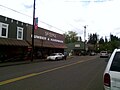
 Main Street Willamina from the Wildwood Hotel.jpg 960x639; 40 KB
-
 Map of Oregon highlighting Yamhill County.svg 6.451x4.810; 136 KB
-
 Menefee County Park shelter - Yamhill County, Oregon.JPG 3.872x2.592; 3,63 MB
-

-
 Mount Hebo.jpg 1.200x798; 1,2 MB
-
 Mystic Wines (14982599319).jpg 5.196x3.732; 21,68 MB
-
 Niagara Falls, Coast Range outside of Willamina.jpg 640x640; 176 KB
-
 North Yamhill at Flying M.jpg 1.360x2.048; 1,36 MB
-
 Oregon 99 - Newberg Dundee (5036588308).jpg 1.280x960; 483 KB
-
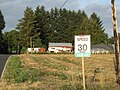
 Oregon Route 18 at McMinnville.JPG 3.872x2.592; 3,91 MB
-
 Oregon Route 240 west of Newberg.JPG 3.872x2.592; 3,8 MB
-
 OregonCoastRangeRocks.JPG 2.816x2.112; 2,96 MB
-
 Power sub station near Amity Oregon.JPG 3.332x1.753; 2,23 MB
-
 Railroad tracks between Willamina and Sheridan Oregon.JPG 1.213x1.269; 498 KB
-
 Railroad tracks near Lafayette Oregon.JPG 2.974x2.237; 2,9 MB
-
 Shipley Oregon.jpg 1.280x1.024; 204 KB
-
 Skybergs Hardware & Liquor Store.jpg 640x480; 54 KB
-
 Soléna and Grand Cru Estates winery - Yamhill County, Oregon.JPG 2.165x1.500; 1,12 MB
-
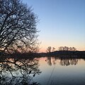 Sunset at Huddleston Park Pond.jpg 640x640; 142 KB
-
 Sunset over Northern Oregon Coast Range shadow.JPG 3.321x2.012; 1,93 MB
-
 Sunset over Northern Oregon Coast Range trees.JPG 3.872x2.592; 3,79 MB
-
 Sunset over Northern Oregon Coast Range with Oak.JPG 3.872x2.592; 3,6 MB
-
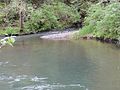
 Turner Creek at Menefee County Park - Yamhill County, Oregon.JPG 3.872x2.592; 3,56 MB
-
 Turner Creek at Menefee County Park 2 - Yamhill County, Oregon.JPG 3.872x2.592; 3,91 MB
-
 Upper Yamhill River - panoramio (1).jpg 3.648x2.736; 4,31 MB
-
 Upper Yamhill River - panoramio.jpg 3.648x2.736; 4,28 MB
-
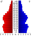 USA Yamhill, Oregon age pyramid.svg 520x600; 7 KB
-
 USFWS IMG 0086 (25971391454).jpg 2.448x3.264; 1,35 MB
-
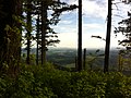
 Valley in the Chehalem Mountains of Oregon.JPG 3.872x2.592; 3,85 MB
-
 Valley in the North Oregon Coast Range - Oregon.JPG 3.872x2.592; 3,66 MB
-
 Wheatland Ferry (21312312124).jpg 2.048x1.536; 2,08 MB
-
 Wheatland Ferry (21748154589).jpg 2.048x1.536; 2,4 MB
-
 Wheatland ferry - Oregon.JPG 2.746x1.202; 596 KB
-
 Wheatland Ferry across the Willamette (21935034655) (2).jpg 2.048x1.536; 2,11 MB
-
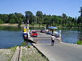 Wheatland Ferry Marion County Oregon.JPG 2.048x1.536; 1,37 MB
-
 Wheatland Oregon.JPG 2.048x1.536; 2 MB
-
 Whiteson Road - Whiteson Oregon.jpg 4.752x3.168; 6,24 MB
-
 Wildwood Hotel and Restaurant.jpg 640x960; 89 KB
-
 Willamette Valley Wine Country (25134584933).jpg 2.048x1.305; 3,19 MB
-
 Willamina Antiques and the Alley on Main Street.jpg 960x639; 103 KB
-
 Yamhill County, OR, USA - panoramio (2).jpg 2.592x1.936; 1,82 MB
-
 Yamhill County, OR, USA - panoramio (3).jpg 2.592x1.936; 1,8 MB
-
 Yamhill County, OR, USA - panoramio.jpg 3.648x2.736; 3,63 MB
-
 Yamhill river at Dayton.jpg 2.048x1.360; 2,87 MB
-
 Yamhill River at locks.JPG 3.872x2.592; 3,92 MB
-
 You talkin' to me? (11703551866).jpg 2.750x2.034; 5,34 MB
.jpg)


.jpg)
.jpg)


.jpg)
.jpg)
.jpg)
.jpg)
.jpg)
.jpg)
.jpg)
.jpg)


.jpg)


.png)
.png)
.png)
.png)
.png)
.png)
.png)
.png)


.jpg)


.jpg)
.jpg)


.JPG)

.jpg)


.jpg)


.jpg)


.jpg)


.jpg)
.jpg)

_(2).jpg)


.jpg)

.jpg)
.jpg)


.jpg)