File:Fauld crater - geograph.org.uk - 582307.jpg
Jump to navigation
Jump to search
No higher resolution available.
Fauld_crater_-_geograph.org.uk_-_582307.jpg (640 × 480 pixels, file size: 68 KB, MIME type: image/jpeg)
Captions
Captions
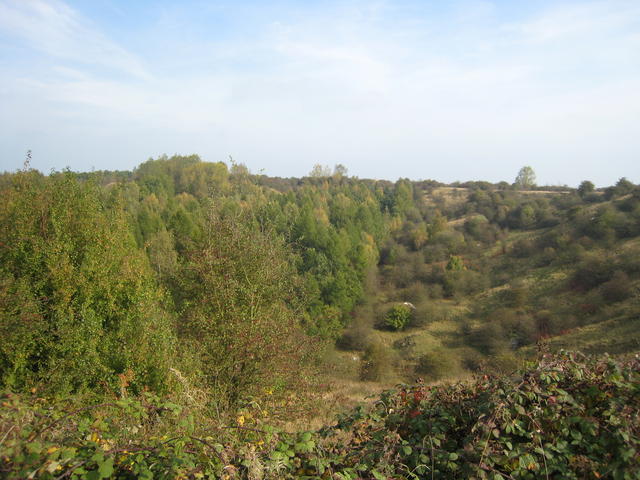
Fauld crater. This crater, some 300-400 foot deep and up to half a mile across is the result of the explosion of 3,500-4,000 tons of munitions stored in the old gypsum mines under this spot. The explosion on 27/11/1944 is reckoned to be the large ...
Summary
[edit]
| Description |
English: Fauld crater. This crater, some 300-400 foot deep and up to half a mile across is the result of the explosion of 3,500-4,000 tons of munitions stored in the old gypsum mines under this spot. The explosion on 27/11/1944 is reckoned to be the largest non-nuclear explosion in either World War. The 582298 on the edge of the crater is dedicated to the 70 or so people who died as a result of the explosion.
See http://www.carolyn.topmum.net/tutbury/fauld/fauldcrater.htm. |
| Date | Taken on 10 October 2007 |
| Source | From geograph.org.uk |
| Author | David Stowell |
| Attribution (required by the license) | David Stowell / Fauld crater / |
| Camera location | | View this and other nearby images on: OpenStreetMap |
|---|
_heading:45.00&language=en)
| Object location | | View this and other nearby images on: OpenStreetMap |
|---|
_heading:45.00&language=en)
Licensing
[edit]

|
This image was taken from the Geograph project collection. See this photograph's page on the Geograph website for the photographer's contact details. The copyright on this image is owned by David Stowell and is licensed for reuse under the Creative Commons Attribution-ShareAlike 2.0 license.
|
This file is licensed under the Creative Commons Attribution-Share Alike 2.0 Generic license.
Attribution: David Stowell
- You are free:
- to share – to copy, distribute and transmit the work
- to remix – to adapt the work
- Under the following conditions:
- attribution – You must give appropriate credit, provide a link to the license, and indicate if changes were made. You may do so in any reasonable manner, but not in any way that suggests the licensor endorses you or your use.
- share alike – If you remix, transform, or build upon the material, you must distribute your contributions under the same or compatible license as the original.
File history
Click on a date/time to view the file as it appeared at that time.
| Date/Time | Thumbnail | Dimensions | User | Comment | |
|---|---|---|---|---|---|
| current | 13:45, 6 February 2011 | | 640 × 480 (68 KB) | GeographBot (talk | contribs) | == {{int:filedesc}} == {{Information |description={{en|1=Fauld crater This crater, some 300-400 foot deep and up to half a mile across is the result of the explosion of 3,500-4,000 tons of munitions stored in the old gypsum mines under this spot. The exp |
You cannot overwrite this file.
File usage on Commons
There are no pages that use this file.