File:View of the Riiser-Larsen Ice Shelf in Antarctica.jpg
View_of_the_Riiser-Larsen_Ice_Shelf_in_Antarctica.jpg (800 × 566 pixels, file size: 73 KB, MIME type: image/jpeg)
Captions
Captions
Summary
[edit]
| Description |
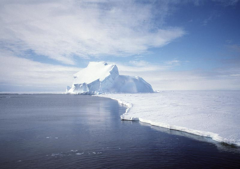
Original caption — For millions of years, Antarctica, the frozen continent at the southern end of the planet, has been encased in a gigantic sheet of ice. Recently, the Gravity Recovery and Climate Experiment (GRACE) satellite has been taking sensitive measurements of the gravity for the entire Earth, including Antarctica. Recent analysis of GRACE data indicate that the Antarctic ice sheet might have lost enough mass to cause the worlds' oceans to rise about .05 inches, on the average, from between 2002 and 2005. Although this may not seem like much, the equivalent amount of water is about 40 trillion gallons, equivalent to the amount of water used by U.S. residents in three months. Uncertainties in the measurement make the mass loss uncertain by about 21 trillion gallons. The iceberg pictured above is a small part of the Antarctic ice sheet. The picture was taken on the Riiser-Larsen ice shelf in December 1995. Future research will likely focus on trying to better understand the data, take more data, predict future trends, and understand possible effects of these trends on the future climate of our entire home planet. |
| Date | December 1995 |
| Source | NASA (Image galleries) |
| Author | Ben Holt – National Aeronautics and Space Administration (NASA) |
Licensing
[edit]
| This file is in the public domain in the United States because it was solely created by NASA. NASA copyright policy states that "NASA material is not protected by copyright unless noted". (See Template:PD-USGov, NASA copyright policy page or JPL Image Use Policy.) | ||
 |
Warnings:
|
File history
Click on a date/time to view the file as it appeared at that time.
| Date/Time | Thumbnail | Dimensions | User | Comment | |
|---|---|---|---|---|---|
| current | 03:26, 28 July 2006 | | 800 × 566 (73 KB) | Felipe Menegaz (talk | contribs) | {{Information| |Description= For millions of years, Antarctica, the frozen continent at the southern end of the planet, has been encased in a gigantic sheet of ice. Recently, the Gravity Recovery and Climate Experiment (GRACE) satellite has been taking se |
You cannot overwrite this file.
File usage on Commons
The following 3 pages use this file:
File usage on other wikis
The following other wikis use this file:
- Usage on azb.wikipedia.org
- Usage on bg.wikipedia.org
- Usage on bs.wikipedia.org
- Usage on cv.wikipedia.org
- Usage on de.wikipedia.org
- Usage on en.wikipedia.org
- Usage on es.wikipedia.org
- Usage on et.wikipedia.org
- Usage on fi.wikipedia.org
- Usage on fr.wikipedia.org
- Usage on hi.wikipedia.org
- Usage on id.wikipedia.org
- Usage on it.wikipedia.org
- Usage on ka.wikipedia.org
- Usage on kbp.wikipedia.org
- Usage on lv.wikipedia.org
- Usage on mk.wikipedia.org
- Usage on nl.wikipedia.org
- Usage on nn.wikipedia.org
- Usage on no.wikipedia.org
- Usage on pl.wikipedia.org
- Usage on ru.wikipedia.org
- Usage on sv.wikipedia.org
- Usage on tr.wikipedia.org
- Usage on uk.wikipedia.org
- Usage on www.wikidata.org
- Usage on zh.wikipedia.org