File:בשורת הסתיו בגמלא.jpg

Original file (4,160 × 3,120 pixels, file size: 7.34 MB, MIME type: image/jpeg)
Captions
Captions
Summary[edit]
| Description |
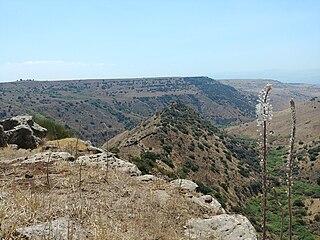
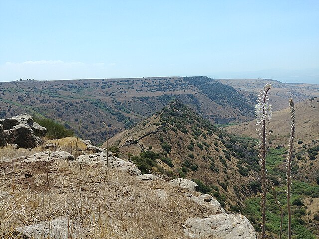
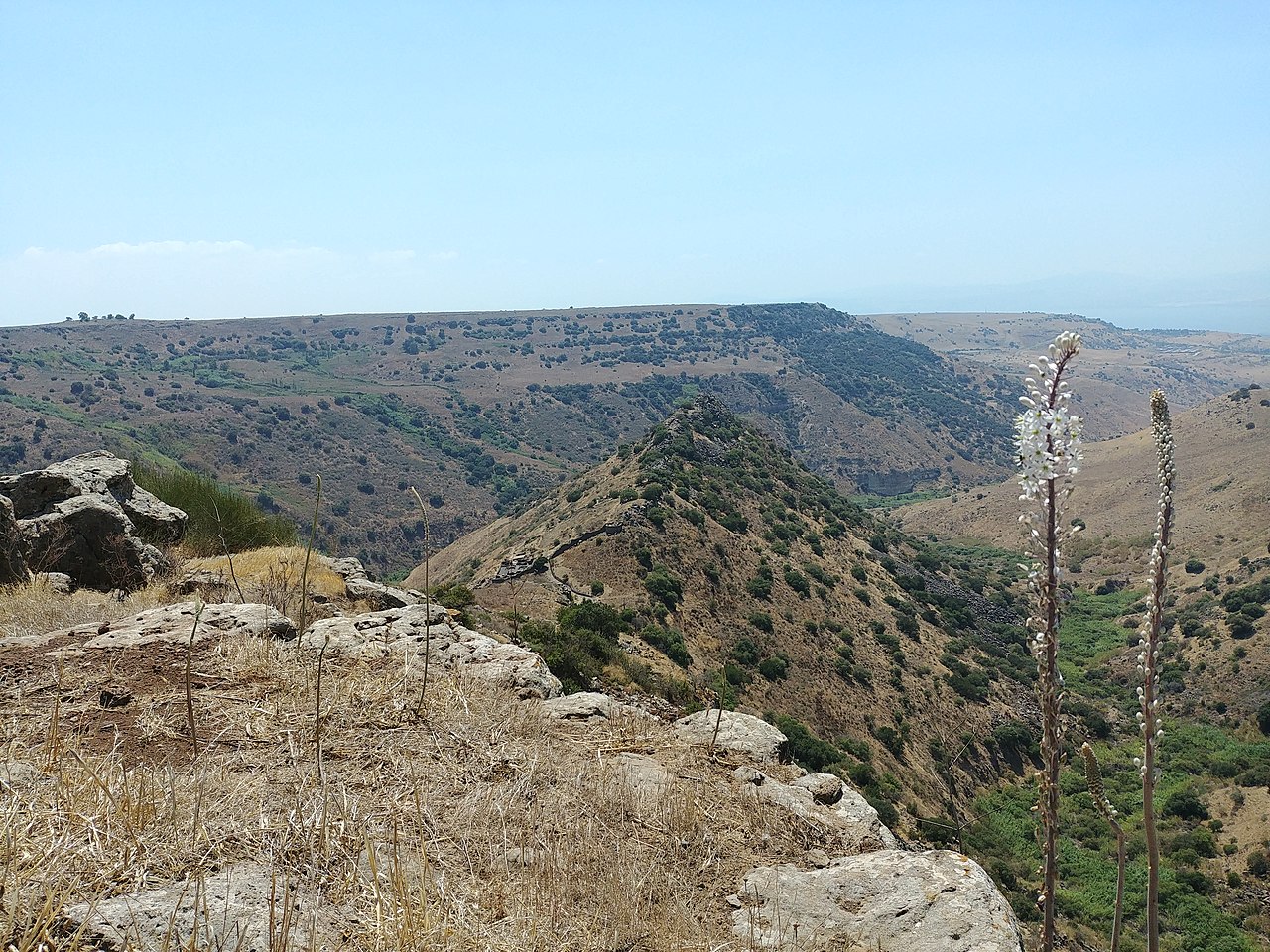
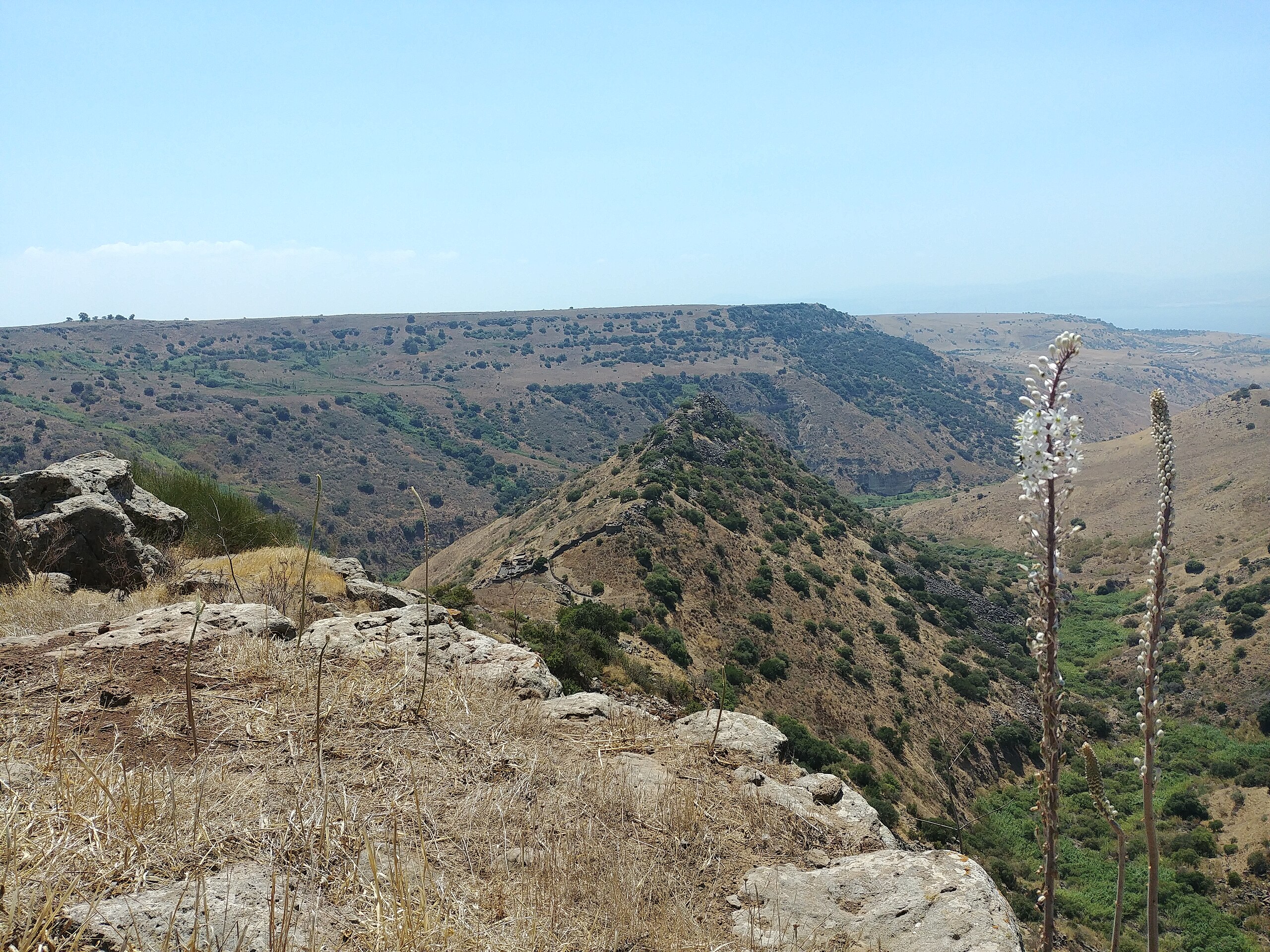
עברית: בתמונה: פריחת חצבים בגמלא הקדומה מבשרת את הסתיו. מבט למערב לעבר שרידי המושבה היהודית העתיקה בגמלא וים הכינרת
צילום: אסף אברהם גמלא הייתה מושבה יהודית מימי בית שני אשר חרבה בזמן המרד הגדול ברומאים במאה הראשונה לספירה. ההיסטוריון היהודי יוסף בן מתתיהו תיאר את גמלא בספרו מלחמת היהודים ברומאים וכן את מאורעות המרד שהביאו לחורבן המקום. "כי ממעל להר גבוה מתנשא שם צוק זקוף ובתווך הוא מעלה גבנון ומשתרע במישור למעלה, ונוטה תלול לפנים ולאחור, והוא דומה בתבניתו לגמל... משתי צלעותיו וממול פניו מוקף הסלע הזה תהומות..." מלחמת היהודים ברומאים (ד, א, 6-5) "כאן פגעו היהודים פגיעה קשה באויבים העולים עליהם, ירו לעברם זרקים מסוגים שונים וגלגלו עליהם סלעים...בהיותם מוקפים מכל עבר נואשו רוב היהודים מכל תקווה להציל את נפשותיהם, חיבקו את בניהם ואת נשותיהם ויחד עם עמם השליכו עצמם מטה אל התהום..." (מלחמת היהודים ברומאים, ד, 79-75)English: In the photo: Drimia blossom in ancient Gamla heralds the fall. Looking west toward the remains of the ancient Jewish settlement of Gamla and the Sea of Galilee.
Photographed by Assaf Avraham Gamla was an ancient Jewish city on the Golan Heights. During the Great Revolt, it became an important stronghold for rebels and because of this Gamla is a symbol of heroism for the modern state of Israel and an important historical and archaeological site. It was one of only five cities in the Galilee and Golan who stood against Vespasian's legions, Josephus Flavius gives a very detailed topographical description of the city and the steep ravines which precluded the need to build a wall around it. Josephus also provides a detailed description of the Roman siege and conquest of Gamla in 67 CE by components of legions. The Romans first attempted to take the city by means of a siege ramp, but were repulsed by the defenders. Only on the second attempt did the Romans succeed in breaching the walls at three different locations and invading the city. They then engaged the Jewish defenders in hand-to-hand combat up the steep hill. Fighting in the cramped streets from an inferior position, the Roman soldiers attempted to defend themselves from the roofs. These subsequently collapsed under the heavy weight, killing many soldiers[11] and forcing a Roman retreat. The legionnaires re-entered the town a few days later, eventually beating Jewish resistance and completing the capture of Gamla.
|
||
| Date | |||
| Source | Own work | ||
| Author | אסף אברהם |
| Camera location | | View this and other nearby images on: OpenStreetMap |
|---|
Licensing[edit]
- You are free:
- to share – to copy, distribute and transmit the work
- to remix – to adapt the work
- Under the following conditions:
- attribution – You must give appropriate credit, provide a link to the license, and indicate if changes were made. You may do so in any reasonable manner, but not in any way that suggests the licensor endorses you or your use.
- share alike – If you remix, transform, or build upon the material, you must distribute your contributions under the same or compatible license as the original.

|
This image was uploaded as part of Wiki Loves Monuments 2018.
|
 |
File history
Click on a date/time to view the file as it appeared at that time.
| Date/Time | Thumbnail | Dimensions | User | Comment | |
|---|---|---|---|---|---|
| current | 08:55, 18 September 2018 | | 4,160 × 3,120 (7.34 MB) | Asafa01 (talk | contribs) | User created page with UploadWizard |
You cannot overwrite this file.
File usage on Commons
The following page uses this file: