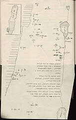
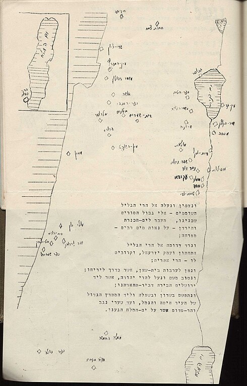
File:מפת הארץ עם ציון של 38 מקומות. קבוץ הבחרות (FL45607625 3944906).jpg
Jump to navigation
Jump to search

Size of this preview: 383 × 600 pixels. Other resolutions: 153 × 240 pixels | 306 × 480 pixels | 490 × 768 pixels | 654 × 1,024 pixels | 2,396 × 3,751 pixels.
Original file (2,396 × 3,751 pixels, file size: 1.88 MB, MIME type: image/jpeg)
Captions
Captions
Add a one-line explanation of what this file represents
Summary[edit]
| מפת הארץ עם ציון של 38 מקומות. קבוץ הבחרות
( |
||||||||||||||||||||||||
|---|---|---|---|---|---|---|---|---|---|---|---|---|---|---|---|---|---|---|---|---|---|---|---|---|
| Title |
מפת הארץ עם ציון של 38 מקומות. קבוץ הבחרות |
|||||||||||||||||||||||
| Publisher |
הקיבוץ המאוחד |
|||||||||||||||||||||||
| Description |
מפת הארץ עם ציון של 38 מקומות : קבוץ הבחרות.. |
|||||||||||||||||||||||
| Language | Hebrew | |||||||||||||||||||||||
| Publication date | 1939 | |||||||||||||||||||||||
| Medium | 1 online resource (1 map). | |||||||||||||||||||||||
| Collection |
|
|||||||||||||||||||||||
| Current location |
|
|||||||||||||||||||||||
| Place of publication | Tel Aviv-Yafo | |||||||||||||||||||||||
| search Merhav catalog | Tel Aviv-Yafo | |||||||||||||||||||||||
| Notes | Digital image of the original in Amir Cahanovitc Collection, Israel. ACC 2511.; Digital image received from donor.; בתוך 'הגדה של פסח'. | |||||||||||||||||||||||
| IE PID | IE45607623 | |||||||||||||||||||||||
| Rosetta filename | FL45607625 | |||||||||||||||||||||||
| NNL item ID (P3959) | 990039449060205171 | |||||||||||||||||||||||
| search Merhav catalog | Hebrew | |||||||||||||||||||||||
| search Merhav catalog | Land settlementEretz Israelהקיבוץ המאוחד | |||||||||||||||||||||||
| Source/Photographer |
|
|||||||||||||||||||||||
| Other versions | ||||||||||||||||||||||||
| Jpg / Tif version |
|
|||||||||||||||||||||||

.jpg)

.jpg&action=edit§ion=1)
Licensing[edit]
.jpg&action=edit§ion=2)
This UK artistic or literary work, of which the author is unknown and cannot be ascertained by reasonable enquiry, is in the public domain because it is one of the following:
|
 |
File history
Click on a date/time to view the file as it appeared at that time.
| Date/Time | Thumbnail | Dimensions | User | Comment | |
|---|---|---|---|---|---|
| current | 12:11, 2 September 2023 | | 2,396 × 3,751 (1.88 MB) | Geagea (talk | contribs) | pattypan 22.03 |
You cannot overwrite this file.
File usage on Commons
The following page uses this file:
.jpg&oldid=799488887)