File:利尻島 - panoramio.jpg
Jump to navigation
Jump to search

Size of this preview: 800 × 569 pixels. Other resolutions: 320 × 227 pixels | 640 × 455 pixels | 1,024 × 728 pixels | 1,280 × 910 pixels | 1,600 × 1,137 pixels.
Original file (1,600 × 1,137 pixels, file size: 289 KB, MIME type: image/jpeg)
Captions
Captions
Add a one-line explanation of what this file represents
Summary[edit]
| Description |
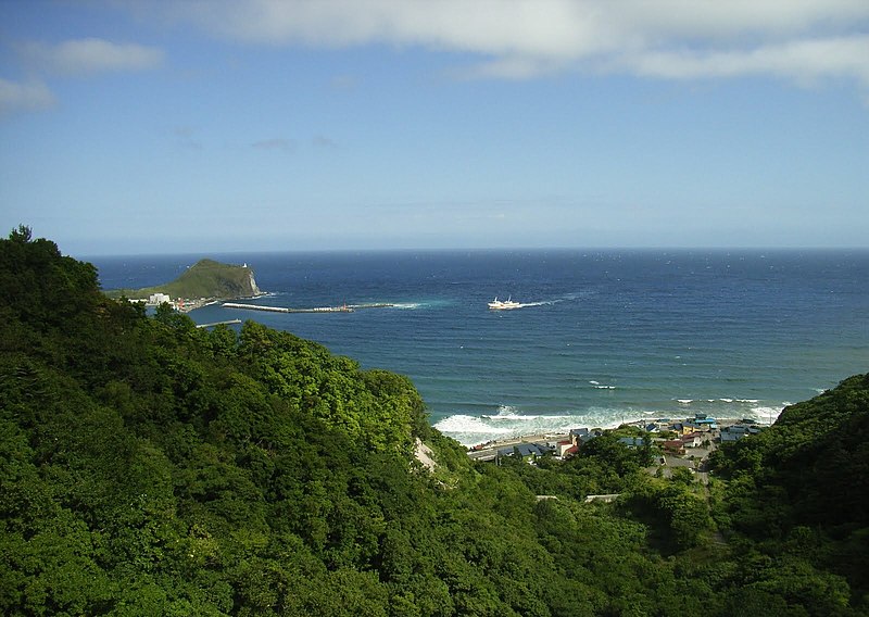
日本語: 利尻島 English: Oshidomari, Rishirifuji, Rishiri District, Hokkaido Prefecture 097-0101, Japan |
| Date | Taken on 15 August 2005 |
| Source | https://web.archive.org/web/20161017133312/http://www.panoramio.com/photo/45636501 |
| Author | Yobito KAYANUMA |
| Tags (from Panoramio photo page) | Rishirifuji, Hokkaido |
| Camera location | | View this and other nearby images on: OpenStreetMap |
|---|
Licensing[edit]
This file is licensed under the Creative Commons Attribution-Share Alike 3.0 Unported license.
Attribution: Yobito KAYANUMA
- You are free:
- to share – to copy, distribute and transmit the work
- to remix – to adapt the work
- Under the following conditions:
- attribution – You must give appropriate credit, provide a link to the license, and indicate if changes were made. You may do so in any reasonable manner, but not in any way that suggests the licensor endorses you or your use.
- share alike – If you remix, transform, or build upon the material, you must distribute your contributions under the same or compatible license as the original.
| This image, which was originally posted to Panoramio, was automatically reviewed on 24 November 2016 by Panoramio upload bot, who confirmed that it was available on Panoramio under the above license on that date. |
File history
Click on a date/time to view the file as it appeared at that time.
| Date/Time | Thumbnail | Dimensions | User | Comment | |
|---|---|---|---|---|---|
| current | 12:43, 30 September 2022 | | 1,600 × 1,137 (289 KB) | R8cocin8 (talk | contribs) | Cropped 5 % vertically using CropTool with precise mode. Removed watermark. |
| 10:05, 24 November 2016 |  | 1,600 × 1,200 (258 KB) | Panoramio upload bot (talk | contribs) | == {{int:filedesc}} == {{Information |description=利尻島 |date={{Taken on|2005-08-15}} |source=http://www.panoramio.com/photo/45636501 |author=[http://www.panoramio.com/user/5198788?with_photo_id=45636501 Yobito KAYANUMA] |permission={{cc-by-sa-3.0|... |
You cannot overwrite this file.
File usage on Commons
There are no pages that use this file.