File:岩沼市町丁別地図.png
Jump to navigation
Jump to search
Size of this preview: 800 × 516 pixels. Other resolutions: 320 × 206 pixels | 640 × 413 pixels | 1,024 × 660 pixels | 1,280 × 825 pixels | 2,625 × 1,692 pixels.
Original file (2,625 × 1,692 pixels, file size: 305 KB, MIME type: image/png)
Captions
Captions
Add a one-line explanation of what this file represents
Summary[edit]
| Description |
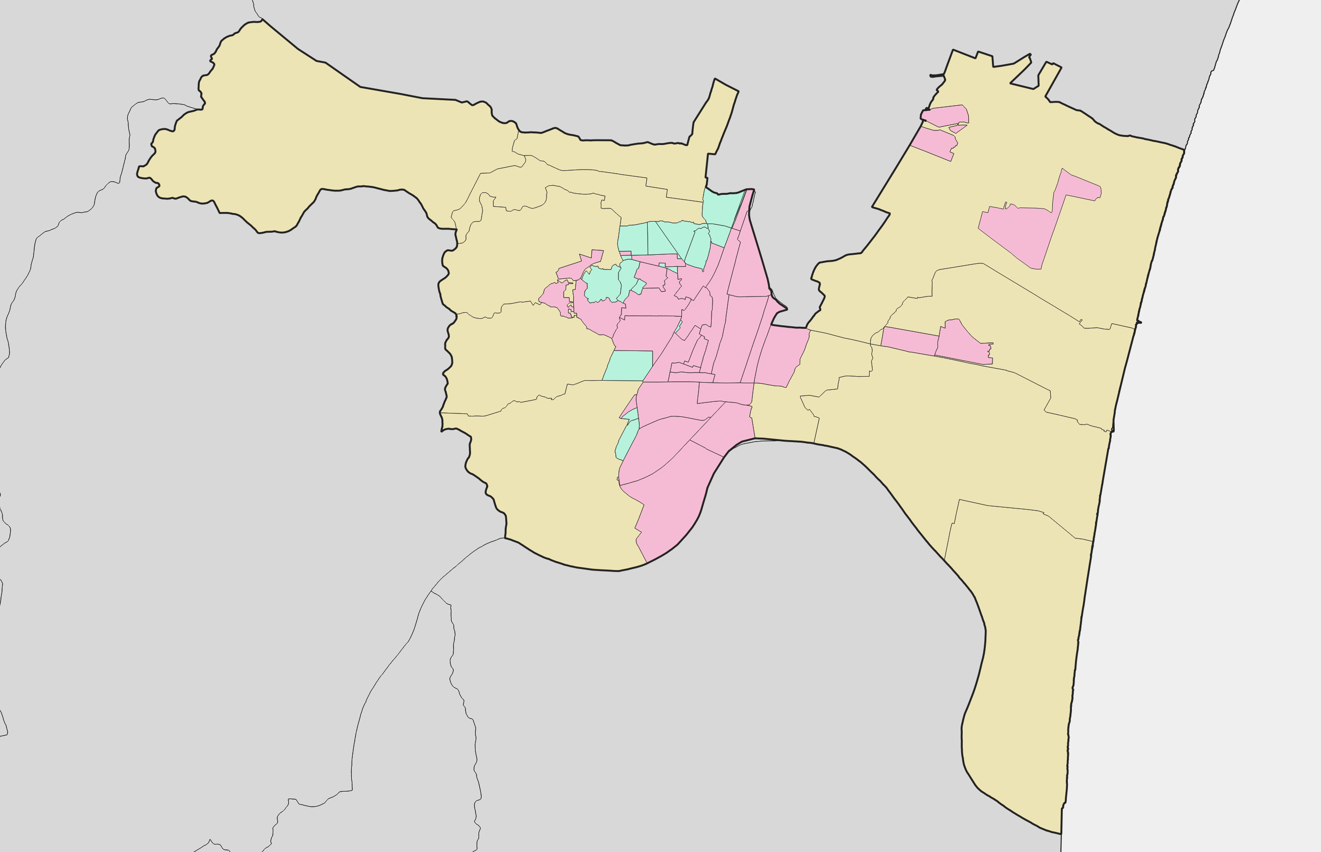
日本語: 宮城県岩沼市の町丁別地図。黄色は大字を、ピンクは町丁を、緑は字若しくは直接番地がくる地域を表している。国土交通省 国土数値情報・総務省 平成27年国勢調査 町丁・字等別境界データを使用。 |
| Date | |
| Source |
|
| Author | 七厩拓 |
Licensing[edit]
I, the copyright holder of this work, hereby publish it under the following license:
This file is licensed under the Creative Commons Attribution-Share Alike 4.0 International license.
- You are free:
- to share – to copy, distribute and transmit the work
- to remix – to adapt the work
- Under the following conditions:
- attribution – You must give appropriate credit, provide a link to the license, and indicate if changes were made. You may do so in any reasonable manner, but not in any way that suggests the licensor endorses you or your use.
- share alike – If you remix, transform, or build upon the material, you must distribute your contributions under the same or compatible license as the original.
File history
Click on a date/time to view the file as it appeared at that time.
| Date/Time | Thumbnail | Dimensions | User | Comment | |
|---|---|---|---|---|---|
| current | 10:40, 25 December 2021 | | 2,625 × 1,692 (305 KB) | 七厩拓 (talk | contribs) | Uploaded own work with UploadWizard |
You cannot overwrite this file.
File usage on Commons
There are no pages that use this file.
File usage on other wikis
The following other wikis use this file:
- Usage on ja.wikipedia.org