File:1856 Uruguay San José map.PNG
Jump to navigation
Jump to search
Size of this preview: 568 × 600 pixels. Other resolutions: 227 × 240 pixels | 455 × 480 pixels | 1,000 × 1,056 pixels.
Original file (1,000 × 1,056 pixels, file size: 138 KB, MIME type: image/png)
Captions
Captions
Add a one-line explanation of what this file represents
Summary[edit]
| Description |
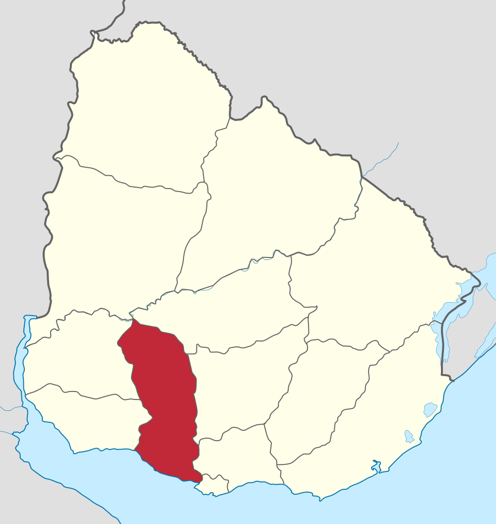
English: 1856 map of San José Department, Uruguay. After the establishment of Florida Department by a decree passed in by the parliament in 1856, it was reduced to what are the present-day departments of Flores and San José Español: Mapa histórico del año 1856 del Departamento de San José. Tras la creación del Departamento de Florida mediante decreto de ese mismo año, su territorio se vio sensiblemente reducido al que en la actualidad ocupan los departamentos de Flores y San José |
| Date | (UTC) |
| Source | |
| Author |
|
| This is a retouched picture, which means that it has been digitally altered from its original version. The original can be viewed here: Uruguay San José map.svg:
|
Licensing[edit]
I, the copyright holder of this work, hereby publish it under the following license:
This file is licensed under the Creative Commons Attribution-Share Alike 3.0 Unported license.
- You are free:
- to share – to copy, distribute and transmit the work
- to remix – to adapt the work
- Under the following conditions:
- attribution – You must give appropriate credit, provide a link to the license, and indicate if changes were made. You may do so in any reasonable manner, but not in any way that suggests the licensor endorses you or your use.
- share alike – If you remix, transform, or build upon the material, you must distribute your contributions under the same or compatible license as the original.
Original upload log[edit]
This image is a derivative work of the following images:
- File:Uruguay_San_José_map.svg licensed with Cc-by-sa-3.0
- 2010-11-04T15:35:35Z Hoverfish 1000x1056 (120692 Bytes) Improved fill detail
- 2010-11-04T13:55:52Z Hoverfish 1000x1056 (118895 Bytes) {{Information |Description={{de|Positionskarte von [[:de:Uruguay|Uruguay]]}} Quadratische Plattkarte, Geographische Begrenzung der Karte: * N: 29.86° S * S: 35.19° S * W: 58,71° W * O: 52,89° W {{en|Location map of
Uploaded with derivativeFX
File history
Click on a date/time to view the file as it appeared at that time.
| Date/Time | Thumbnail | Dimensions | User | Comment | |
|---|---|---|---|---|---|
| current | 13:45, 16 November 2017 | | 1,000 × 1,056 (138 KB) | Milenioscuro (talk | contribs) | mejoras |
| 02:34, 28 December 2011 |  | 568 × 600 (68 KB) | Pugilist25 (talk | contribs) | == {{int:filedesc}} == {{Information |Description={{en|1856 map of San José Department, Uruguay. After the establishment of Florida Department by a decree passed in by the parliament in 1856, it was reduced to what are the present-day departments of Flor |
You cannot overwrite this file.
File usage on Commons
There are no pages that use this file.