File:2012 11 01 036 Leopold Reitz Weg.jpg
Original file (2,540 × 1,967 pixels, file size: 5.29 MB, MIME type: image/jpeg)
Captions
Summary[edit]
Description2012 11 01 036 Leopold Reitz Weg.jpg |
Designation: 
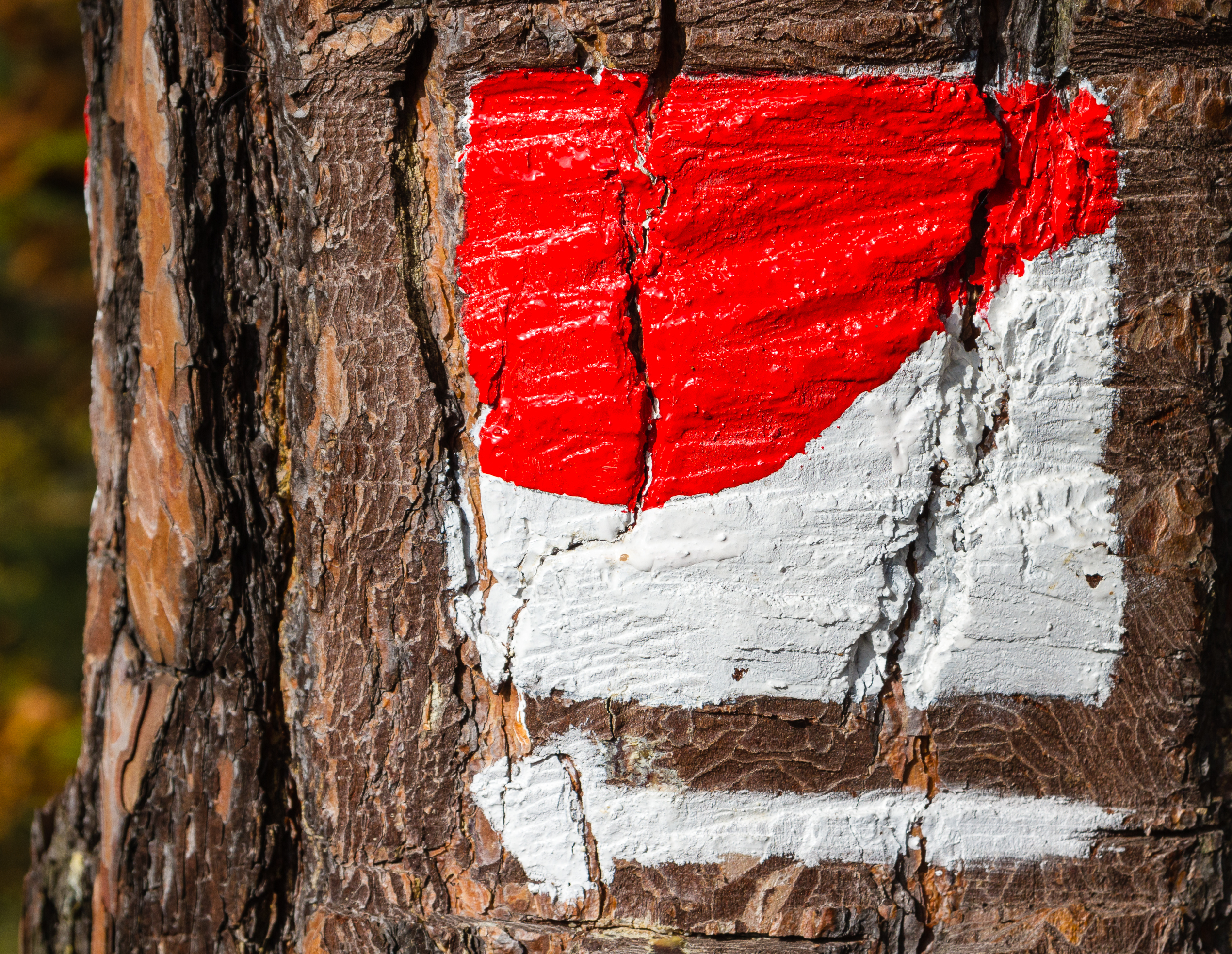
Hiking trail sign Pfälzer Weinsteig |
Date | Taken on 1 November 2012, 11:41:30 |
Source | Self-photographed |
Author | Friedrich Haag |
Attribution (required by the license) InfoField | © Friedrich Haag / Wikimedia Commons / |
InfoField | © Friedrich Haag / Wikimedia Commons |
Camera location | 49° 21′ 37.35″ N, 8° 06′ 32.64″ E | View this and other nearby images on: OpenStreetMap | 49.360375; 8.109068 |
---|
Licensing[edit]
- You are free:
- to share – to copy, distribute and transmit the work
- to remix – to adapt the work
- Under the following conditions:
- attribution – You must give appropriate credit, provide a link to the license, and indicate if changes were made. You may do so in any reasonable manner, but not in any way that suggests the licensor endorses you or your use.
- share alike – If you remix, transform, or build upon the material, you must distribute your contributions under the same or compatible license as the original.
Assessment[edit]
This image has been assessed using the Quality image guidelines and is considered a Quality image.
العربية ∙ جازايرية ∙ беларуская ∙ беларуская (тарашкевіца) ∙ български ∙ বাংলা ∙ català ∙ čeština ∙ Cymraeg ∙ Deutsch ∙ Schweizer Hochdeutsch ∙ Zazaki ∙ Ελληνικά ∙ English ∙ Esperanto ∙ español ∙ eesti ∙ euskara ∙ فارسی ∙ suomi ∙ français ∙ galego ∙ עברית ∙ हिन्दी ∙ hrvatski ∙ magyar ∙ հայերեն ∙ Bahasa Indonesia ∙ italiano ∙ 日本語 ∙ Jawa ∙ ქართული ∙ 한국어 ∙ kurdî ∙ Lëtzebuergesch ∙ lietuvių ∙ македонски ∙ മലയാളം ∙ मराठी ∙ Bahasa Melayu ∙ Nederlands ∙ Norfuk / Pitkern ∙ polski ∙ português ∙ português do Brasil ∙ rumantsch ∙ română ∙ русский ∙ sicilianu ∙ slovenčina ∙ slovenščina ∙ shqip ∙ српски / srpski ∙ svenska ∙ தமிழ் ∙ తెలుగు ∙ ไทย ∙ Tagalog ∙ Türkçe ∙ toki pona ∙ українська ∙ vèneto ∙ Tiếng Việt ∙ 中文 ∙ 中文(简体) ∙ 中文(繁體) ∙ +/− |
File history
Click on a date/time to view the file as it appeared at that time.
Date/Time | Thumbnail | Dimensions | User | Comment | |
---|---|---|---|---|---|
current | 16:00, 17 December 2015 | 2,540 × 1,967 (5.29 MB) | F. Riedelio (talk | contribs) | User created page with UploadWizard |
You cannot overwrite this file.
File usage on Commons
The following 8 pages use this file:
- User:F. Riedelio/Fotowettbewerbe/2015
- User:F. Riedelio/Quality Image Promotion/2016
- Commons:Files used on the OpenStreetMap Wiki/1
- Commons:Photo challenge/2015 - December - Red and white
- Commons:Photo challenge/2015 - December - Red and white/Voting
- Commons:Photo challenge/2015 - December - Red and white/Voting/Result
- Commons:Quality images/Subject/Objects/Statues, Monuments and Plaques/archive 2016-1
- Commons:Quality images candidates/Archives February 03 2016
Metadata
This file contains additional information such as Exif metadata which may have been added by the digital camera, scanner, or software program used to create or digitize it. If the file has been modified from its original state, some details such as the timestamp may not fully reflect those of the original file. The timestamp is only as accurate as the clock in the camera, and it may be completely wrong.
Author | 16 16:46:21 |
---|---|
Exposure time | 1/500 sec (0.002) |
F-number | f/8 |
ISO speed rating | 200 |
Date and time of data generation | 11:41, 1 November 2012 |
Lens focal length | 64 mm |
Latitude | 49° 21′ 37.35″ N |
Longitude | 8° 6′ 32.65″ E |
Altitude | 256 meters above sea level |
Online copyright statement | http://creativecommons.org/licenses/by-sa/4.0/de/legalcode |
Short title |
|
Copyright holder |
|
Image title |
|
Usage terms | |
City shown | Neustadt an der Weinstraße |
Orientation | Normal |
Horizontal resolution | 1.0032778985644 dpi |
Vertical resolution | 181.90625 dpi |
File change date and time | 3 (Windows) |
Exposure Program | Manual |
Exif version | 2.3 |
Date and time of digitizing | 11:41, 1 November 2012 |
APEX shutter speed | 8.965784 |
APEX aperture | 6 |
APEX exposure bias | 0 |
Maximum land aperture | 4.25 APEX (f/4.36) |
Metering mode | Pattern |
Flash | Flash did not fire, compulsory flash suppression |
Focal plane X resolution | 5,715.545755237 |
Focal plane Y resolution | 5,808.4033613445 |
Focal plane resolution unit | inches |
Custom image processing | Normal process |
Exposure mode | Manual exposure |
White balance | Auto white balance |
Scene capture type | Standard |
GPS time (atomic clock) | 10:41 |
Geodetic survey data used | WGS-84 |
GPS date | 1 November 2012 |
GPS tag version | 0.0.2.2 |
Lens used | EF24-85mm f/3.5-4.5 USM |
Serial number of camera | 0580515884 |
Software used | Adobe Photoshop Lightroom 6.3 (Windows) |
Date metadata was last modified | 16:31, 17 December 2015 |
Unique ID of original document | A850D683200B411EEEF0D6553AABC8BF |
Copyright status | Copyright status not set |
Keywords |
|
Code for country shown | DE |
Sublocation of city shown | Lindenberg |
Country shown | Deutschland |
Province or state shown | Rheinland-Pfalz |
IIM version | 4 |
Structured data
Items portrayed in this file
depicts
49°21'37.35000"N, 8°6'32.64599"E
1 November 2012
0.002 second
64 millimetre
200
image/jpeg
3c3e3195384e67b67b37613a78a4a377425f4ae0
5,543,011 byte
1,967 pixel
2,540 pixel
- Rhineland-Palatinate photographs taken on 2012-11-01
- Information field template with formatting
- Files with coordinates missing SDC location of creation (49° N, 8° E)
- CC-BY-SA-4.0
- Self-published work
- Quality images
- Images by F. Riedelio
- Taken with Canon EOS 7D
- Quality images by F. Riedelio
- Quality images of Germany by F. Riedelio
- Pages with maps