File:2024 Wales Caerphilly Community map.svg
Jump to navigation
Jump to search

Size of this PNG preview of this SVG file: 423 × 599 pixels. Other resolutions: 169 × 240 pixels | 339 × 480 pixels | 542 × 768 pixels | 723 × 1,024 pixels | 1,446 × 2,048 pixels | 512 × 725 pixels.
Original file (SVG file, nominally 512 × 725 pixels, file size: 345 KB)
Captions
Captions
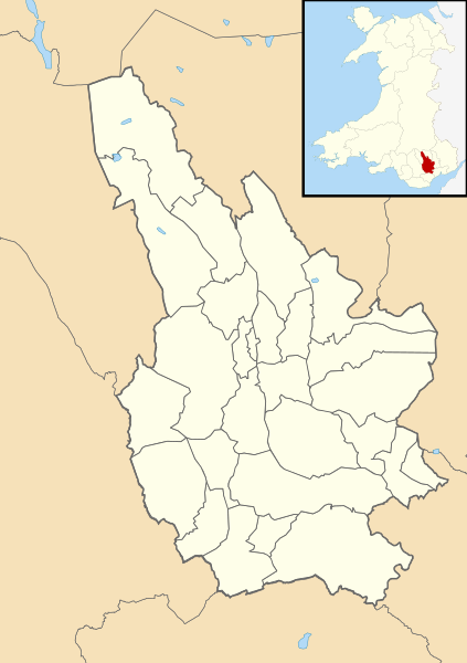
Map of the communities in Caerphilly County Borough, as of March 2024.
Summary[edit]
| Description |
English: Map of the communities in Caerphilly County Borough, Wales, as of March 2024. Using Ordnance Survey OpenData Boundary-Line product (October 2023) data.
This vector image includes elements that have been taken or adapted from this file: This vector image includes elements that have been taken or adapted from this file: |
| Date | |
| Source | Own work |
| Author | DankJae |
.svg)
Licensing[edit]
I, the copyright holder of this work, hereby publish it under the following license:
This file is licensed under the Creative Commons Attribution 4.0 International license.
- You are free:
- to share – to copy, distribute and transmit the work
- to remix – to adapt the work
- Under the following conditions:
- attribution – You must give appropriate credit, provide a link to the license, and indicate if changes were made. You may do so in any reasonable manner, but not in any way that suggests the licensor endorses you or your use.
File history
Click on a date/time to view the file as it appeared at that time.
| Date/Time | Thumbnail | Dimensions | User | Comment | |
|---|---|---|---|---|---|
| current | 01:32, 17 March 2024 | | 512 × 725 (345 KB) | DankJae (talk | contribs) | Uploaded own work with UploadWizard |
You cannot overwrite this file.
File usage on Commons
The following 27 pages use this file:
- File:2024 Wales Caerphilly Community Aber Valley map.svg
- File:2024 Wales Caerphilly Community Abercarn map.svg
- File:2024 Wales Caerphilly Community Argoed map.svg
- File:2024 Wales Caerphilly Community Bargoed map.svg
- File:2024 Wales Caerphilly Community Bedwas, Trethomas and Machen map.svg
- File:2024 Wales Caerphilly Community Blackwood map.svg
- File:2024 Wales Caerphilly Community Caerphilly map.svg
- File:2024 Wales Caerphilly Community Cefn Fforest map.svg
- File:2024 Wales Caerphilly Community Crosskeys map.svg
- File:2024 Wales Caerphilly Community Crumlin map.svg
- File:2024 Wales Caerphilly Community Darran Valley map.svg
- File:2024 Wales Caerphilly Community Gelligaer map.svg
- File:2024 Wales Caerphilly Community Llanbradach and Pwllypant map.svg
- File:2024 Wales Caerphilly Community Maesycwmmer map.svg
- File:2024 Wales Caerphilly Community Nelson map.svg
- File:2024 Wales Caerphilly Community New Tredegar map.svg
- File:2024 Wales Caerphilly Community Newbridge map.svg
- File:2024 Wales Caerphilly Community Pengam map.svg
- File:2024 Wales Caerphilly Community Penmaen map.svg
- File:2024 Wales Caerphilly Community Penyrheol, Trecenydd and Energlyn map.svg
- File:2024 Wales Caerphilly Community Pontllanfraith map.svg
- File:2024 Wales Caerphilly Community Rhymney map.svg
- File:2024 Wales Caerphilly Community Risca East map.svg
- File:2024 Wales Caerphilly Community Risca West map.svg
- File:2024 Wales Caerphilly Community Rudry map.svg
- File:2024 Wales Caerphilly Community Van map.svg
- File:2024 Wales Caerphilly Community Ynysddu map.svg