File:Abkhazia tpc92.jpg
Jump to navigation
Jump to search

Size of this preview: 800 × 486 pixels. Other resolutions: 320 × 195 pixels | 640 × 389 pixels | 1,024 × 622 pixels | 1,280 × 778 pixels | 2,076 × 1,262 pixels.
Original file (2,076 × 1,262 pixels, file size: 585 KB, MIME type: image/jpeg)
Captions
Captions
Add a one-line explanation of what this file represents
Summary[edit]
| Description |
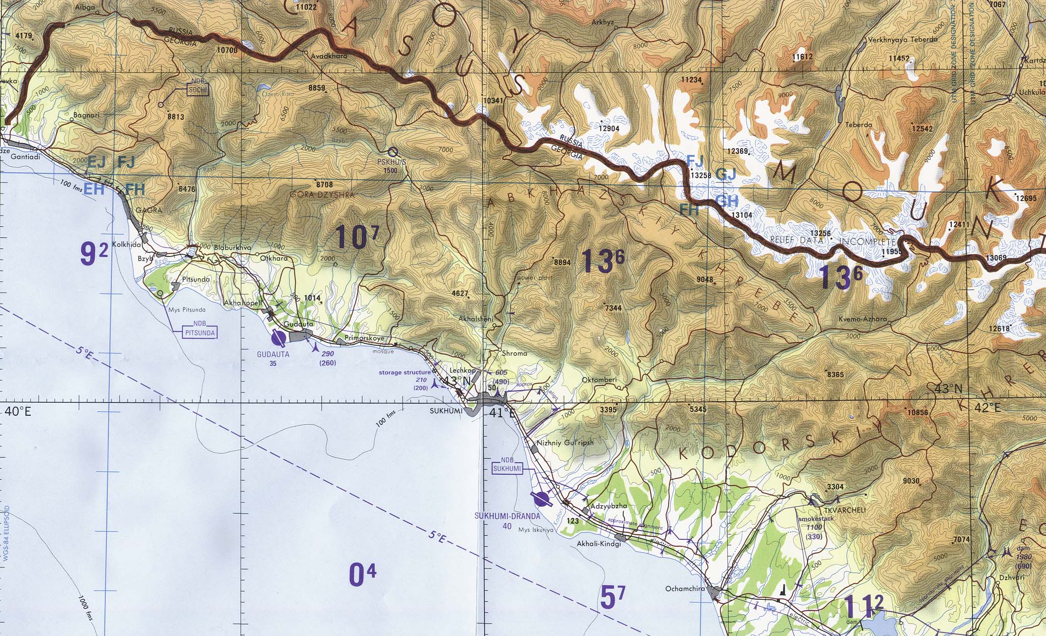
English: Abkhazia Region (tactical pilotage chart) original scale 1:500,000 Portion of Defense Mapping Agency TPC F-4D 1992 (586K) Not for navigational use[1] Русский: Физическая карта Абхазии |
| Date | |
| Source | http://www.lib.utexas.edu/maps/commonwealth/abkhazia_tpc92.jpg |
| Author | Defense Mapping Agency |
Licensing[edit]
This work is in the public domain in the United States because it is a work prepared by an officer or employee of the United States Government as part of that person’s official duties under the terms of Title 17, Chapter 1, Section 105 of the US Code.
Note: This only applies to original works of the Federal Government and not to the work of any individual U.S. state, territory, commonwealth, county, municipality, or any other subdivision. This template also does not apply to postage stamp designs published by the United States Postal Service since 1978. (See § 313.6(C)(1) of Compendium of U.S. Copyright Office Practices). It also does not apply to certain US coins; see The US Mint Terms of Use.
|
 | |
| This file has been identified as being free of known restrictions under copyright law, including all related and neighboring rights. | ||
File history
Click on a date/time to view the file as it appeared at that time.
| Date/Time | Thumbnail | Dimensions | User | Comment | |
|---|---|---|---|---|---|
| current | 10:49, 8 August 2008 | | 2,076 × 1,262 (585 KB) | Sasha Krotov (talk | contribs) | {{Information |Description={{en|Abkhazia Region (tactical pilotage chart) original scale 1:500,000 Portion of Defense Mapping Agency TPC F-4D 1992 (586K) Not for navigational use[http://www.lib.utexas.edu/maps/georgia_republic.html]}}{{ru|Физическ |
You cannot overwrite this file.
File usage on Commons
There are no pages that use this file.