File:Administration territoriale française de.svg
Jump to navigation
Jump to search

Size of this PNG preview of this SVG file: 685 × 460 pixels. Other resolutions: 320 × 215 pixels | 640 × 430 pixels | 1,024 × 688 pixels | 1,280 × 860 pixels | 2,560 × 1,719 pixels.
Original file (SVG file, nominally 685 × 460 pixels, file size: 7 KB)
Captions
Captions
Add a one-line explanation of what this file represents
Summary[edit]
| Description |
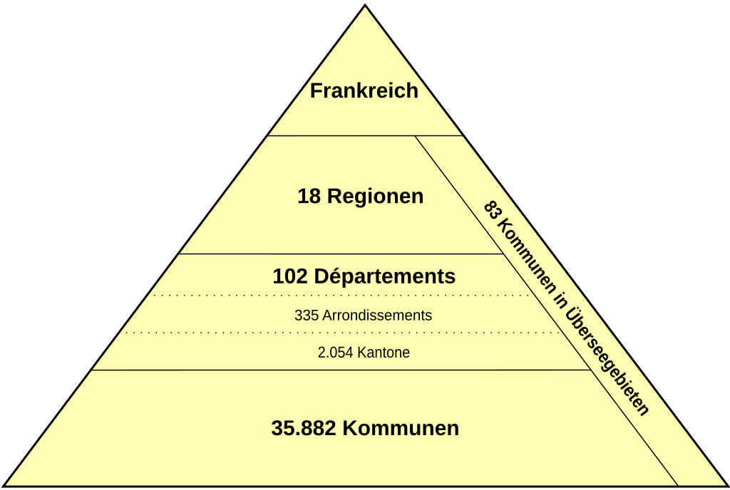
Deutsch: Gebietsverwaltung Frankreichs |
| Date | |
| Source |
This file was derived from: Administration territoriale française.svg |
| Author | Ttog |
Licensing[edit]
| This work is ineligible for copyright and therefore in the public domain because it consists entirely of information that is common property and contains no original authorship. |
File history
Click on a date/time to view the file as it appeared at that time.
| Date/Time | Thumbnail | Dimensions | User | Comment | |
|---|---|---|---|---|---|
| current | 19:50, 13 January 2016 | | 685 × 460 (7 KB) | Pampelonne (talk | contribs) | Updated latest 2015/2016 numbers, sources: http://www.weka.fr/actualite/intercommunalite/article/la-france-passe-sous-la-barre-des-36000-communes-a-35945-34604/ and http://www.insee.fr/fr/methodes/nomenclatures/cog/documentation.asp?page=documentation.htm |
| 17:21, 12 January 2016 |  | 685 × 460 (7 KB) | Pampelonne (talk | contribs) | User created page with UploadWizard |
You cannot overwrite this file.
File usage on Commons
The following page uses this file:
File usage on other wikis
The following other wikis use this file:
- Usage on de.wikipedia.org
- Usage on uk.wikipedia.org