File:Admiralty Chart No 884 Nautical chart of Artaki Bay, Sea of Marmara, Published 1881.jpg
Jump to navigation
Jump to search

Size of this preview: 800 × 590 pixels. Other resolutions: 320 × 236 pixels | 640 × 472 pixels | 1,024 × 755 pixels | 1,280 × 944 pixels | 2,560 × 1,888 pixels | 8,184 × 6,036 pixels.
Original file (8,184 × 6,036 pixels, file size: 7.33 MB, MIME type: image/jpeg)
Captions
Captions
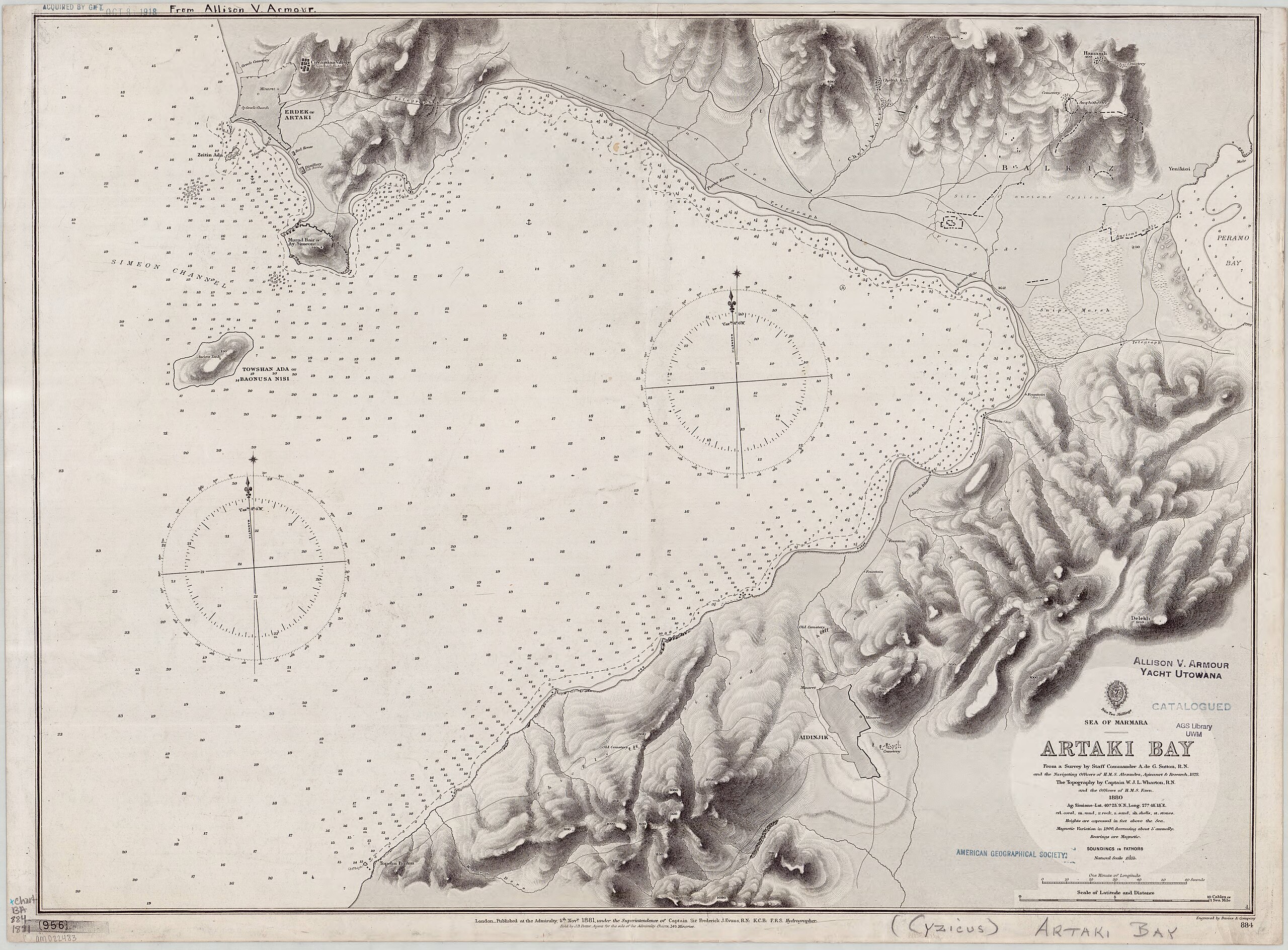
Nautical chart of Artaki Bay, Sea of Marmara
Summary[edit]
| Description |
English: Nautical chart of Artaki Bay, Sea of Marmara. Surveyed by Staff Commander A. de G. Sutton and the navigating officers of H.M.S. Alexendra, Agincourt& Research, 1878. The topography by Captain W.J.L. Wharton and the officers of H.M.S. Fawn, 1880. |
| Date | |
| Source | https://collections.lib.uwm.edu/digital/collection/agdm/id/8544/ |
| Author | Great Britain. Hydrographic Office |
Licensing[edit]
|
This work is in the public domain in its country of origin and other countries and areas where the copyright term is the author's life plus 70 years or fewer. This work is in the public domain in the United States because it was published (or registered with the U.S. Copyright Office) before January 1, 1929. | |
| This file has been identified as being free of known restrictions under copyright law, including all related and neighboring rights. | |
File history
Click on a date/time to view the file as it appeared at that time.
| Date/Time | Thumbnail | Dimensions | User | Comment | |
|---|---|---|---|---|---|
| current | 22:34, 23 February 2019 | | 8,184 × 6,036 (7.33 MB) | Balkanique (talk | contribs) | User created page with UploadWizard |
You cannot overwrite this file.
File usage on Commons
The following page uses this file:
- File:Nautical chart of Artaki Bay, Sea of Marmara.jpg (file redirect)