File:Aerial - from Seneca Lake to Cayuga Lake 02 - white balanced (9646274111).jpg
Jump to navigation
Jump to search

Size of this preview: 800 × 531 pixels. Other resolutions: 320 × 213 pixels | 640 × 425 pixels | 1,024 × 680 pixels | 1,280 × 850 pixels | 2,560 × 1,700 pixels | 4,288 × 2,848 pixels.
Original file (4,288 × 2,848 pixels, file size: 7.16 MB, MIME type: image/jpeg)
Captions
Captions
Add a one-line explanation of what this file represents
Summary
[edit]| Description |
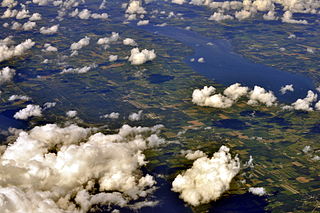
English: Aerial view from SSW of a portion of Seneca County, New York between Seneca Lake and Cayuga Lake, centered roughly at Template:Romulus, New York. |
||
| Date | |||
| Source | Aerial - from Seneca Lake to Cayuga Lake 02 - white balanced | ||
| Author | Joe Mabel (on Flickr as Joe Mabel from Seattle, US) | ||
| Permission (Reusing this file) |
Joe Mabel, the copyright holder of this work, hereby publishes it under the following licenses: This file is licensed under the Creative Commons Attribution-Share Alike 2.0 Generic license. Attribution: Joe Mabel
This file is licensed under the Creative Commons Attribution-Share Alike 3.0 Unported license. Attribution: Joe Mabel
You may select the license of your choice. |
||
| Other versions |
|

.jpg)
.jpg&action=edit§ion=1)
| This image, originally posted to Flickr, was reviewed on 4 September 2013 by the administrator or reviewer File Upload Bot (Magnus Manske), who confirmed that it was available on Flickr under the stated license on that date. |
| Annotations | This image is annotated: View the annotations at Commons |
.jpg)
File history
Click on a date/time to view the file as it appeared at that time.
| Date/Time | Thumbnail | Dimensions | User | Comment | |
|---|---|---|---|---|---|
| current | 02:11, 4 September 2013 | | 4,288 × 2,848 (7.16 MB) | File Upload Bot (Magnus Manske) (talk | contribs) | Transferred from Flickr by User:Jmabel |
You cannot overwrite this file.
File usage on Commons
The following page uses this file:
.jpg&oldid=887479339)