File:Aerial Photography Index for Morgan County, Alabama, Sheet 7 - DPLA - ae2cab71a05495366ef099d508262c14.jpg
Jump to navigation
Jump to search

Size of this preview: 504 × 599 pixels. Other resolutions: 202 × 240 pixels | 404 × 480 pixels | 646 × 768 pixels | 862 × 1,024 pixels | 1,723 × 2,048 pixels | 6,000 × 7,131 pixels.
Original file (6,000 × 7,131 pixels, file size: 3.31 MB, MIME type: image/jpeg)
Captions
Captions
Add a one-line explanation of what this file represents
Summary
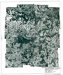
[edit]| Aerial Photography Index for Morgan County, Alabama, Sheet 7
( |
||||||||||||||
|---|---|---|---|---|---|---|---|---|---|---|---|---|---|---|
| Creator | Department of Agriculture. Commodity Stabilization Service. Aerial Photography Field Office. ca. 1953-1961 | |||||||||||||
| Title |
Aerial Photography Index for Morgan County, Alabama, Sheet 7 |
|||||||||||||
| Date | 1937 | |||||||||||||
| Collection |
|
|||||||||||||
| Source/Photographer |
|
|||||||||||||
| Permission (Reusing this file) |
|
|||||||||||||
| Standardized rights statement |
|
|||||||||||||


File history
Click on a date/time to view the file as it appeared at that time.
| Date/Time | Thumbnail | Dimensions | User | Comment | |
|---|---|---|---|---|---|
| current | 22:52, 23 November 2020 | | 6,000 × 7,131 (3.31 MB) | DPLA bot (talk | contribs) | Uploading DPLA ID ae2cab71a05495366ef099d508262c14 |
You cannot overwrite this file.
File usage on Commons
The following page uses this file: