File:Aerial view of the southeastern town of Forestville, the southwestern town of Clay Banks, and part of the northern town of Ahnapee in Door and Kewaunee counties in Wisconsin 2020.png
Jump to navigation
Jump to search

Size of this preview: 437 × 600 pixels. Other resolutions: 175 × 240 pixels | 350 × 480 pixels | 560 × 768 pixels | 746 × 1,024 pixels | 1,493 × 2,048 pixels | 9,269 × 12,716 pixels.
Original file (9,269 × 12,716 pixels, file size: 215.86 MB, MIME type: image/png)
Captions
Captions
Add a one-line explanation of what this file represents
| Warning | The original file is very high-resolution. It might not load properly or could cause your browser to freeze when opened at full size. |
|---|
| Description |
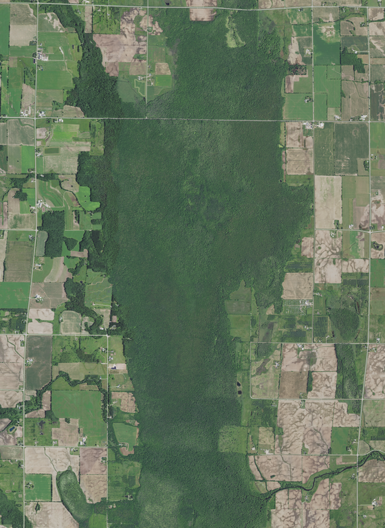
English: Aerial view of the southeastern town of Forestville and the southwestern town of Clay Banks in Door County and part of the northern town of Ahnapee in Kewaunee County. Photo taken in Wisconsin on June 27, 2020. About four fifths of the photo depicts Kewaunee County and one fifth depicts Door County. Silver Creek (bottom right) flows east towards the Ahnapee River as a tributary.
The Black Ash Swamp (page 34, pdf page 40) is at the center.
|
|||
| Date | ||||
| Source | converted to .png by Epiphyllumlover from the original .tif available as item M_4408720_SE_16_060_20200627 on EarthExplorer | |||
| Author | Aerial Photography Field Office (APFO) for NAIP, USGS; in contract with the Surdex Corporation | |||
| Permission (Reusing this file) |
|
File history
Click on a date/time to view the file as it appeared at that time.
| Date/Time | Thumbnail | Dimensions | User | Comment | |
|---|---|---|---|---|---|
| current | 23:13, 24 March 2022 | | 9,269 × 12,716 (215.86 MB) | Epiphyllumlover (talk | contribs) | c:User:Rillke/bigChunkedUpload.js: {{Information | Description = {{en|Aerial view of the southeastern town of Forestville and the southwestern town of Clay Banks in Door County and part of the northern town of Ahnapee in Kewaunee County. Photo taken in Wisconsin on June 27, 2020. About four fifths of the photo depicts Kewaunee Count... |
You cannot overwrite this file.
File usage on Commons
There are no pages that use this file.