File:Altiplano Cundiboyacense (subdivisions).png
Jump to navigation
Jump to search

Size of this preview: 652 × 600 pixels. Other resolutions: 261 × 240 pixels | 522 × 480 pixels | 835 × 768 pixels | 1,114 × 1,024 pixels | 1,740 × 1,600 pixels.
Original file (1,740 × 1,600 pixels, file size: 6.57 MB, MIME type: image/png)
Captions
Captions
Add a one-line explanation of what this file represents
Summary
[edit].png&action=edit§ion=1)
| Description |
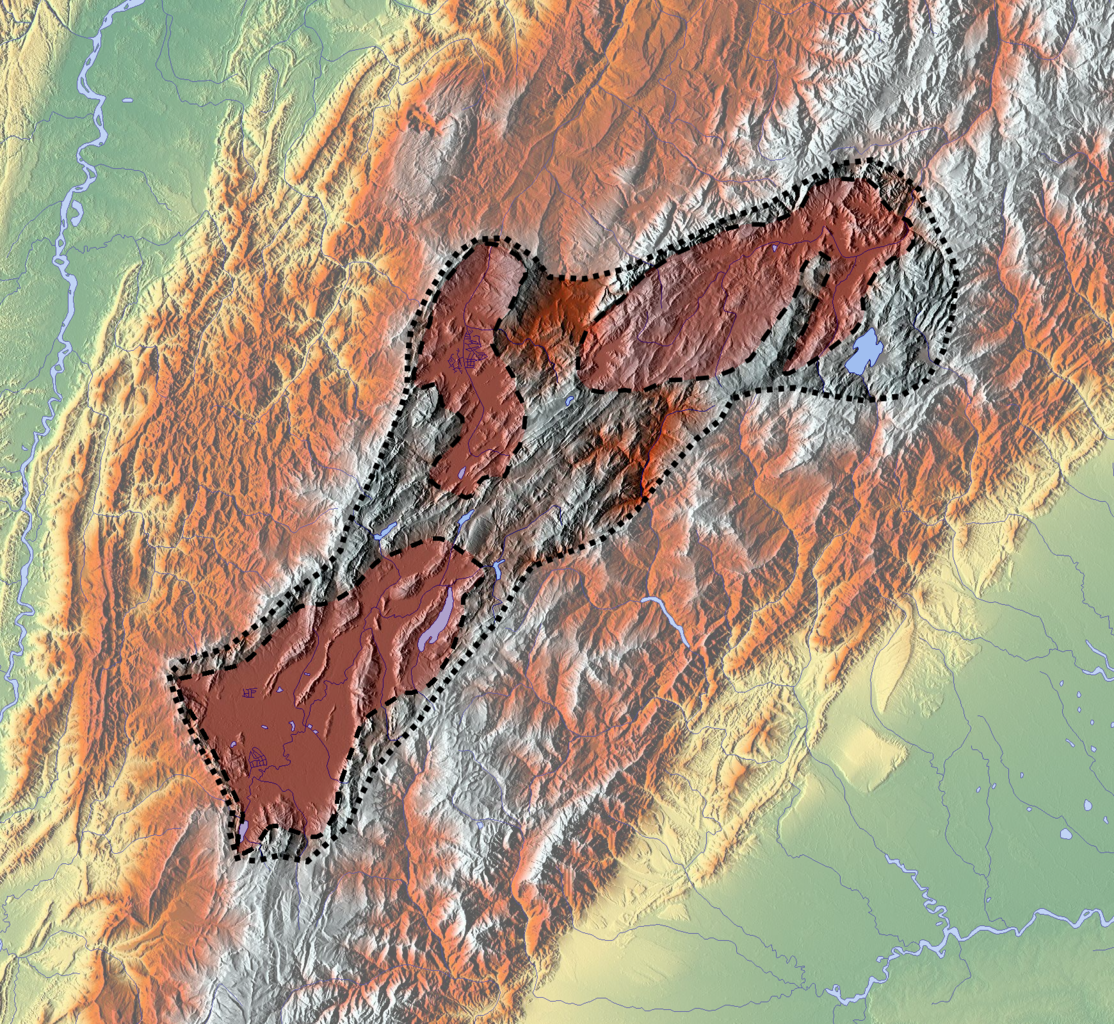
Français : Carte de l'altiplano cundiboyacense, en Colombie.
En rouge, d'ouest en est :
English: Map of the altiplano cundiboyacense, in Colombia.
|
| Date | |
| Source |
Own work
|
| Author | Dr Brains |
Licensing
[edit].png&action=edit§ion=2)
I, the copyright holder of this work, hereby publish it under the following license:

|
Permission is granted to copy, distribute and/or modify this document under the terms of the GNU Free Documentation License, Version 1.2 or any later version published by the Free Software Foundation; with no Invariant Sections, no Front-Cover Texts, and no Back-Cover Texts. A copy of the license is included in the section entitled GNU Free Documentation License. |
File history
Click on a date/time to view the file as it appeared at that time.
| Date/Time | Thumbnail | Dimensions | User | Comment | |
|---|---|---|---|---|---|
| current | 20:32, 6 April 2013 | | 1,740 × 1,600 (6.57 MB) | Dr Brains (talk | contribs) | User created page with UploadWizard |
You cannot overwrite this file.
File usage on Commons
There are no pages that use this file.
File usage on other wikis
The following other wikis use this file:
- Usage on en.wikipedia.org
- Muisca
- Tunja
- Duitama
- Sogamoso
- Altiplano Cundiboyacense
- History of Bogotá
- Bogotá savanna
- Bacatá
- Chicamocha River
- Paja Formation
- Gyalideopsis chicaque
- Aquiminzaque
- Sagipa
- Tisquesusa
- Quemuenchatocha
- Michuá
- Hunzahúa
- Nemequene
- Saguamanchica
- Meicuchuca
- Battle of Chocontá
- Muisca Confederation
- Muisca religion
- Tundama
- Sugamuxi
- Battle of Pasca
- Herrera Period
- Nompanim
- Muisca astronomy
- Template:Timeline of inhabitation of the Altiplano Cundiboyacense
- Women in Muisca society
- Spanish conquest of the Muisca
- Muisca warfare
- Muisca art
- Tibitó
- Checua
- List of Muisca and pre-Muisca sites
- Ocetá Páramo
- Template:History of the Muisca
- Eastern Hills (Bogotá)
- Battle of Tocarema
- Module:Location map/data/Colombia Altiplano Cundiboyacense
- Module:Location map/data/Colombia Altiplano Cundiboyacense/doc
- Sabana Formation
- Ritoque Formation
- Module:Location map/data/Altiplano Cundiboyacense
- Usage on es.wikipedia.org
- Usage on nl.wikipedia.org
- Usage on si.wikipedia.org
View more global usage of this file.
.png)
.png&oldid=844358734)