File:Angola mapa.png
Jump to navigation
Jump to search
No higher resolution available.
Angola_mapa.png (330 × 354 pixels, file size: 10 KB, MIME type: image/png)
Captions
Captions
Add a one-line explanation of what this file represents
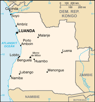
| Description | Map of Angola from CIA World Factbook, translated from en:Image:Angola map.png | |||
| Source | CIA World Factbook | |||
| Author | Users Nádvorník, Ludek on cs.wikipedia | |||
| Permission (Reusing this file) |
|
|||
| Other versions |
Originally from cs.wikipedia; description page is (was) here
|

(Uploaded using CommonsHelper or PushForCommons archive copy at the Wayback Machine)
Original upload log[edit]
| Date/Time | Dimensions | User | Comment |
|---|---|---|---|
| 26 July 2006, 11:36:24 | 330 × 354 (11145 bytes) | Timichal (talk · contribs) | {{Information| |Description= Map of Angola from CIA World Factbook, translated from [[:en:Image:Angola map.png]] |Source=CIA World Factbook |Date= |Author=Users [[:cs:User:Nádvorník|Nádvorník]], [[:cs:User:Ludek|Ludek]] on [http://cs.wikipedia.org cs. |
File history
Click on a date/time to view the file as it appeared at that time.
| Date/Time | Thumbnail | Dimensions | User | Comment | |
|---|---|---|---|---|---|
| current | 16:59, 16 August 2014 | | 330 × 354 (10 KB) | GifTagger (talk | contribs) | Bot: Converting file to superior PNG file. (Source: Angola_mapa.gif). This GIF was problematic due to non-greyscale color table. |
You cannot overwrite this file.
File usage on Commons
The following 2 pages use this file:
File usage on other wikis
The following other wikis use this file:
- Usage on cs.wikipedia.org
- Usage on sk.wikipedia.org