File:Anuario.Oficial.Argentina.1912.jpg

Original file (2,528 × 3,712 pixels, file size: 1.38 MB, MIME type: image/jpeg)
Captions
Captions
| DescriptionAnuario.Oficial.Argentina.1912.jpg |
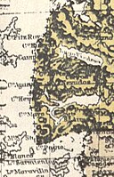
Here is a reproduction of the map of the Governorships of Santa Cruz and Tierra del Fuego included in the "Official Yearbook of the Argentine Republic", "published by the Ministery of the Interior, Foreign Affairs and Agriculture" in Buenos Aires in 1912. In the Beagle Channel region the international boundary is not marked, but the difference in the colours used to denote the territories of each of the countries established that all the islands and islets extending southward from the Beagle Channel as far as Cape Horn are under Chilean sovereignty |
|||||
| Date | ||||||
| Source | Relaciones Chileno-Argentinas, La controversia del Beagle, edited by chilean Foreign Affairs, Geneve, Switzerland, 1979 | |||||
| Author | "Official Yearbook of the Argentine Republic" | |||||
| Permission (Reusing this file) |
|
|||||
| Other versions |
|
|||||
File history
Click on a date/time to view the file as it appeared at that time.
| Date/Time | Thumbnail | Dimensions | User | Comment | |
|---|---|---|---|---|---|
| current | 23:23, 11 January 2008 |  | 2,528 × 3,712 (1.38 MB) | Keysanger (talk | contribs) | {{Information |Description=Here is a reproduction of the map of the Governorships of Santa Cruz and Tierra del Fuego included in the "Official Yearbook of the Argentine Republic", "published by the Ministery of the Interior, Foreign Affairs and Agricultur |
You cannot overwrite this file.
File usage on Commons
The following page uses this file:
Metadata
This file contains additional information such as Exif metadata which may have been added by the digital camera, scanner, or software program used to create or digitize it. If the file has been modified from its original state, some details such as the timestamp may not fully reflect those of the original file. The timestamp is only as accurate as the clock in the camera, and it may be completely wrong.
| _error | 0 |
|---|
