File:Apharwat Right Wing.jpg
Jump to navigation
Jump to search

Size of this preview: 800 × 600 pixels. Other resolutions: 320 × 240 pixels | 640 × 480 pixels | 1,024 × 768 pixels | 1,280 × 960 pixels | 2,560 × 1,920 pixels | 4,096 × 3,072 pixels.
Original file (4,096 × 3,072 pixels, file size: 2.33 MB, MIME type: image/jpeg)
Captions
Captions
Add a one-line explanation of what this file represents
Summary[edit]
| Description |
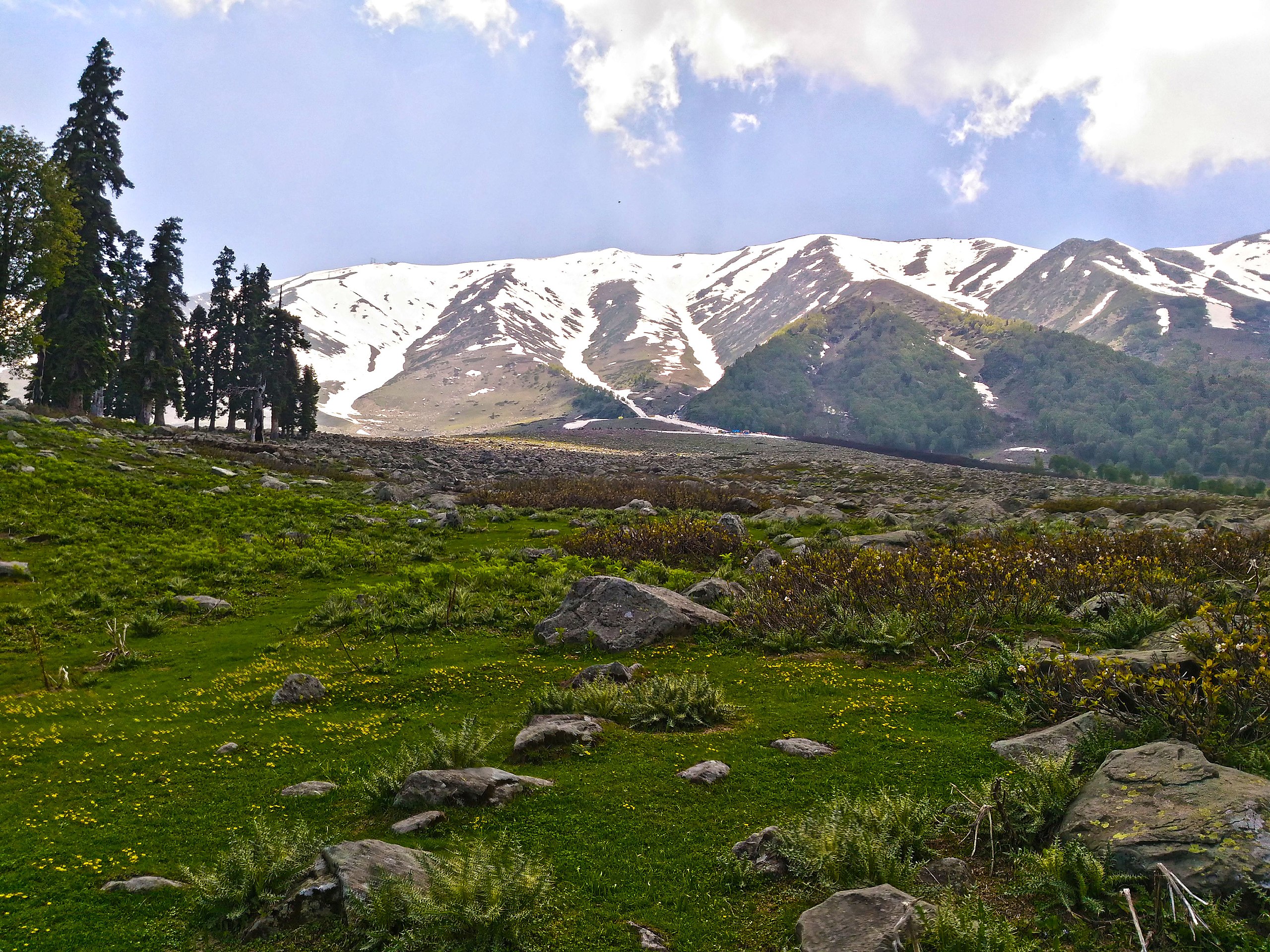
English: Right side of Apharwat Peak where Asia's highest and longest cable car project, the Gulmarg Gondola is installed.It is the dead end of cable car project there. This pic is taken in summer 2016, when ice started to melt. The Apharwat peak is in range of Pir panjal mountains which acts as a side of Gulmarg Wildlife Sanctuary which exists on left side of the mountains.
Apharwat Peak is a summit, situated at a height of 4,390 metres (14,403 ft) above the sea level. |
| Date | |
| Source | Own work |
| Author | Shabir Dar |
| Camera location | | View this and other nearby images on: OpenStreetMap |
|---|
Licensing[edit]
I, the copyright holder of this work, hereby publish it under the following license:
This file is licensed under the Creative Commons Attribution-Share Alike 4.0 International license.
- You are free:
- to share – to copy, distribute and transmit the work
- to remix – to adapt the work
- Under the following conditions:
- attribution – You must give appropriate credit, provide a link to the license, and indicate if changes were made. You may do so in any reasonable manner, but not in any way that suggests the licensor endorses you or your use.
- share alike – If you remix, transform, or build upon the material, you must distribute your contributions under the same or compatible license as the original.
This image was uploaded as part of Wiki Loves Earth 2016.
|
 |
File history
Click on a date/time to view the file as it appeared at that time.
| Date/Time | Thumbnail | Dimensions | User | Comment | |
|---|---|---|---|---|---|
| current | 05:52, 10 June 2016 | | 4,096 × 3,072 (2.33 MB) | Shabir.dr (talk | contribs) | User created page with UploadWizard |
You cannot overwrite this file.
File usage on Commons
The following page uses this file: