File:Arad Josephinische Landesaufnahme pg21-31.jpg
Jump to navigation
Jump to search

Size of this preview: 800 × 537 pixels. Other resolutions: 320 × 215 pixels | 640 × 429 pixels | 1,024 × 687 pixels | 1,280 × 859 pixels | 2,560 × 1,717 pixels | 8,610 × 5,775 pixels.
Original file (8,610 × 5,775 pixels, file size: 18.24 MB, MIME type: image/jpeg)
Captions
Captions
Add a one-line explanation of what this file represents
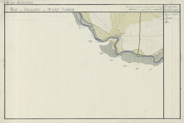
| Name shown on the map Nume din hartă |
Administrative unit Unitate administrativă |
Romanian name Numele românesc |
Hungarian name Numele unguresc |
German name Numele german |
Country today Ţara de astăzi |
|---|---|---|---|---|---|
| Sajtin | Czanader Csanád vármegye Comitatul Cenad Komitat Csanád |
Şeitin | Sajtény | Romania |
Summary[edit]
| Description |
English: Arad County, 1782-85. Josephinische Landesaufnahme pg.21-31 |
||||
| Date | between 1782 and 1785 | ||||
| Source | Österreichisches Staatsarchiv, Kriegsarchiv | ||||
| Author | Historische Militärkarte der österreichisch-ungarischen Monarchie | ||||
| Permission (Reusing this file) |
|
||||
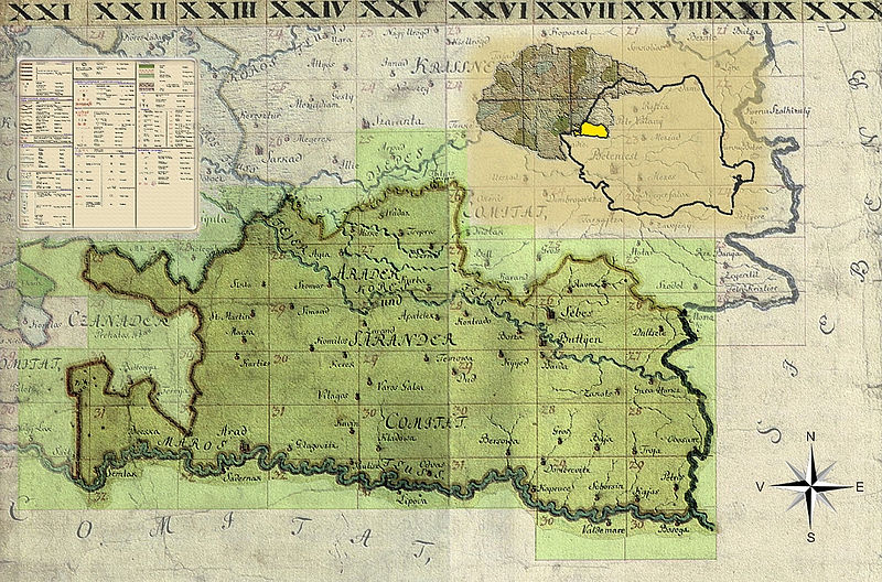
Clickable Map of the Arad County[edit]
File history
Click on a date/time to view the file as it appeared at that time.
| Date/Time | Thumbnail | Dimensions | User | Comment | |
|---|---|---|---|---|---|
| current | 17:22, 2 April 2010 | | 8,610 × 5,775 (18.24 MB) | Asybaris01 (talk | contribs) | {{Information |Description={{ro|1=Arad Josephinische Landesaufnahme pg21-31}} |Source={{own}} |Author=Asybaris01 |Date=1782-1785 |Permission= |other_versions= }} Category:Josephinische Landaufnahme |
You cannot overwrite this file.
File usage on Commons
There are no pages that use this file.
File usage on other wikis
The following other wikis use this file:
- Usage on arz.wikipedia.org
- Usage on de.wikipedia.org
- Usage on hu.wikipedia.org
- Usage on ro.wikipedia.org
- Usage on www.wikidata.org