File:Australia Victoria complete Melbourne metropolitan area location map.svg
Jump to navigation
Jump to search

Size of this PNG preview of this SVG file: 534 × 404 pixels. Other resolutions: 317 × 240 pixels | 635 × 480 pixels | 1,015 × 768 pixels | 1,280 × 968 pixels | 2,560 × 1,937 pixels.
Original file (SVG file, nominally 534 × 404 pixels, file size: 1.74 MB)
Captions
Captions
Add a one-line explanation of what this file represents
| Description |
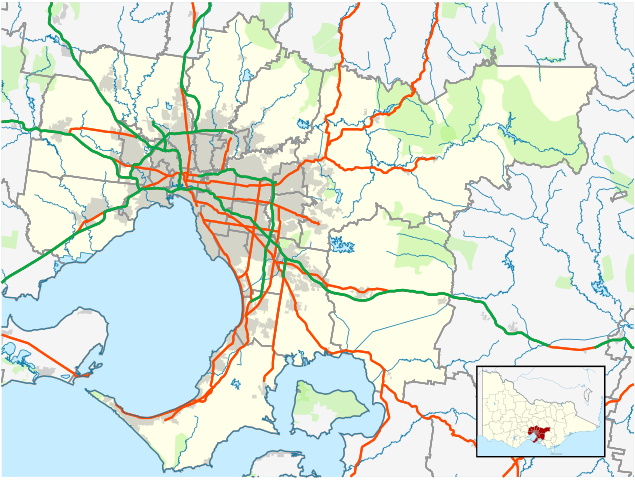
English: Blank map of Melbourne, Victoria, Australia, with the following information shown:
Geographic limits:
|
||
| Source | Own work + VicMap Lite | ||
| Author | Cassowary |

File history
Click on a date/time to view the file as it appeared at that time.
| Date/Time | Thumbnail | Dimensions | User | Comment | |
|---|---|---|---|---|---|
| current | 16:21, 28 February 2011 | | 534 × 404 (1.74 MB) | Cassowary (talk | contribs) | {{Information |Description ={{en|1=Blank map of Melbourne, Victoria, Australia, with the following information shown: * LGA boundaries * Coastline, lakes and rivers * Roads and railways * Urban areas * Parks Geographic lim |
You cannot overwrite this file.
File usage on Commons
There are no pages that use this file.
File usage on other wikis
The following other wikis use this file:
- Usage on ar.wikipedia.org
- Usage on bn.wikipedia.org
- Usage on ceb.wikipedia.org
- Usage on en.wikipedia.org
- Melbourne Airport
- Wesburn, Victoria
- Moorabbin Airport
- Tynong, Victoria
- Essendon Airport
- ACDC Lane
- List of airports in the Melbourne area
- Module:Location map/data/Australia Victoria Melbourne metropolitan area complete/doc
- Lilydale Airport
- User:VicState2017
- Module:Location map/data/Australia Victoria Melbourne metropolitan area complete
- Usage on fa.wikipedia.org
- Usage on id.wikipedia.org
- Usage on kn.wikipedia.org
- Usage on si.wikipedia.org
- Usage on ta.wikipedia.org
- Usage on tr.wikipedia.org
- Usage on ur.wikipedia.org
- Usage on uz.wikipedia.org
- Usage on war.wikipedia.org
- Usage on zh.wikipedia.org