File:Austria topographic map.png
Jump to navigation
Jump to search

Size of this preview: 800 × 421 pixels. Other resolutions: 320 × 168 pixels | 640 × 337 pixels | 1,024 × 539 pixels | 1,280 × 674 pixels | 2,000 × 1,053 pixels.
Original file (2,000 × 1,053 pixels, file size: 641 KB, MIME type: image/png)
Captions
Captions
Add a one-line explanation of what this file represents
| Description |
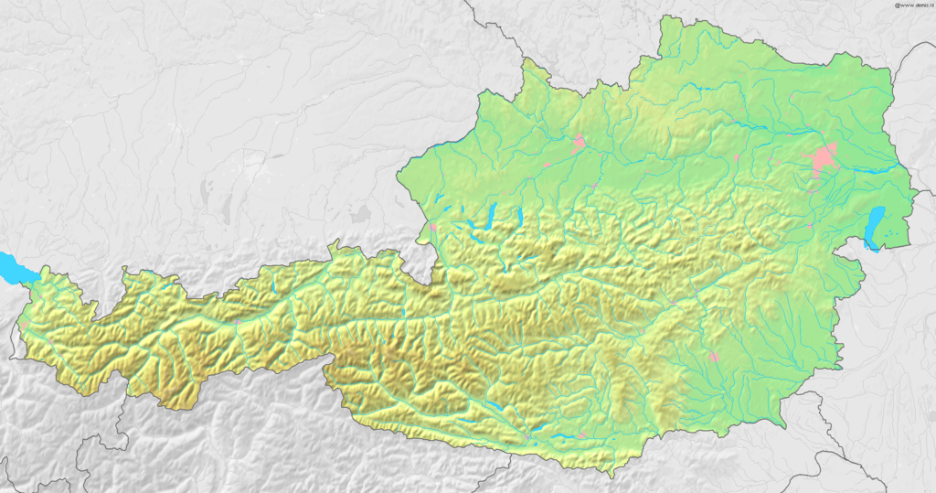
English: Topographic Map of Austria
Deutsch: Topografische Karte von Österreich |
| Date | |
| Source | Map created from DEMIS Mapserver, which are public domain. Edited by myself |
| Author | User:Reinim19 |
| Permission (Reusing this file) |
This file is licensed under the Creative Commons Attribution-Share Alike 3.0 Unported license.
|
File history
Click on a date/time to view the file as it appeared at that time.
| Date/Time | Thumbnail | Dimensions | User | Comment | |
|---|---|---|---|---|---|
| current | 09:15, 14 July 2008 | | 2,000 × 1,053 (641 KB) | Reinim19 (talk | contribs) | {{Information |Description= |Source= |Date= |Author= |Permission= |other_versions= }} |
| 09:34, 25 April 2008 |  | 2,000 × 965 (452 KB) | Reinim19 (talk | contribs) | ||
| 12:21, 17 April 2008 |  | 1,514 × 756 (279 KB) | Reinim19 (talk | contribs) | {{Information |Description= |Source=eigene Arbeit |Date= |Author= Reinim19 |Permission= |other_versions= }} |
You cannot overwrite this file.
File usage on Commons
There are no pages that use this file.
File usage on other wikis
The following other wikis use this file:
- Usage on fi.wikipedia.org
- Usage on fr.wikipedia.org
- Usage on hu.wikipedia.org
- Usage on hu.wiktionary.org
- Usage on lv.wikipedia.org
- Usage on vep.wikipedia.org
- Usage on vi.wikipedia.org