File:Babruysk Sikorskaga 38 (Church) 2.JPG
Jump to navigation
Jump to search

Size of this preview: 800 × 600 pixels. Other resolutions: 320 × 240 pixels | 640 × 480 pixels | 1,024 × 768 pixels | 1,280 × 960 pixels | 2,560 × 1,920 pixels | 3,264 × 2,448 pixels.
Original file (3,264 × 2,448 pixels, file size: 3.22 MB, MIME type: image/jpeg)
Captions
Captions
Add a one-line explanation of what this file represents
Summary[edit]
_2.JPG&action=edit§ion=1)
| Camera location | | View this and other nearby images on: OpenStreetMap |
|---|
_2.JPG¶ms=053.200906_N_0029.230936_E_globe:Earth_type:camera__&language=en)
| Description |
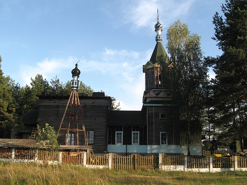
Беларуская (тарашкевіца): Царква з в. Куляшоўка Клімавіцкага раёна. г. Бабруйск. 1893 год. Сікорскага, 38.
Русский: Xрам из села Кулешовка Климовичского района Климовичского района. г. Бобруйск. Сикорского, 38.
Оригинальный храм был построен в с.Кулешовка в 1893 г., закрыта в 1959 г. Перенос на Луковую гору в Бобруйске начался в 2000 г. К концу 2003 г. был возведён фундамент храма на новом месте[1]. Однако строительство до сих пор не завершено. English: Babruysk, Church 1893. St. Sikorskaga, 38.
|
||
| Date | |||
| Source | Own work | ||
| Author | APTEM |
Licensing[edit]
_2.JPG&action=edit§ion=2)
I, the copyright holder of this work, hereby publish it under the following license:
This file is licensed under the Creative Commons Attribution-Share Alike 3.0 Unported license.
- You are free:
- to share – to copy, distribute and transmit the work
- to remix – to adapt the work
- Under the following conditions:
- attribution – You must give appropriate credit, provide a link to the license, and indicate if changes were made. You may do so in any reasonable manner, but not in any way that suggests the licensor endorses you or your use.
- share alike – If you remix, transform, or build upon the material, you must distribute your contributions under the same or compatible license as the original.

|
This image was uploaded as part of Wiki Loves Monuments 2012.
|
 |
File history
Click on a date/time to view the file as it appeared at that time.
| Date/Time | Thumbnail | Dimensions | User | Comment | |
|---|---|---|---|---|---|
| current | 06:00, 8 September 2012 | | 3,264 × 2,448 (3.22 MB) | APTEM (talk | contribs) | User created page with UploadWizard |
You cannot overwrite this file.
File usage on Commons
There are no pages that use this file.
_2.JPG&oldid=814574765)