File:Baldersdale - geograph.org.uk - 855008.jpg
Jump to navigation
Jump to search
No higher resolution available.
Baldersdale_-_geograph.org.uk_-_855008.jpg (640 × 427 pixels, file size: 239 KB, MIME type: image/jpeg)
Captions
Captions
Add a one-line explanation of what this file represents
Summary[edit]
| Description |
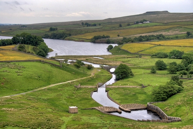
English: Baldersdale View from the top of the dam. About half the outlet pool is in this grid square. On the left buttercups dominate the fields of Hannah's Meadow Nature Reserve. The Pennine Way crosses the river over the small bridge, centre. Far right is the 389m flat topped summit of Goldsborough. |
| Date | |
| Source | From geograph.org.uk |
| Author | Mick Garratt |
| Attribution (required by the license) | Mick Garratt / Baldersdale / |
| Camera location | | View this and other nearby images on: OpenStreetMap |
|---|
_heading:112.00&language=en)
| Object location | | View this and other nearby images on: OpenStreetMap |
|---|
_heading:112.00&language=en)
Licensing[edit]

|
This image was taken from the Geograph project collection. See this photograph's page on the Geograph website for the photographer's contact details. The copyright on this image is owned by Mick Garratt and is licensed for reuse under the Creative Commons Attribution-ShareAlike 2.0 license.
|
This file is licensed under the Creative Commons Attribution-Share Alike 2.0 Generic license.
Attribution: Mick Garratt
- You are free:
- to share – to copy, distribute and transmit the work
- to remix – to adapt the work
- Under the following conditions:
- attribution – You must give appropriate credit, provide a link to the license, and indicate if changes were made. You may do so in any reasonable manner, but not in any way that suggests the licensor endorses you or your use.
- share alike – If you remix, transform, or build upon the material, you must distribute your contributions under the same or compatible license as the original.
File history
Click on a date/time to view the file as it appeared at that time.
| Date/Time | Thumbnail | Dimensions | User | Comment | |
|---|---|---|---|---|---|
| current | 01:39, 21 February 2011 | | 640 × 427 (239 KB) | GeographBot (talk | contribs) | == {{int:filedesc}} == {{Information |description={{en|1=Baldersdale View from the top of the dam. About half the outlet pool is in this grid square. On the left buttercups dominate the fields of Hannah's Meadow Nature Reserve. The Pennine Way crosses the |
You cannot overwrite this file.
File usage on Commons
There are no pages that use this file.