File:Barajas pista.png
Jump to navigation
Jump to search
No higher resolution available.
Barajas_pista.png (234 × 453 pixels, file size: 4 KB, MIME type: image/png)
Captions
Captions
Add a one-line explanation of what this file represents
Summary[edit]
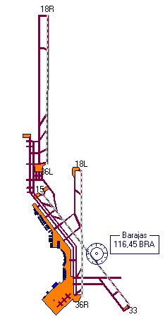
| Description | Skizze zeigt die Lage der Pisten von Bajaras | ||
| Date | |||
| Source | Own work (Original text: eigene Skizze nach Unterlagen der AENA angeferigt.(!nicht im Massstab genau wiedergeben!! soll nur die Diskussion beenden welche Piste es nun wirklich gibt.)) | ||
| Author | selber mit einfachem Zeichenprogram erstellt. | ||
| Permission (Reusing this file) |
stimme der Lizenz GNU-FDL zu | ||
| Other versions |
|

Licensing[edit]
selber mit einfachem Zeichenprogram erstellt, the copyright holder of this work, hereby publishes it under the following license:

|
Permission is granted to copy, distribute and/or modify this document under the terms of the GNU Free Documentation License, Version 1.2 or any later version published by the Free Software Foundation; with no Invariant Sections, no Front-Cover Texts, and no Back-Cover Texts. A copy of the license is included in the section entitled GNU Free Documentation License. |
| This file is licensed under the Creative Commons Attribution-Share Alike 3.0 Unported license. | ||
| Attribution: selber mit einfachem Zeichenprogram erstellt | ||
| ||
| This licensing tag was added to this file as part of the GFDL licensing update. |
Original upload log[edit]
| Date/Time | Dimensions | User | Comment |
|---|---|---|---|
| 9 July 2006, 01:59:05 | 234 × 453 (4346 bytes) | Buscador (talk · contribs) | {{Information |Description= Skizze zeigt die Lage der Pisten von Bajaras |Source=eigene Skizze nach Unterlagen der AENA angeferigt.(!nicht im Massstab genau wiedergeben!! soll nur die Diskussion beenden welche Piste es nun wirklich gibt.) |Date=2006 |Auth |
File history
Click on a date/time to view the file as it appeared at that time.
| Date/Time | Thumbnail | Dimensions | User | Comment | |
|---|---|---|---|---|---|
| current | 18:35, 23 August 2014 | | 234 × 453 (4 KB) | GifTagger (talk | contribs) | Bot: Converting file to superior PNG file. (Source: Barajas_pista.gif). This GIF was problematic due to non-greyscale color table. |
You cannot overwrite this file.
File usage on Commons
The following 2 pages use this file:
File usage on other wikis
The following other wikis use this file:
- Usage on ast.wikipedia.org
- Usage on ca.wikipedia.org
- Usage on es.wikipedia.org
- Usage on gl.wikipedia.org
- Usage on pt.wikipedia.org
- Usage on www.wikidata.org