File:Beit Netofa valley & Hoshaya and Shikhin.JPG
From Wikimedia Commons, the free media repository
Jump to navigation
Jump to search
Size of this preview: 800 × 183 pixels. Other resolutions: 320 × 73 pixels | 640 × 146 pixels | 1,024 × 234 pixels | 1,280 × 293 pixels | 4,720 × 1,080 pixels.
Original file (4,720 × 1,080 pixels, file size: 1.18 MB, MIME type: image/jpeg)
File information
Structured data
Captions
Summary[edit]
DescriptionBeit Netofa valley & Hoshaya and Shikhin.JPG |
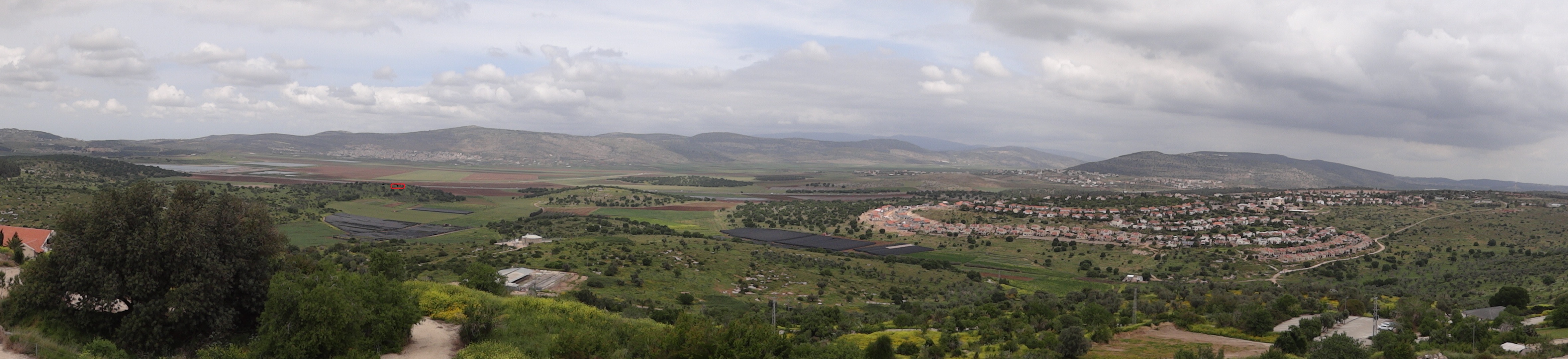
Beit Netofa valley', Israel בקעת בית נטופה בגליל, ישראל מימין הושעיה, משמאל בקעת בית נטופה, מיקום שיחין העתיקה מסומן במלבן אדום על הגבעה השמאלית השנייה להושעיה |
|||
Date | ||||
Source | Own work | |||
Author | Hanay | |||
Permission (Reusing this file) |
This file is licensed under the Creative Commons Attribution-Share Alike 3.0 Unported license. Attribution: Hanay
|
|||
Other versions |
|
File history
Click on a date/time to view the file as it appeared at that time.
Date/Time | Thumbnail | Dimensions | User | Comment | |
---|---|---|---|---|---|
current | 01:39, 7 June 2017 | 4,720 × 1,080 (1.18 MB) | Hanay (talk | contribs) | עם סימון שיחין באדום | |
01:29, 7 June 2017 | 4,720 × 1,080 (1.27 MB) | Hanay (talk | contribs) | File:Beit Netofa valley & Hoshaya (2).JPG cropped 4 % horizontally using CropTool with lossless mode. |
You cannot overwrite this file.
File usage on Commons
The following 2 pages use this file:
File usage on other wikis
The following other wikis use this file:
Metadata
This file contains additional information such as Exif metadata which may have been added by the digital camera, scanner, or software program used to create or digitize it. If the file has been modified from its original state, some details such as the timestamp may not fully reflect those of the original file. The timestamp is only as accurate as the clock in the camera, and it may be completely wrong.
Camera manufacturer | SONY |
---|---|
Camera model | DSC-HX100V |
Exposure time | 1/250 sec (0.004) |
F-number | f/2.8 |
ISO speed rating | 100 |
Date and time of data generation | 11:57, 12 April 2012 |
Lens focal length | 4.8 mm |
Orientation | Normal |
Horizontal resolution | 72 dpi |
Vertical resolution | 72 dpi |
File change date and time | 11:57, 12 April 2012 |
Y and C positioning | Co-sited |
Exposure Program | Normal program |
Exif version | 2.3 |
Date and time of digitizing | 11:57, 12 April 2012 |
Meaning of each component |
|
Image compression mode | 2 |
APEX brightness | 10.5171875 |
APEX exposure bias | 0 |
Maximum land aperture | 3 APEX (f/2.83) |
Metering mode | Pattern |
Light source | Unknown |
Flash | Flash did not fire, compulsory flash suppression |
Supported Flashpix version | 1 |
Color space | sRGB |
File source | Digital still camera |
Scene type | A directly photographed image |
Custom image processing | Normal process |
Exposure mode | Auto exposure |
White balance | Auto white balance |
Scene capture type | Standard |
Contrast | Normal |
Saturation | Normal |
Sharpness | Normal |
Receiver status | Measurement interoperability |
Reference for direction of image | Magnetic direction |
Direction of image | 349.75 |
Geodetic survey data used | WGS-84 |
GPS differential correction | 0 |
GPS tag version | 2.3.0.0 |