File:Belle-Île-en-Mer topographic blank map.png
Jump to navigation
Jump to search

Size of this preview: 764 × 600 pixels. Other resolutions: 306 × 240 pixels | 611 × 480 pixels | 978 × 768 pixels | 1,118 × 878 pixels.
Original file (1,118 × 878 pixels, file size: 434 KB, MIME type: image/png)
Captions
Captions
Add a one-line explanation of what this file represents
| Description |
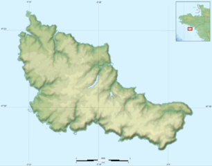
Français : Carte topographique vierge de Belle-Île-en-Mer Deutsch: Topographische Karte zum Belle-Île, English: Topographic map of Belle Île Español: Mapa topográfico de Belle-Île-en-Mer Italiano: Carta topografica de Belle Île 日本語: ベル・イル島の地形地図 Português: Carta topográfica do Belle-Isle |
||||
| Date | |||||
| Source |
Français : Création personnelle ;
English: Own work ;
|
||||
| Author | Bourrichon - fr:Bourrichon | ||||
| Permission (Reusing this file) |
I, the copyright holder of this work, hereby publish it under the following licenses:
This file is licensed under the Creative Commons Attribution-Share Alike 3.0 Unported, 2.5 Generic, 2.0 Generic and 1.0 Generic license.
You may select the license of your choice. |
||||
| Other versions |
[]
|


File history
Click on a date/time to view the file as it appeared at that time.
| Date/Time | Thumbnail | Dimensions | User | Comment | |
|---|---|---|---|---|---|
| current | 20:27, 23 May 2010 | | 1,118 × 878 (434 KB) | Bourrichon (talk | contribs) | {{Information |Description= {{fr|Carte topographique vierge de Belle-Île-en-Mer}}{{de|Topographische Karte zum Belle-Île, in Französische}}{{en|Topographic map in French of Belle Île}}{{e |
You cannot overwrite this file.
File usage on Commons
The following 7 pages use this file:
- File:Belle-Île-en-Mer administrative map-fr.png
- File:Belle-Île-en-Mer administrative map-fr.svg
- File:Belle-Île-en-Mer blank map.png
- File:Belle-Île-en-Mer topographic blank map.png
- File:Belle-Île-en-Mer topographic map-fr.png
- File:Belle-Île-en-Mer topographic map-fr.svg
- Template:Other versions/Belle-Île-en-Mer map
File usage on other wikis
The following other wikis use this file:
- Usage on fr.wikipedia.org
- Discussion Projet:Morbihan/archive
- Aiguilles de Port-Coton
- Pointe des Poulains
- Modèle:Géolocalisation/Belle-Île-en-Mer
- Wikipédia:Atelier graphique/Cartes/Archives/mars 2013
- Wikipédia:Atelier modèle de géolocalisation/Archives/2013
- Grotte de l'Apothicairerie
- Koh Kastell
- Vallon nord de Port-Maria
- Pointe de Skeul
- Dunes de Donnant