File:Birchwood railway station, Warrington, geograph-5841729-by-Nigel-Thompson.jpg
Jump to navigation
Jump to search

Size of this preview: 800 × 600 pixels. Other resolutions: 320 × 240 pixels | 640 × 480 pixels | 1,024 × 768 pixels | 1,280 × 960 pixels | 1,600 × 1,200 pixels.
Original file (1,600 × 1,200 pixels, file size: 427 KB, MIME type: image/jpeg)
Captions
Captions
Add a one-line explanation of what this file represents
Summary[edit]
| Description |
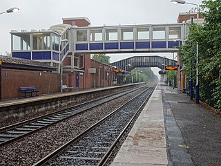
English: Birchwood railway station, Warrington
Opened in 1981 by British Rail on the line from Manchester to Liverpool via Warrington. View east towards Glazebrook and Manchester, some 2 years after the old footbridge had been replaced by a new one. The old one was still in situ but closed off, when this image was taken. |
||
| Date | |||
| Source | https://www.geograph.org.uk/photo/5841729 | ||
| Author | Nigel Thompson | ||
| Permission (Reusing this file) |
This file is licensed under the Creative Commons Attribution-Share Alike 2.0 Generic license. Attribution: Nigel Thompson
|
||
| Attribution (required by the license) | Nigel Thompson / Birchwood railway station, Warrington / | ||

| Camera location | | View this and other nearby images on: OpenStreetMap |
|---|
_heading:67.00&language=en)
| Object location | | View this and other nearby images on: OpenStreetMap |
|---|
_heading:67.00&language=en)
File history
Click on a date/time to view the file as it appeared at that time.
| Date/Time | Thumbnail | Dimensions | User | Comment | |
|---|---|---|---|---|---|
| current | 22:50, 27 April 2019 | | 1,600 × 1,200 (427 KB) | G-13114 (talk | contribs) | == {{int:filedesc}} == {{Information |description={{en|1=Birchwood railway station, Warrington Opened in 1981 by British Rail on the line from Manchester to Liverpool via Warrington. View east towards Glazebrook and Manchester, some 2 years after the old footbridge had been replaced by a new one. The old one was still in situ but closed off, when this image was taken.}} |date=2018-07-13 |source= Geograph |author= Nigel Thompson |permission= {{Geograph|5661143|Nigel Thompson}} |other_vers... |
You cannot overwrite this file.
File usage on Commons
The following 2 pages use this file:
File usage on other wikis
The following other wikis use this file:
- Usage on en.wikipedia.org