File:Bonnington Linn - geograph.org.uk - 75426.jpg
Jump to navigation
Jump to search
No higher resolution available.
Bonnington_Linn_-_geograph.org.uk_-_75426.jpg (640 × 480 pixels, file size: 123 KB, MIME type: image/jpeg)
Captions
Captions
Add a one-line explanation of what this file represents
Summary[edit]
| Description |
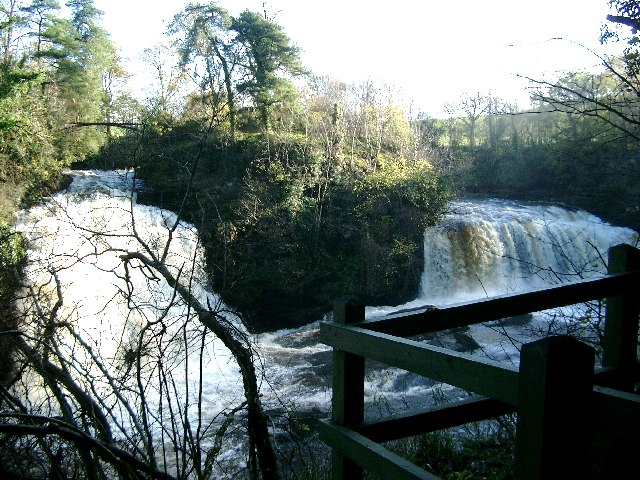
English: Bonnington Linn. On this visit, after some days of heavy rain, the falls were in full force (even with the hydro station drawing water and running in parallel). The Victorian bridge can be seen top left. Sadly it is now derelict and unsafe so the central island between the two falls can not be reached. |
| Date | |
| Source | From geograph.org.uk |
| Author | Gordon Brown |
| Attribution (required by the license) | Gordon Brown / Bonnington Linn / |
| Camera location | | View this and other nearby images on: OpenStreetMap |
|---|
_&language=en)
| Object location | | View this and other nearby images on: OpenStreetMap |
|---|
_&language=en)
Licensing[edit]

|
This image was taken from the Geograph project collection. See this photograph's page on the Geograph website for the photographer's contact details. The copyright on this image is owned by Gordon Brown and is licensed for reuse under the Creative Commons Attribution-ShareAlike 2.0 license.
|
This file is licensed under the Creative Commons Attribution-Share Alike 2.0 Generic license.
Attribution: Gordon Brown
- You are free:
- to share – to copy, distribute and transmit the work
- to remix – to adapt the work
- Under the following conditions:
- attribution – You must give appropriate credit, provide a link to the license, and indicate if changes were made. You may do so in any reasonable manner, but not in any way that suggests the licensor endorses you or your use.
- share alike – If you remix, transform, or build upon the material, you must distribute your contributions under the same or compatible license as the original.
File history
Click on a date/time to view the file as it appeared at that time.
| Date/Time | Thumbnail | Dimensions | User | Comment | |
|---|---|---|---|---|---|
| current | 13:40, 30 January 2010 | | 640 × 480 (123 KB) | GeographBot (talk | contribs) | == {{int:filedesc}} == {{Information |description={{en|1=Bonnington Linn. On this visit, after some days of heavy rain, the falls were in full force (even with the hydro station drawing water and running in parallel). The Victorian bridge can be seen top |
You cannot overwrite this file.
File usage on Commons
There are no pages that use this file.