File:Borderless countries.PNG
Jump to navigation
Jump to search
Size of this preview: 800 × 370 pixels. Other resolutions: 320 × 148 pixels | 640 × 296 pixels | 1,357 × 628 pixels.
Original file (1,357 × 628 pixels, file size: 29 KB, MIME type: image/png)
Captions
Captions
Add a one-line explanation of what this file represents

|
File:Borderless countries.svg is a vector version of this file. It should be used in place of this PNG file when not inferior.
File:Borderless countries.PNG → File:Borderless countries.svg
For more information, see Help:SVG. |
 |
Summary[edit]
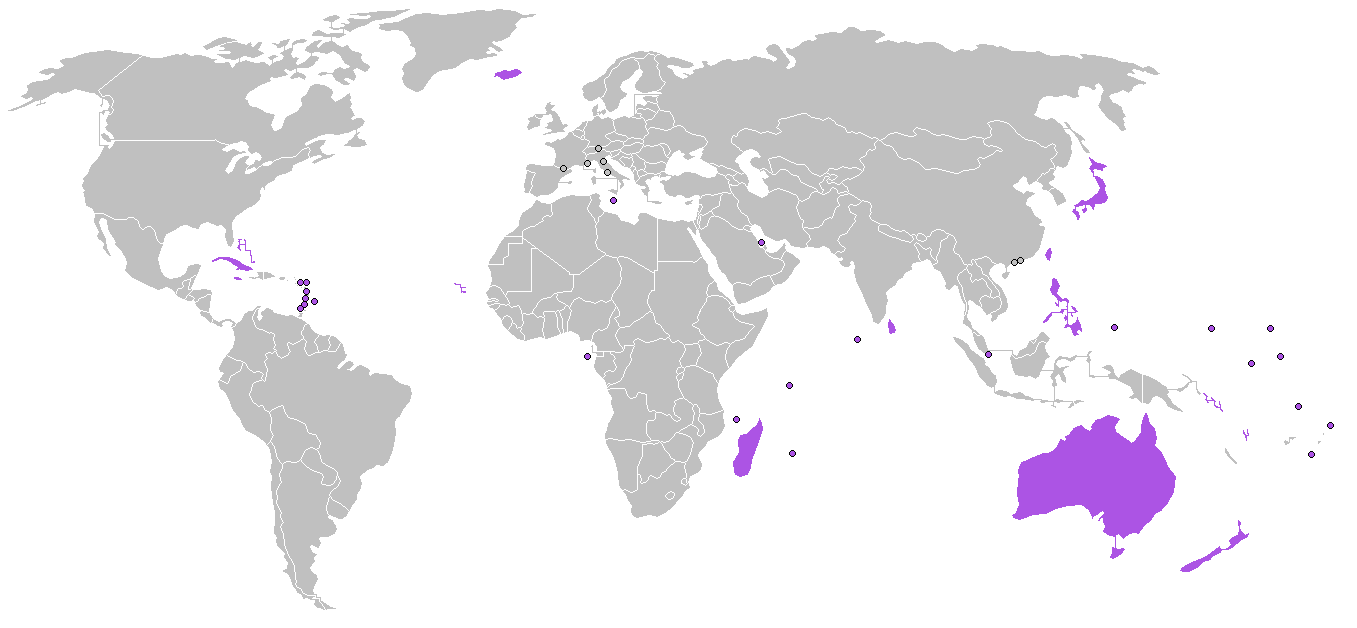
| Description | Map of the world, locating borderless countries (purple) as listed on w:Borderless country. |
| Source | own work, based on File:BlankMap-World.png |
| Author | edited by Roke |
Licensing[edit]
I, the copyright holder of this work, hereby publish it under the following licenses:

|
Permission is granted to copy, distribute and/or modify this document under the terms of the GNU Free Documentation License, Version 1.2 or any later version published by the Free Software Foundation; with no Invariant Sections, no Front-Cover Texts, and no Back-Cover Texts. A copy of the license is included in the section entitled GNU Free Documentation License. |
| This file is licensed under the Creative Commons Attribution-Share Alike 3.0 Unported license. | ||
| ||
| This licensing tag was added to this file as part of the GFDL licensing update. |
You may select the license of your choice.
File history
Click on a date/time to view the file as it appeared at that time.
| Date/Time | Thumbnail | Dimensions | User | Comment | |
|---|---|---|---|---|---|
| current | 20:10, 23 December 2014 | | 1,357 × 628 (29 KB) | Inops (talk | contribs) | rm Cyprus; it has borders with en:Akrotiri and Dhekelia |
| 22:29, 26 August 2013 |  | 1,357 × 628 (36 KB) | Coinmanj (talk | contribs) | Bahamas is a borderless country | |
| 05:01, 28 December 2007 |  | 1,357 × 628 (46 KB) | Hoshie (talk | contribs) | added Cabinda (Angola) and Montenegro. Under same. | |
| 21:37, 27 August 2007 |  | 1,357 × 628 (46 KB) | Luis wiki (talk | contribs) | Australia is a Borderless country. | |
| 14:22, 23 August 2007 |  | 1,357 × 628 (26 KB) | Yath~commonswiki (talk | contribs) | ||
| 05:41, 3 March 2006 |  | 1,357 × 628 (46 KB) | Roke~commonswiki (talk | contribs) | Borderless countries as listed on w:Borderless country |
You cannot overwrite this file.
File usage on Commons
There are no pages that use this file.
File usage on other wikis
The following other wikis use this file:
- Usage on ar.wikipedia.org
- Usage on ary.wikipedia.org
- Usage on az.wikipedia.org
- Usage on de.wikipedia.org
- Usage on eo.wikipedia.org
- Usage on fr.wikipedia.org
- Usage on hu.wikipedia.org
- Usage on is.wikipedia.org
- Usage on it.wikipedia.org
- Usage on ja.wikipedia.org
- Usage on ka.wikipedia.org
- Usage on ko.wikipedia.org
- Usage on la.wikipedia.org
- Usage on lv.wikipedia.org
- Usage on nn.wikipedia.org
- Usage on pa.wikipedia.org
- Usage on pnb.wikipedia.org
- Usage on te.wikipedia.org
- Usage on th.wikipedia.org
- Usage on tr.wikipedia.org
- Usage on ur.wikipedia.org
- Usage on vec.wikipedia.org
- Usage on vi.wikipedia.org
- Usage on yo.wikipedia.org
- Usage on zh.wikipedia.org
Metadata
Categories:
- Locator maps of islands
- Locator maps of countries of North America (gray scheme)
- Locator maps of countries of Asia (gray scheme)
- Locator maps of countries of Europe (gray scheme)
- Locator maps of countries of Oceania (gray scheme)
- Locator maps of countries of Africa (gray scheme)
- Locator maps of countries of South America (gray scheme)
- Maps of the world with small regions drawn as circles