File:Boskapel - panoramio.jpg
From Wikimedia Commons, the free media repository
Jump to navigation
Jump to search
Size of this preview: 449 × 599 pixels. Other resolutions: 180 × 240 pixels | 360 × 480 pixels | 576 × 768 pixels | 768 × 1,024 pixels | 2,000 × 2,667 pixels.
Original file (2,000 × 2,667 pixels, file size: 3.79 MB, MIME type: image/jpeg)
File information
Structured data
Captions
Summary[edit]
DescriptionBoskapel - panoramio.jpg |
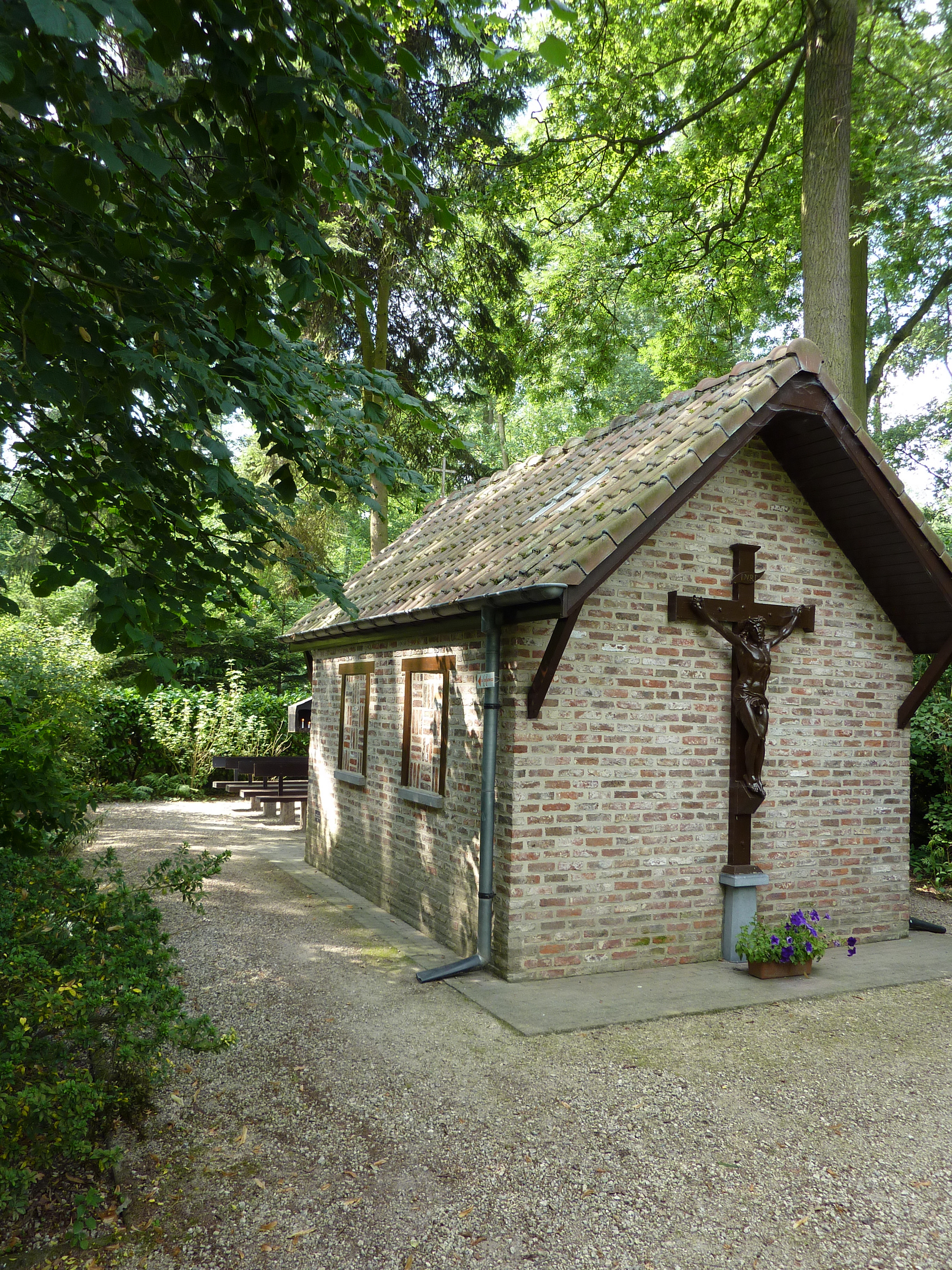
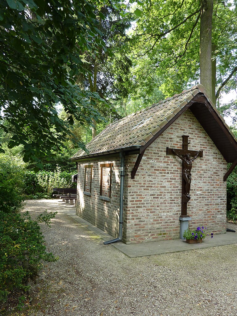
Nederlands: Boskapel
|
||
Date | Taken on 28 July 2010 | ||
Source | https://web.archive.org/web/20161016121654/http://www.panoramio.com/photo/47359396 | ||
Author | LucT | ||
Permission (Reusing this file) |
This file is licensed under the Creative Commons Attribution-Share Alike 3.0 Unported license. Attribution: LucT
|
Camera location | 50° 58′ 46.15″ N, 4° 22′ 11.53″ E | View this and other nearby images on: OpenStreetMap | 50.979485; 4.369869 |
---|
File history
Click on a date/time to view the file as it appeared at that time.
Date/Time | Thumbnail | Dimensions | User | Comment | |
---|---|---|---|---|---|
current | 10:21, 9 November 2016 | 2,000 × 2,667 (3.79 MB) | Panoramio upload bot (talk | contribs) | {{Information |description=Boskapel |date={{Taken on|2010-07-28}} |source=http://www.panoramio.com/photo/47359396 |author=[http://www.panoramio.com/user/4152218?with_photo_id=47359396 LucT] |permission={{cc-by-sa-3.0|LucT}} {{Panoramioreview|Panoramio_... |
You cannot overwrite this file.
File usage on Commons
There are no pages that use this file.
File usage on other wikis
The following other wikis use this file:
- Usage on nl.wikipedia.org
Metadata
This file contains additional information such as Exif metadata which may have been added by the digital camera, scanner, or software program used to create or digitize it. If the file has been modified from its original state, some details such as the timestamp may not fully reflect those of the original file. The timestamp is only as accurate as the clock in the camera, and it may be completely wrong.
Camera manufacturer | Panasonic |
---|---|
Camera model | DMC-TZ7 |
Author | LucT |
Copyright holder | LucT 2010 |
Exposure time | 1/80 sec (0.0125) |
F-number | f/3.3 |
ISO speed rating | 80 |
Date and time of data generation | 11:34, 28 July 2010 |
Lens focal length | 4.1 mm |
Latitude | 50° 58′ 46.15″ N |
Longitude | 4° 22′ 11.53″ E |
Altitude | 9.468 meters above sea level |
City shown | Grimbergen Humbeek |
Orientation | Normal |
Horizontal resolution | 180 dpi |
Vertical resolution | 180 dpi |
Software used | Ver.1.2 |
File change date and time | 11:34, 28 July 2010 |
Y and C positioning | Co-sited |
Exposure Program | Normal program |
Exif version | 2.21 |
Date and time of digitizing | 11:34, 28 July 2010 |
Meaning of each component |
|
Image compression mode | 4 |
APEX exposure bias | 0 |
Maximum land aperture | 3.44 APEX (f/3.29) |
Metering mode | Pattern |
Light source | Unknown |
Flash | Flash did not fire, auto mode |
Supported Flashpix version | 1 |
Color space | sRGB |
Sensing method | One-chip color area sensor |
File source | Digital still camera |
Scene type | A directly photographed image |
Custom image processing | Normal process |
Exposure mode | Auto exposure |
White balance | Auto white balance |
Digital zoom ratio | 0 |
Focal length in 35 mm film | 25 mm |
Scene capture type | Standard |
Scene control | None |
Contrast | Normal |
Saturation | Normal |
Sharpness | Normal |
GPS time (atomic clock) | 09:34 |
Satellites used for measurement | 0 |
Geodetic survey data used | WGS-84 |
GPS date | 28 July 2010 |
GPS tag version | 0.0.2.2 |
Keywords | België |
Sublocation of city shown | Ipsvoorde |
Province or state shown | Brabant |
Code for country shown | BEL |
Country shown | België |
IIM version | 4 |
Structured data
Items portrayed in this file
depicts
28 July 2010
50°58'46.1444092"N, 4°22'11.5292359"E
0.0125 second
3.3
4.1 millimetre
image/jpeg
8d4620250576fac59531abf394860d4e7eca84bf
3,971,524 byte
2,667 pixel
2,000 pixel
Hidden categories:
- Onroerend erfgoed with known IDs
- Belgium photographs taken on 2010-07-28
- CC-BY-SA-3.0
- Panoramio images reviewed by trusted users
- Photos from Panoramio
- Files with coordinates missing SDC location of creation (50° N, 4° E)
- Panoramio files uploaded by Panoramio upload bot
- Photos from Panoramio ID 4152218
- Pages with maps