File:Boulder Crescent Park Historical Marker in Colorado Springs.jpg
Original file (4,032 × 3,024 pixels, file size: 5.91 MB, MIME type: image/jpeg)
Captions
Summary
[edit]DescriptionBoulder Crescent Park Historical Marker in Colorado Springs.jpg |
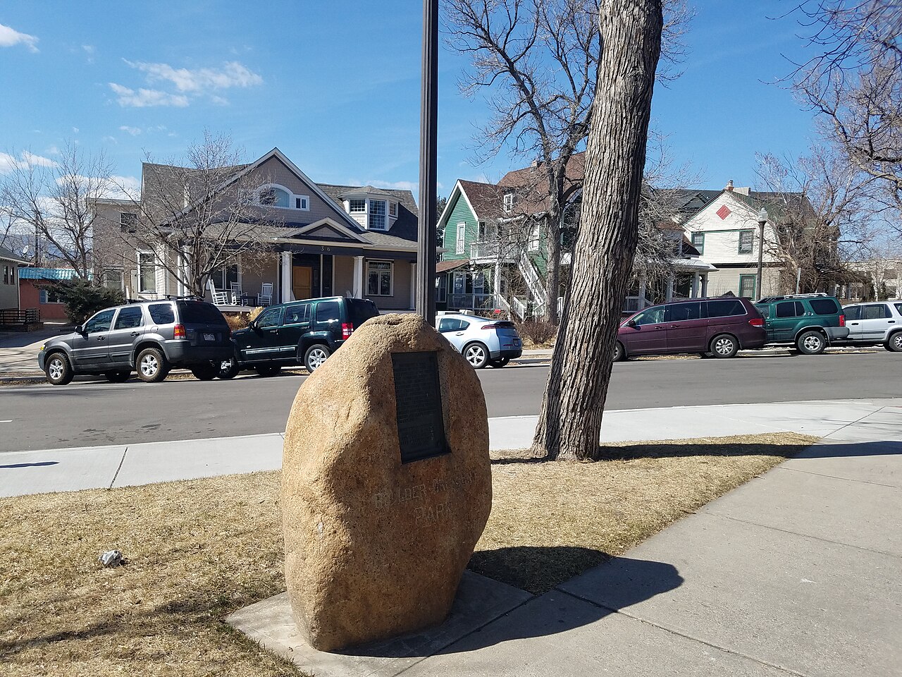
English: Tablet at Boulder Crescent Park placed in 1913 by the El Paso County Pioneer Association in memory of three young boys who were killed in 1868 by Indians. |
Date | |
Source | Own work |
Author | ForgottenColorado |
Camera location | 38° 50′ 19.82″ N, 104° 49′ 31.12″ W | View this and other nearby images on: OpenStreetMap | 38.838839; -104.825311 |
---|
Licensing
[edit]- You are free:
- to share – to copy, distribute and transmit the work
- to remix – to adapt the work
- Under the following conditions:
- attribution – You must give appropriate credit, provide a link to the license, and indicate if changes were made. You may do so in any reasonable manner, but not in any way that suggests the licensor endorses you or your use.
- share alike – If you remix, transform, or build upon the material, you must distribute your contributions under the same or compatible license as the original.
This image was uploaded as part of Wiki Loves Monuments 2020.
Afrikaans ∙ Alemannisch ∙ azərbaycanca ∙ Bahasa Indonesia ∙ Bahasa Melayu ∙ Bikol Central ∙ bosanski ∙ brezhoneg ∙ català ∙ čeština ∙ Cymraeg ∙ dansk ∙ davvisámegiella ∙ Deutsch ∙ eesti ∙ English ∙ español ∙ Esperanto ∙ euskara ∙ français ∙ Frysk ∙ Gaeilge ∙ galego ∙ hrvatski ∙ Ido ∙ italiano ∙ latviešu ∙ Lëtzebuergesch ∙ Malagasy ∙ magyar ∙ Malti ∙ Nederlands ∙ norsk ∙ norsk nynorsk ∙ norsk bokmål ∙ polski ∙ português ∙ português do Brasil ∙ română ∙ shqip ∙ sicilianu ∙ slovenčina ∙ slovenščina ∙ suomi ∙ svenska ∙ Tagalog ∙ Türkçe ∙ Yorùbá ∙ Zazaki ∙ Ελληνικά ∙ беларуская ∙ беларуская (тарашкевіца) ∙ български ∙ кыргызча ∙ македонски ∙ русский ∙ српски / srpski ∙ українська ∙ ქართული ∙ հայերեն ∙ नेपाली ∙ हिन्दी ∙ বাংলা ∙ മലയാളം ∙ ไทย ∙ 한국어 ∙ +/− |
File history
Click on a date/time to view the file as it appeared at that time.
Date/Time | Thumbnail | Dimensions | User | Comment | |
---|---|---|---|---|---|
current | 04:06, 9 October 2020 | 4,032 × 3,024 (5.91 MB) | ForgottenColorado (talk | contribs) | Uploaded own work with UploadWizard |
You cannot overwrite this file.
File usage on Commons
There are no pages that use this file.
Metadata
This file contains additional information such as Exif metadata which may have been added by the digital camera, scanner, or software program used to create or digitize it. If the file has been modified from its original state, some details such as the timestamp may not fully reflect those of the original file. The timestamp is only as accurate as the clock in the camera, and it may be completely wrong.
Camera manufacturer | samsung |
---|---|
Camera model | SM-G935P |
Exposure time | 1/2,528 sec (0.00039556962025316) |
F-number | f/1.7 |
ISO speed rating | 50 |
Date and time of data generation | 14:45, 13 March 2018 |
Lens focal length | 4.2 mm |
User comments | JKJK'|ïø~öyëPª¯¯æ¹é牵JÀ{_ÿÿ;àÿÿÂÔÿÿæaXÉÿÿ§IÿÿX´ˆˆˆˆˆˆˆˆˆˆ"‘ˆˆˆˆˆˆˆˆˆˆˆˆˆˆˆ‘ˆˆˆˆˆˆˆˆˆˆˆˆˆˆ""ˆˆˆ"ˆˆˆˆˆˆˆˆˆˆ‘"ˆˆˆ"""‘‘"ˆˆ"‘`‘""""‘‘‘‘‘‘‘P3`‘@"@"P3"‘‘@"‘‘‘‘‘‘‘a™ ‘0A"Q3‘‘‘‘‘‘"p```‘‘‘"‘P3‘‘‘’™ pqª
‘`a™ ‘‘‘‘‘‘‘@"P3P3qª qª ’™ `P3`‘‘000@"00@"@"qª a™ ’™ a™ @"a™ 0@"@"0‘0@"@"Q3Q3qª qª pa™ a™ a™ bRQ3Q3Q3bbRba™ a™ a™ a™ a™ bbRQ3Q3Q3Q3RRbRba™ qª qª Q3Q3‘P3Q3Q3Q3Q3Rbba™ Q3a™ a™ a™ ’™ ’™ ‘@"Q3Q3Q3A"RbbRQ3Q3Q3‘Q3Q3Q3Q3Q3Q3Q3Q3“7gõç’§úc{d…d…d…d…{eú«Ìþú%““ ò7g7gõ5õçõç^ŸÐJâ¯Î¿FAFA™fU †<gFAFAFAFAð:ç#…ª ç#³…‡… N† 5‚ÿÿ:†ç#†3jžç#À…І +† Œg™dP€ À0+üÿúÿ†ÀÐ;glquy}€ƒ†‰Œ”™ž¤«²·½ÃÇÊÏÔÚáêóù$*18?HP[fmw?‰– ¬½ËÛòÿÿÿÿ##### …ç†ÿFAFA|ç~ç|ç…ç…ç?ç†çˆç?ç®®®®‡Nª ¯ ÎRJ 0 EED :‚E J B 2à ¯Nîîîîq&&¨ X ¨ Æýÿÿÿ…ïKÓ ¦ ¾ ê©R „© 1 ÷9ÈÜQ 6 3 Èaˆàð* 3 ¶Œzg â PŒ 5 ‰§Ëk T £ Ũt ‹ ‡ ؾH N D j = ·bª( ú .~Ëë t?SõÿÿÿŒ J &{ Ü ôÿÿÿ)ª ª ° ~)éÿÿÿXC p\?ñÿÿÿžÿÿÿK¶ÿÿÿ]—ÿÿÿ[/ýèÿÿÿ aoš~‹ îÿÿÿïÿÿÿC , ESpy<.Ñssdjag¤¤¤¤¤¤¤¤¤¤¤¤¤¤¤¤¤¤¤¤¤¤¤¤¤¤¤¤¤¤¤¤ssuniqueidf`& „`PC12QSII00SM21FFF001FC1S06ssoisD84IL05 D84IL05 D84IL05 0 2 |
Latitude | 38° 50′ 19.82″ N |
Longitude | 104° 49′ 31.12″ W |
Altitude | 1,816 meters above sea level |
Width | 4,032 px |
Height | 3,024 px |
Orientation | Normal |
Horizontal resolution | 72 dpi |
Vertical resolution | 72 dpi |
Software used | G935PVPS5BRA1 |
File change date and time | 14:45, 13 March 2018 |
Y and C positioning | Centered |
Exposure Program | Normal program |
Exif version | 2.2 |
Date and time of digitizing | 14:45, 13 March 2018 |
Meaning of each component |
|
APEX shutter speed | 11.303 |
APEX aperture | 1.53 |
APEX brightness | 8.68 |
APEX exposure bias | 0 |
Maximum land aperture | 1.53 APEX (f/1.7) |
Metering mode | Center weighted average |
Light source | Unknown |
Flash | Flash did not fire |
Supported Flashpix version | 1 |
Color space | sRGB |
Sensing method | One-chip color area sensor |
Scene type | A directly photographed image |
Exposure mode | Auto exposure |
White balance | Auto white balance |
Focal length in 35 mm film | 26 mm |
Scene capture type | Standard |
Unique image ID | C12QSJK01SM |
GPS time (atomic clock) | 20:47 |
GPS date | 13 March 2018 |
GPS tag version | 0.0.2.2 |
Structured data
Items portrayed in this file
depicts
some value
38°50'19.820"N, 104°49'31.120"W
13 March 2018
0.00039556962025316455 second
1.7
4.2 millimetre
image/jpeg
d7573c5c409b035aa7551ee4e1fe5d0406a1b505
6,200,325 byte
3,024 pixel
4,032 pixel
- Files with coordinates missing SDC location of creation
- CC-BY-SA-4.0
- Self-published work
- Images from Wiki Loves Monuments 2020
- Images from Wiki Loves Monuments 2020 in the United States
- Images from Wiki Loves Monuments 2020 in Colorado
- Images from Wiki Loves Monuments missing SDC depicts
- Images from Wiki Loves Monuments missing SDC location of creation
- Wiki Loves Monuments 2020 in the United States unreviewed
- Uploaded via Campaign:wlm-us
- Pages with maps