File:Boven-Surinamerivier, met Gran en Pikin Rio.png
Jump to navigation
Jump to search
No higher resolution available.
Boven-Surinamerivier,_met_Gran_en_Pikin_Rio.png (292 × 542 pixels, file size: 19 KB, MIME type: image/png)
Captions
Captions
Add a one-line explanation of what this file represents
Summary[edit]
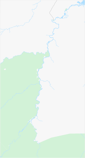
| Description |
Nederlands: Boven-Surinamerivier, inclusief de benedenloop van de Gran Rio en Pikin Rio
English: Upper-Suriname River, including downstream Gran Rio and Pikin Rio |
|||||||||||||||
| Date | ||||||||||||||||
| Source | www.openstreetmap.org, 4.565 North, -55.62 West -55.28 East -3.84 South | |||||||||||||||
| Author | OpenStreetMap contributors | |||||||||||||||
| Permission (Reusing this file) |
|
|||||||||||||||
| Other versions |

File history
Click on a date/time to view the file as it appeared at that time.
| Date/Time | Thumbnail | Dimensions | User | Comment | |
|---|---|---|---|---|---|
| current | 09:56, 6 April 2022 | | 292 × 542 (19 KB) | Ymnes (talk | contribs) | == {{int:filedesc}} == {{Information |Description={{nl|Boven-Surinamerivier, inclusief de benedenloop van de Gran Rio en Pikin Rio}} {{en|Upper-Suriname River, including downstream Gran Rio and Pikin Rio}} |Source=[https://www.openstreetmap.org/#map=10/4.2101/-55.5922&layers=T www.openstreetmap.org], 4.58 North, -55.62 West -55.22 East -3.84 South |Date=2022-04-06 |Author=OpenStreetMap contributors |Permission={{OpenStreetMap}} |other_versions= }} Category:Location maps of Suriname |
| 09:21, 6 April 2022 |  | 248 × 531 (17 KB) | Ymnes (talk | contribs) | == {{int:filedesc}} == {{Information |Description={{nl|Boven-Surinamerivier, inclusief de benedenloop van de Gran Rio en Pikin Rio}} {{en|Upper-Suriname River, including downstream Gran Rio and Pikin Rio}} |Source=[https://www.openstreetmap.org https://www.openstreetmap.org/#map=10/4.3026/-55.7089&layers=T], 4.565 North, -55.62 West, -55.28 East, 3.84 South |Date=2022-04-06 |Author=OpenStreetMap contributors |Permission={{OpenStreetMap}} |other_versions= }} Category:Location maps of Suriname | |
| 08:52, 6 April 2022 |  | 277 × 560 (18 KB) | Ymnes (talk | contribs) | {{Information |Description={{nl|Boven-Surinamerivier, inclusief de benedenloop van de Gran Rio en Pikin Rio}} {{en|Upper-Suriname River, including downstream Gran Rio and Pikin Rio}} |Source=[https://www.openstreetmap.org www.openstreetmap.org], 4.565 North, -55.62 West, -55.28 East, 3.84 South |Date=2022-04-06 |Author=OpenStreetMap contributors |Permission={{OpenStreetMap}} |other_versions= }} Category:Location maps of Suriname |
You cannot overwrite this file.
File usage on Commons
The following page uses this file:
File usage on other wikis
The following other wikis use this file:
- Usage on en.wikipedia.org
- Usage on nl.wikipedia.org
- Usage on si.wikipedia.org