File:Bura Irrigation Supply Canal at Nanighi 1998.jpg
Jump to navigation
Jump to search

Size of this preview: 800 × 558 pixels. Other resolutions: 320 × 223 pixels | 640 × 446 pixels | 1,024 × 714 pixels | 1,437 × 1,002 pixels.
Original file (1,437 × 1,002 pixels, file size: 323 KB, MIME type: image/jpeg)
Captions
Captions
Add a one-line explanation of what this file represents
Summary[edit]
| Description |
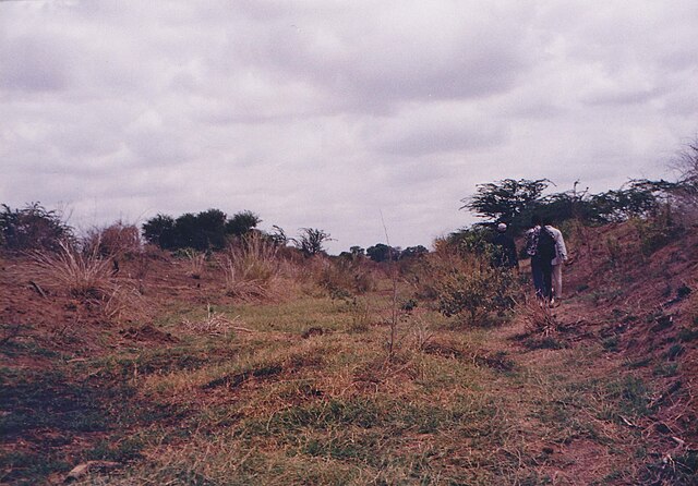
English: Supply Canal Bura Irrigation Project.
This picture was taken North of Nanighi, after the El Nino rains of 1997-1998. The floods destroyed a huge dyke and the irrigation supply canal was destroyed. It took years before it was repaired. |
| Date | |
| Source | Own work |
| Author | Jerome KL |
| Camera location | | View this and other nearby images on: OpenStreetMap |
|---|
This picture was taken about 3 km fom the pumping station, North of Nanighi
Licensing[edit]
I, the copyright holder of this work, hereby publish it under the following license:
This file is licensed under the Creative Commons Attribution-Share Alike 4.0 International license.
- You are free:
- to share – to copy, distribute and transmit the work
- to remix – to adapt the work
- Under the following conditions:
- attribution – You must give appropriate credit, provide a link to the license, and indicate if changes were made. You may do so in any reasonable manner, but not in any way that suggests the licensor endorses you or your use.
- share alike – If you remix, transform, or build upon the material, you must distribute your contributions under the same or compatible license as the original.
File history
Click on a date/time to view the file as it appeared at that time.
| Date/Time | Thumbnail | Dimensions | User | Comment | |
|---|---|---|---|---|---|
| current | 22:22, 6 February 2017 | | 1,437 × 1,002 (323 KB) | Jerome KL (talk | contribs) | User created page with UploadWizard |
You cannot overwrite this file.
File usage on Commons
There are no pages that use this file.
File usage on other wikis
The following other wikis use this file:
- Usage on en.wikipedia.org