File:Busbridge war memorial, cropped from geograph.org.uk - 1373874.jpg
Jump to navigation
Jump to search
No higher resolution available.
Busbridge_war_memorial,_cropped_from_geograph.org.uk_-_1373874.jpg (77 × 136 pixels, file size: 5 KB, MIME type: image/jpeg)
Captions
Captions
Add a one-line explanation of what this file represents
Summary[edit]
| Description |
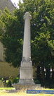
English: Brighton Road, Busbridge The parish church sits in the fork between Brighton and Hambledon Roads.
http://busbridgechurch.org/ |
| Date | |
| Source |
This file was derived from: Brighton Road, Busbridge - geograph.org.uk - 1373874.jpg |
| Author | Colin Smith |
| Other versions | |
| Attribution (required by the license) | Colin Smith / Brighton Road, Busbridge / |

| Camera location | | View this and other nearby images on: OpenStreetMap |
|---|
Licensing[edit]
This file is licensed under the Creative Commons Attribution-Share Alike 2.0 Generic license.
Attribution: Colin Smith
- You are free:
- to share – to copy, distribute and transmit the work
- to remix – to adapt the work
- Under the following conditions:
- attribution – You must give appropriate credit, provide a link to the license, and indicate if changes were made. You may do so in any reasonable manner, but not in any way that suggests the licensor endorses you or your use.
- share alike – If you remix, transform, or build upon the material, you must distribute your contributions under the same or compatible license as the original.
File history
Click on a date/time to view the file as it appeared at that time.
| Date/Time | Thumbnail | Dimensions | User | Comment | |
|---|---|---|---|---|---|
| current | 20:30, 25 September 2016 | | 77 × 136 (5 KB) | Carcharoth (talk | contribs) | File:Brighton Road, Busbridge - geograph.org.uk - 1373874.jpg cropped 88 % horizontally and 72 % vertically using CropTool with precise mode. |
You cannot overwrite this file.
File usage on Commons
The following page uses this file: