File:CKT20084-C15B-28 Nairiku industrial park atsugi kanagawa Japan.jpg
Jump to navigation
Jump to search

Size of this preview: 585 × 600 pixels. Other resolutions: 234 × 240 pixels | 468 × 480 pixels | 749 × 768 pixels | 999 × 1,024 pixels | 1,997 × 2,048 pixels | 3,717 × 3,811 pixels.
Original file (3,717 × 3,811 pixels, file size: 1.75 MB, MIME type: image/jpeg)
Captions
Captions
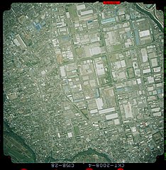
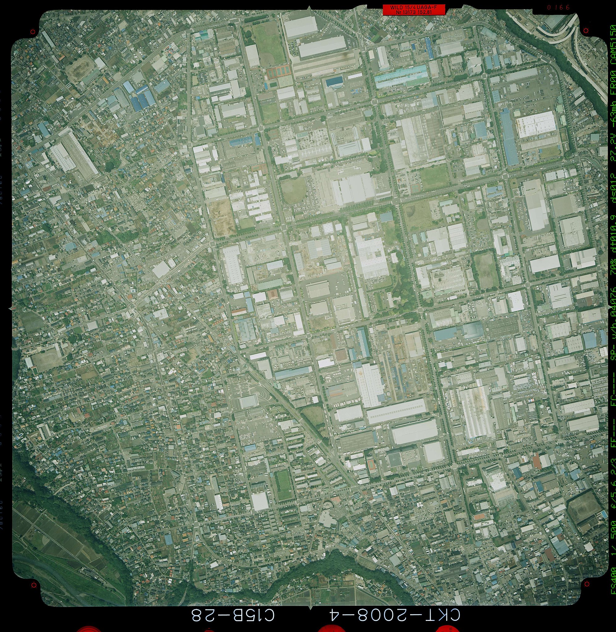
an aerial photo of Nairiku Industrial Park in 2008.Atsugi,Kanagawa,Japan.
Summary
[edit]
| Description |
日本語: 2008年の神奈川県厚木市付近にある内陸工業団地の国土地理院による航空写真。
English: an aerial photo of Nairiku Industrial Park in 2008.Atsugi,Kanagawa,Japan. |
| Date | |
| Source | https://mapps.gsi.go.jp/maplibSearch.do?specificationId=1512759 |
| Author | 国土交通省国土地理院 |
Licensing
[edit]

|
This work is licensed under the Government of Japan Standard Terms of Use (Ver.2.0). The Terms of Use are compatible with the Creative Commons Attribution License 4.0 International. For the terms of use of this work, see this license page.
|
This file is licensed under the Creative Commons Attribution 4.0 International license.
Attribution: 国土地理院 (Geospatial Information Authority of Japan)
- You are free:
- to share – to copy, distribute and transmit the work
- to remix – to adapt the work
- Under the following conditions:
- attribution – You must give appropriate credit, provide a link to the license, and indicate if changes were made. You may do so in any reasonable manner, but not in any way that suggests the licensor endorses you or your use.

|
The copyright holder of this file, the Ministry of Land, Infrastructure, Transport and Tourism of Japan, allows anyone to use it for any purpose, provided that the copyright holder is properly attributed. Redistribution, derivative work, commercial use, and all other use is permitted. |
Attribution:
Copyright © National Land Image Information (Color Aerial Photographs), Ministry of Land, Infrastructure, Transport and Tourism
|
 |
This image is copyrighted by the Ministry of Land, Infrastructure, Transport and Tourism of Japan. For terms of use, see the stipulation to use of National Land Information (in Japanese) and message from MLIT (in Japanese and English). When you display this image on an article, include the following phrase in the description: "Made based on National Land Image Information (Color Aerial Photographs), Ministry of Land, Infrastructure, Transport and Tourism".
|
File history
Click on a date/time to view the file as it appeared at that time.
| Date/Time | Thumbnail | Dimensions | User | Comment | |
|---|---|---|---|---|---|
| current | 05:27, 19 March 2022 | | 3,717 × 3,811 (1.75 MB) | Tengusabaki (talk | contribs) | Uploaded a work by 国土交通省国土地理院 from https://mapps.gsi.go.jp/maplibSearch.do?specificationId=1512759 with UploadWizard |
You cannot overwrite this file.
File usage on Commons
There are no pages that use this file.
File usage on other wikis
The following other wikis use this file:
- Usage on ja.wikipedia.org