File:CSIRO ScienceImage 420 Areas Predicted to be at Risk of Salinity.jpg
Jump to navigation
Jump to search

Size of this preview: 774 × 599 pixels. Other resolutions: 310 × 240 pixels | 620 × 480 pixels | 992 × 768 pixels | 1,280 × 991 pixels | 2,157 × 1,670 pixels.
Original file (2,157 × 1,670 pixels, file size: 3.53 MB, MIME type: image/jpeg)
Captions
Captions
Add a one-line explanation of what this file represents
Summary[edit]
| Description |
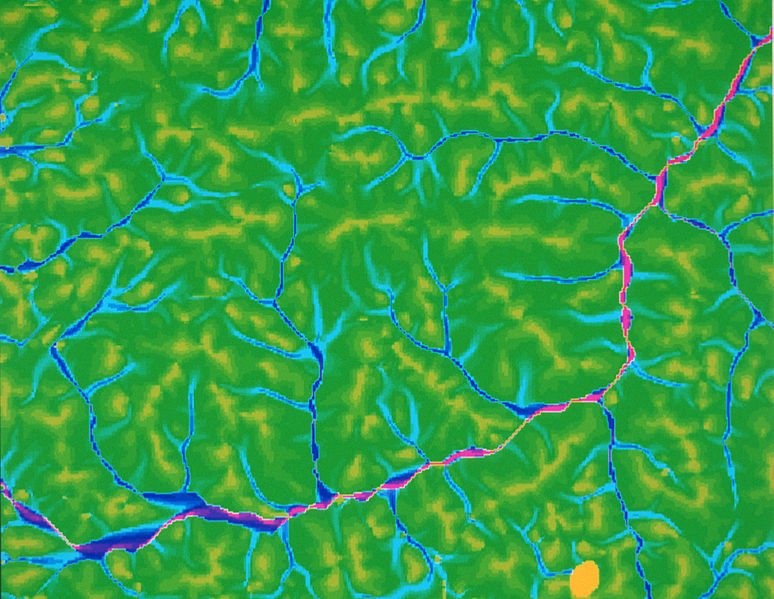
English: Predicting areas at risk of salinity. This map shows the degree of water accumulation at any position. |
| Date | |
| Source | http://www.scienceimage.csiro.au/image/420 |
| Author | , CSIRO |
| Permission (Reusing this file) |
http://www.scienceimage.csiro.au/pages/about/ |
| Rights holder | CSIRO |
Licensing[edit]
This file is licensed under the Creative Commons Attribution 3.0 Unported license.
Attribution: CSIRO
- You are free:
- to share – to copy, distribute and transmit the work
- to remix – to adapt the work
- Under the following conditions:
- attribution – You must give appropriate credit, provide a link to the license, and indicate if changes were made. You may do so in any reasonable manner, but not in any way that suggests the licensor endorses you or your use.
File history
Click on a date/time to view the file as it appeared at that time.
| Date/Time | Thumbnail | Dimensions | User | Comment | |
|---|---|---|---|---|---|
| current | 15:39, 17 September 2014 | | 2,157 × 1,670 (3.53 MB) | File Upload Bot (99of9) (talk | contribs) | {{User:99of9/CSIRO_template |id=420 |Title=Areas Predicted to be at Risk of Salinity |Creator= |Creator_scheme=LCNA |Date=2000-02-16 |Date_scheme=ISO8601 |Description=Predicting areas at risk of salinity. This map shows the degree of water accumulation... |
You cannot overwrite this file.
File usage on Commons
There are no pages that use this file.