File:California Wildfires 20170708.jpg
Jump to navigation
Jump to search
Size of this preview: 600 × 600 pixels. Other resolutions: 240 × 240 pixels | 480 × 480 pixels | 768 × 768 pixels | 1,024 × 1,024 pixels | 1,564 × 1,564 pixels.
Original file (1,564 × 1,564 pixels, file size: 409 KB, MIME type: image/jpeg)
Captions
Captions
Add a one-line explanation of what this file represents
Summary
[edit]
| Description |
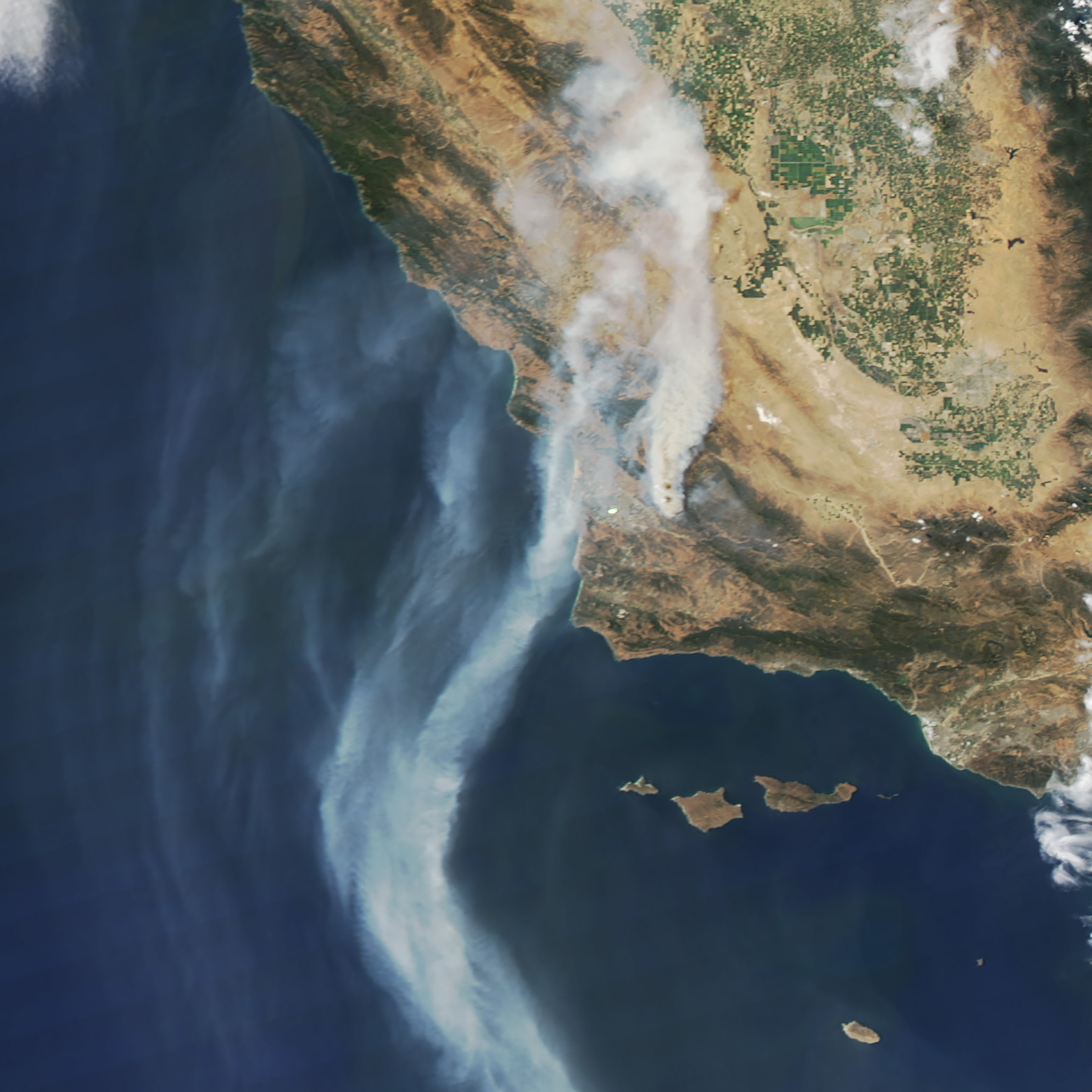
English: On July 8, 2017, the Moderate Resolution Imaging Spectroradiometer (MODIS) on NASA’s Aqua satellite captured this image of smoke streaming from the Alamo fire. Actively burning areas, detected by MODIS’s thermal bands, are outlined in red. Through July 10, 2017, the fire had charred roughly 30,000 acres (100 square kilometers) in San Luis Obispo County, California. Meanwhile, the Whittier fire, near Cachuma Lake (Santa Barbara County) had scorched 10,000 acres. |
| Date | |
| Source | https://earthobservatory.nasa.gov/NaturalHazards/view.php?id=90547&src=twitter-nh |
| Author | NASA |
Licensing
[edit]
| This file is in the public domain in the United States because it was solely created by NASA. NASA copyright policy states that "NASA material is not protected by copyright unless noted". (See Template:PD-USGov, NASA copyright policy page or JPL Image Use Policy.) | ||
 |
Warnings:
|
File history
Click on a date/time to view the file as it appeared at that time.
| Date/Time | Thumbnail | Dimensions | User | Comment | |
|---|---|---|---|---|---|
| current | 05:01, 11 July 2017 | | 1,564 × 1,564 (409 KB) | DanEverett45 (talk | contribs) | User created page with UploadWizard |
You cannot overwrite this file.
File usage on Commons
The following page uses this file:
File usage on other wikis
The following other wikis use this file:
- Usage on ar.wikipedia.org
- Usage on en.wikipedia.org
- Usage on fa.wikipedia.org
- Usage on fi.wikipedia.org
- Usage on ru.wikinews.org
- Usage on www.wikidata.org
- Usage on zh.wikipedia.org