File:Callapoda Portolan Chart of Europe 1560.jpg
Jump to navigation
Jump to search

Size of this preview: 800 × 477 pixels. Other resolutions: 320 × 191 pixels | 640 × 382 pixels | 1,024 × 611 pixels | 1,280 × 764 pixels | 2,560 × 1,528 pixels | 10,469 × 6,248 pixels.
Original file (10,469 × 6,248 pixels, file size: 17.15 MB, MIME type: image/jpeg)
Captions
Captions
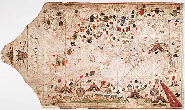
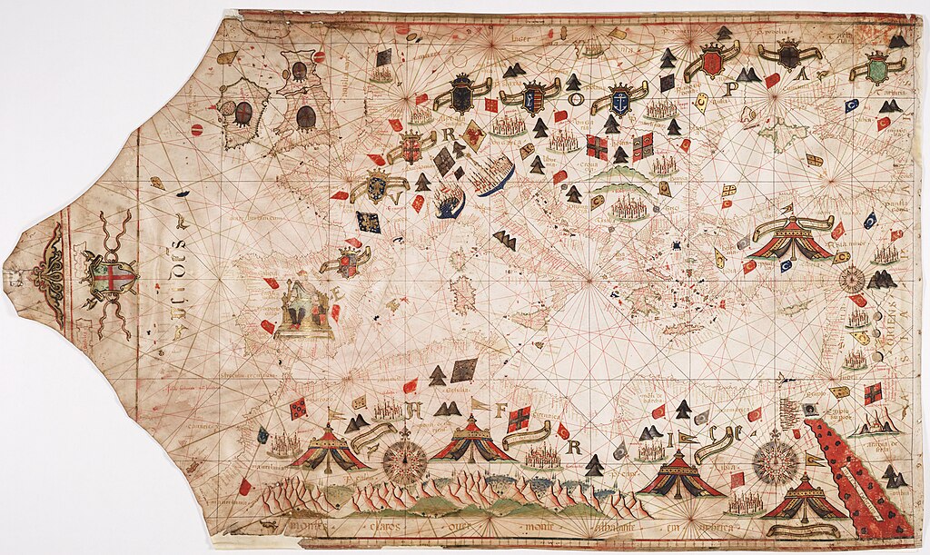
Portolan chart of Europe
Summary[edit]
| Description |
English: Portolan chart of Europe, drafted by Georgio Sideri / Callapoda |
| Date | |
| Source | https://maps.nls.uk/view/74425392 |
| Author | Sideri, Georgio / Callapoda |
Licensing[edit]
Original map:
|
This work is in the public domain in its country of origin and other countries and areas where the copyright term is the author's life plus 70 years or fewer. This work is in the public domain in the United States because it was published (or registered with the U.S. Copyright Office) before January 1, 1929. | |
| This file has been identified as being free of known restrictions under copyright law, including all related and neighboring rights. | |
Any derivative rights in the digital version have been released by the National Library of Scotland under the following license:
This file is licensed under the Creative Commons Attribution 4.0 International license.
- You are free:
- to share – to copy, distribute and transmit the work
- to remix – to adapt the work
- Under the following conditions:
- attribution – You must give appropriate credit, provide a link to the license, and indicate if changes were made. You may do so in any reasonable manner, but not in any way that suggests the licensor endorses you or your use.
File history
Click on a date/time to view the file as it appeared at that time.
| Date/Time | Thumbnail | Dimensions | User | Comment | |
|---|---|---|---|---|---|
| current | 14:26, 9 January 2024 | | 10,469 × 6,248 (17.15 MB) | Kognos (talk | contribs) | Uploaded a work by Sideri, Georgio / Callapoda from https://maps.nls.uk/view/74425392 with UploadWizard |
You cannot overwrite this file.
File usage on Commons
There are no pages that use this file.