File:Canal d'Entreroches, Dufour Map 1865, 01 12.png
Jump to navigation
Jump to search
Size of this preview: 409 × 599 pixels. Other resolutions: 164 × 240 pixels | 328 × 480 pixels | 524 × 768 pixels | 1,187 × 1,738 pixels.
Original file (1,187 × 1,738 pixels, file size: 1.63 MB, MIME type: image/png)
Captions
Captions
Add a one-line explanation of what this file represents
Summary[edit]
| Description |
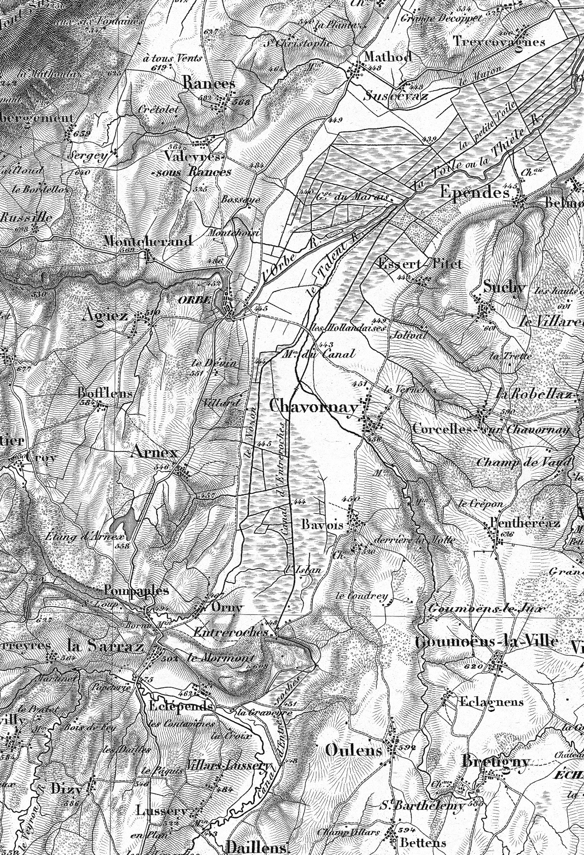
English: The Canal d’Entreroches on the Dufour Map (Topographic Map of Switzerland). Extract of sheet 011 Pontarlier from 1849.
Deutsch: Der Canal d’Entreroches auf der Dufourkarte (Topographische Karte der Schweiz). Ausschnitt aus dem Blatt 011 Pontarlier von 1849.
Français : Canal d'Entreroches
|
| Date | before 1865 |
| Source | Bundesamt für Landestopografie (swisstopo). |
| Author | Eidgenössisches Topographisches Bureau unter der Leitung von Guillaume-Henri Dufour (reworked and uploaded by Хрюша, 2012-02-14). |
| Title |
Canal d'Entreroches |
|||||||||
| Map legend |
Deutsch: Zeichen und Abkürzungen |
|||||||||
| Geotemporal data | ||||||||||
| Map location | Vaud | |||||||||
| Bounding box |
|
|||||||||
| Georeferencing | ||||||||||
| Bibliographic data | ||||||||||
| Part of the series | Topographische Karte der Schweiz | |||||||||
| Map sheet | 11 (crop) | |||||||||
Licensing[edit]
|
This work is in the public domain in its country of origin and other countries and areas where the copyright term is the author's life plus 100 years or fewer. | |
| This file has been identified as being free of known restrictions under copyright law, including all related and neighboring rights. | |
File history
Click on a date/time to view the file as it appeared at that time.
| Date/Time | Thumbnail | Dimensions | User | Comment | |
|---|---|---|---|---|---|
| current | 06:30, 14 February 2012 | | 1,187 × 1,738 (1.63 MB) | Chriusha (talk | contribs) | == {{int:filedesc}} == {{Information |description={{en}}The ''Canal d’Entreroches'' on the Dufour Map (Topographic Map of Switzerland). Extract of sheet 251 ''La Sarraz'' at scale 1:50,000. {{de}}Der ''Canal d’Entreroches'' auf der Dufourkarte (Topogr |
You cannot overwrite this file.
File usage on Commons
The following page uses this file:
- File:Canal d'Entreroche, Dufour Map 1865, 01 12.png (file redirect)
File usage on other wikis
The following other wikis use this file:
- Usage on en.wikipedia.org
- Usage on it.wikipedia.org
- Usage on pl.wikipedia.org