File:CanelonesCiudadesSantaLucia.svg
Jump to navigation
Jump to search

Size of this PNG preview of this SVG file: 800 × 600 pixels. Other resolutions: 320 × 240 pixels | 640 × 480 pixels | 1,024 × 768 pixels | 1,280 × 960 pixels | 2,560 × 1,920 pixels | 2,000 × 1,500 pixels.
Original file (SVG file, nominally 2,000 × 1,500 pixels, file size: 681 KB)
Captions
Captions
Add a one-line explanation of what this file represents
Summary[edit]
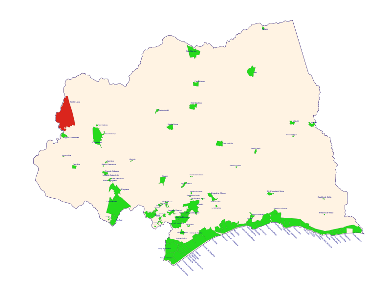
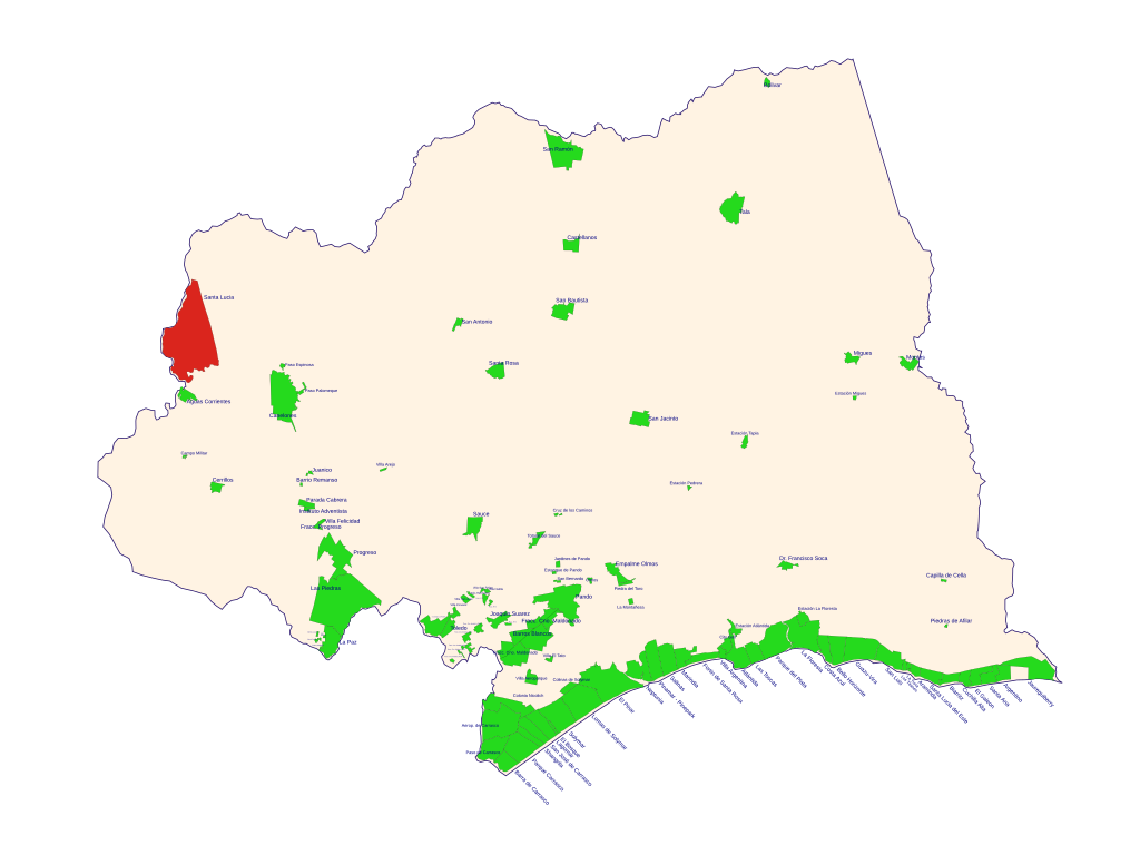
| Description | Mapa vectorial del departamento de Canelones (Uruguay), con ciudades, asentamientos y algunos barrios. La localidad de Santa Lucía esta resaltada con rojo. |
| Date | Unknown date |
| Source | Own work |
| Author | Zeroth |
Licensing[edit]
| I, the copyright holder of this work, release this work into the public domain. This applies worldwide. In some countries this may not be legally possible; if so: I grant anyone the right to use this work for any purpose, without any conditions, unless such conditions are required by law. |
File history
Click on a date/time to view the file as it appeared at that time.
| Date/Time | Thumbnail | Dimensions | User | Comment | |
|---|---|---|---|---|---|
| current | 16:18, 2 October 2007 | | 2,000 × 1,500 (681 KB) | Zeroth (talk | contribs) | Mapa vectorial del departamento de Canelones (Uruguay), con ciudades, asentamientos y algunos barrios. La localidad de '''Santa Lucía''' esta resaltada con rojo. |
You cannot overwrite this file.
File usage on Commons
There are no pages that use this file.