File:Cantons de Cayenne (svg).svg
Jump to navigation
Jump to search

Size of this PNG preview of this SVG file: 559 × 600 pixels. Other resolutions: 224 × 240 pixels | 447 × 480 pixels | 716 × 768 pixels | 954 × 1,024 pixels | 1,909 × 2,048 pixels | 1,552 × 1,665 pixels.
Original file (SVG file, nominally 1,552 × 1,665 pixels, file size: 5.72 MB)
Captions
Captions
Add a one-line explanation of what this file represents
Summary[edit]
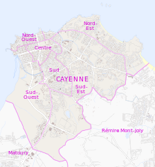
| Description |
Deutsch: Karte der Cantons von Cayenne
English: Map of adminstartive units of Cayenne
Français : Carte des cantons de Cayenne |
|||
| Date | see file history | |||
| Source | Own work, using OpenStreetMap data for the background | |||
| Author | Maximilian Dörrbecker (Chumwa) | |||
| Permission (Reusing this file) |
This file is licensed under the Creative Commons Attribution-Share Alike 2.0 Generic license.
|
|||
| Other versions |
|

.svg)
.svg&action=edit§ion=1)
File history
Click on a date/time to view the file as it appeared at that time.
| Date/Time | Thumbnail | Dimensions | User | Comment | |
|---|---|---|---|---|---|
| current | 17:11, 31 October 2013 | | 1,552 × 1,665 (5.72 MB) | Chumwa (talk | contribs) | == {{int:filedesc}} == {{Information |Description= {{de|Karte der Cantons von Cayenne}} {{en|Map of adminstartive units of Cayenne}} {{fr|Carte des cantons de Cayenne}} |Author=Maximilian Dörrbecker (Chumwa) |S... |
You cannot overwrite this file.
File usage on Commons
The following 3 pages use this file:
File usage on other wikis
The following other wikis use this file:
- Usage on de.wikipedia.org
.svg&oldid=847549367)