File:Capital Beltway Map Color.png
Jump to navigation
Jump to search
No higher resolution available.
Capital_Beltway_Map_Color.png (562 × 487 pixels, file size: 66 KB, MIME type: image/png)
Captions
Captions
Add a one-line explanation of what this file represents
Summary
[edit]
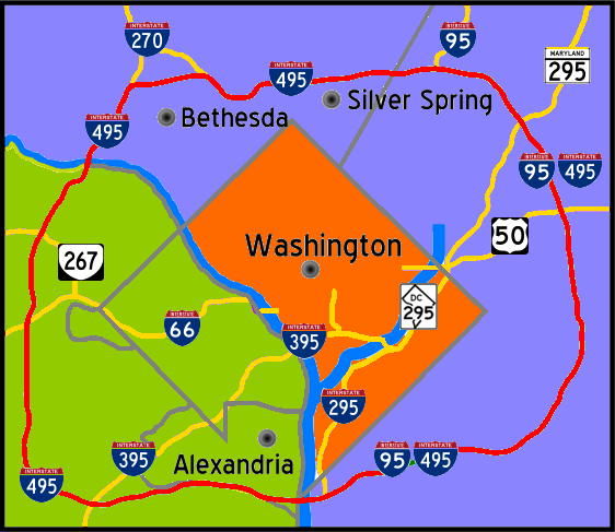
| Description | Interstate 495 in the state of Maryland and Commonwealth of Virgina in red surrounds the District of Columbia like a "belt", hence the name. |
| Date | |
| Source | Own work |
| Author | Squiggygfm |

|
File:Capital Beltway Map Color.svg is a vector version of this file. It should be used in place of this PNG file.
File:Capital Beltway Map Color.png → File:Capital Beltway Map Color.svg
For more information, see Help:SVG. |
 |
Licensing
[edit]
| I, the copyright holder of this work, release this work into the public domain. This applies worldwide. In some countries this may not be legally possible; if so: I grant anyone the right to use this work for any purpose, without any conditions, unless such conditions are required by law. |
File history
Click on a date/time to view the file as it appeared at that time.
| Date/Time | Thumbnail | Dimensions | User | Comment | |
|---|---|---|---|---|---|
| current | 19:55, 26 April 2007 | | 562 × 487 (66 KB) | Squiggyfm (talk | contribs) | {{Information |Description= Interstate 495 in the state of Maryland and Commonwealth of Virgina in red surrounds the District of Columbia like a "belt", hence the name. |Source= |Date= April 26, 2007 |Author= Squiggygfm }} |
You cannot overwrite this file.
File usage on Commons
There are no pages that use this file.