File:Captain Henry Wirz obelisk.JPG

Original file (4,608 × 3,456 pixels, file size: 5.5 MB, MIME type: image/jpeg)
Captions
Captions
Summary[edit]
| Description |
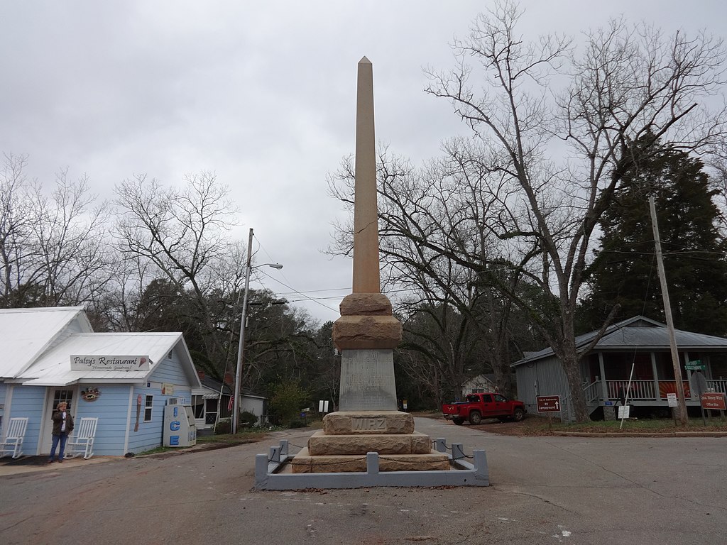
English: Captain Henry Wirz obelisk, Andersonville, Sumter County, Georgia. The text panels along the four sides of the monument read as follows:
When time shall have softened passion and prejudice, when reason shall have stripped the mask from misrepresentations, then justice, holding evenly her scales, will require much of past censures and praise to change places. Jefferson Davis, Dec. 1888
Discharging his duty with such humanity as the harsh circumstances of the times, and the policy of the foe permitted Capt. Wirz became at last the victim of a misdirected popular clamor. He was arrested in the time of peace, while under the protection of parole, tried by a military commission of a service to which he did not belong, and condemned to ignominious death on charges of excessive cruelty to Federal prisoners. He indignantly spurned a pardon proffered on condition that he would incriminate President Davis and thus exonerate himself from charges of which both were innocent.
In memory of Captain Henry Wirz, C.S.A. born Zurich, Switzerland, 1822, sentenced to death and executed at Washington D.C. November 10, 1865. To rescue his name from the stigma attached to it by embittered prejudice this shaft is erected by the Georgia division, United Daughters of the Confederacy.
|
| Date | |
| Source | Own work |
| Author | Michael Rivera |
| Other versions |
.JPG)
| Camera location | | View this and other nearby images on: OpenStreetMap |
|---|
Licensing[edit]
- You are free:
- to share – to copy, distribute and transmit the work
- to remix – to adapt the work
- Under the following conditions:
- attribution – You must give appropriate credit, provide a link to the license, and indicate if changes were made. You may do so in any reasonable manner, but not in any way that suggests the licensor endorses you or your use.
- share alike – If you remix, transform, or build upon the material, you must distribute your contributions under the same or compatible license as the original.
File history
Click on a date/time to view the file as it appeared at that time.
| Date/Time | Thumbnail | Dimensions | User | Comment | |
|---|---|---|---|---|---|
| current | 12:47, 9 January 2015 | | 4,608 × 3,456 (5.5 MB) | Mjrmtg (talk | contribs) | User created page with UploadWizard |
You cannot overwrite this file.
File usage on Commons
The following 2 pages use this file:
File usage on other wikis
The following other wikis use this file:
- Usage on tr.wikipedia.org