File:Carte des provinces belges.svg
Jump to navigation
Jump to search

Size of this PNG preview of this SVG file: 742 × 599 pixels. Other resolutions: 297 × 240 pixels | 594 × 480 pixels | 951 × 768 pixels | 1,268 × 1,024 pixels | 2,535 × 2,048 pixels | 921 × 744 pixels.
Original file (SVG file, nominally 921 × 744 pixels, file size: 24 KB)
Captions
Captions
Add a one-line explanation of what this file represents
| Description |
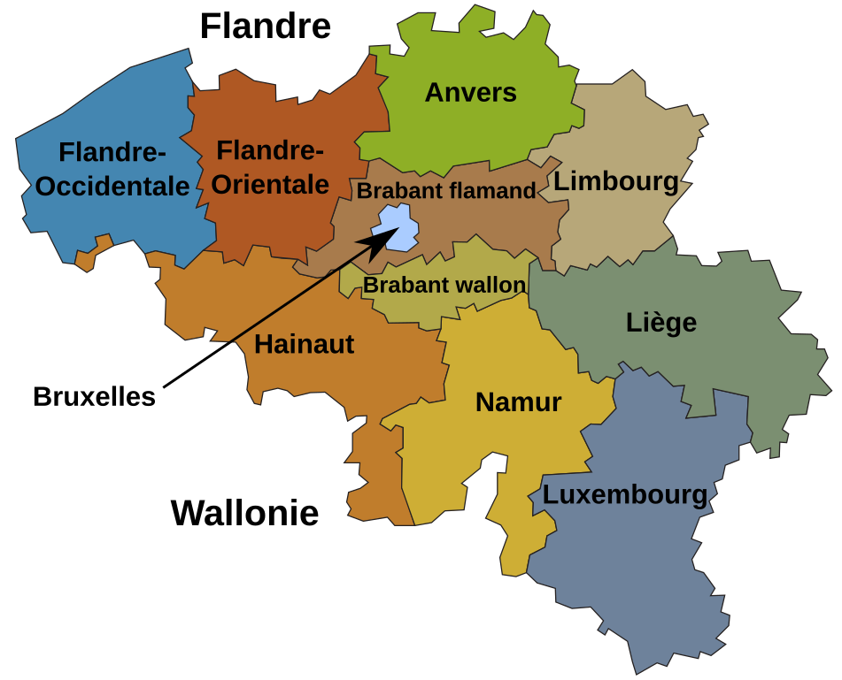
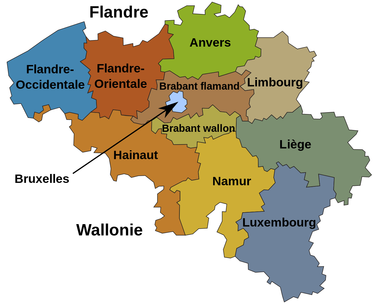
Norsk bokmål: Kart over Belgias regioner og provinser
Français : Carte des provinces de Belgique |
| Date | (UTC) |
| Source | |
| Author |
|
I, the copyright holder of this work, hereby publish it under the following licenses:
| This file is licensed under the Creative Commons Attribution-Share Alike 3.0 Unported license. | ||
| ||
| This licensing tag was added to this file as part of the GFDL licensing update. |

|
Permission is granted to copy, distribute and/or modify this document under the terms of the GNU Free Documentation License, Version 1.2 or any later version published by the Free Software Foundation; with no Invariant Sections, no Front-Cover Texts, and no Back-Cover Texts. A copy of the license is included in the section entitled GNU Free Documentation License. |
You may select the license of your choice.
Original upload log[edit]
This image is a derivative work of the following images:
- File:Belgia_regioner_og_provinser.svg licensed with Cc-by-sa-3.0-migrated, GFDL
- 2010-01-15T16:57:45Z Kjetil r 921x744 (137503 Bytes) riktig farge for Baarle-Hertog; ny farge for Brussel
- 2010-01-12T22:45:28Z FinnWikiNo 921x744 (131468 Bytes) Changed some of colors, changed «Vallonia» to «Vallonsk Brabant» and a minor issue more.
- 2010-01-11T23:39:43Z Kjetil r 842x595 (124550 Bytes) correct territory for Limburg
- 2008-09-23T16:09:48Z Kjetil r 842x595 (125824 Bytes) {{Information |Description={{no|Kart over Belgias regioner og provinser}} |Source=Based upon [[:Image:Belgium RegProv.png]] |Date=2008-09-23 |Author=Original map by [[User:Kneiphof]], SVG derivative and Norwegian translation
Uploaded with derivativeFX
File history
Click on a date/time to view the file as it appeared at that time.
| Date/Time | Thumbnail | Dimensions | User | Comment | |
|---|---|---|---|---|---|
| current | 17:06, 15 July 2010 | | 921 × 744 (24 KB) | Otourly (talk | contribs) | {{Information |Description={{no|Kart over Belgias regioner og provinser}} {{fr|Carte des provinces de Belgique}} |Source=*File:Belgia_regioner_og_provinser.svg |Date=2010-07-15 17:03 (UTC) |Author=*[[:File:Belgia_regione |
You cannot overwrite this file.
File usage on Commons
There are no pages that use this file.
File usage on other wikis
The following other wikis use this file: