File:Cartes pistes mars 2024 Mont-Avalanche Saint-Adolphe-d'Howard Quebec.jpg
Jump to navigation
Jump to search
Size of this preview: 450 × 600 pixels. Other resolutions: 180 × 240 pixels | 360 × 480 pixels | 576 × 768 pixels | 768 × 1,024 pixels | 1,536 × 2,048 pixels | 3,024 × 4,032 pixels.
Original file (3,024 × 4,032 pixels, file size: 3.26 MB, MIME type: image/jpeg)
Captions
Captions
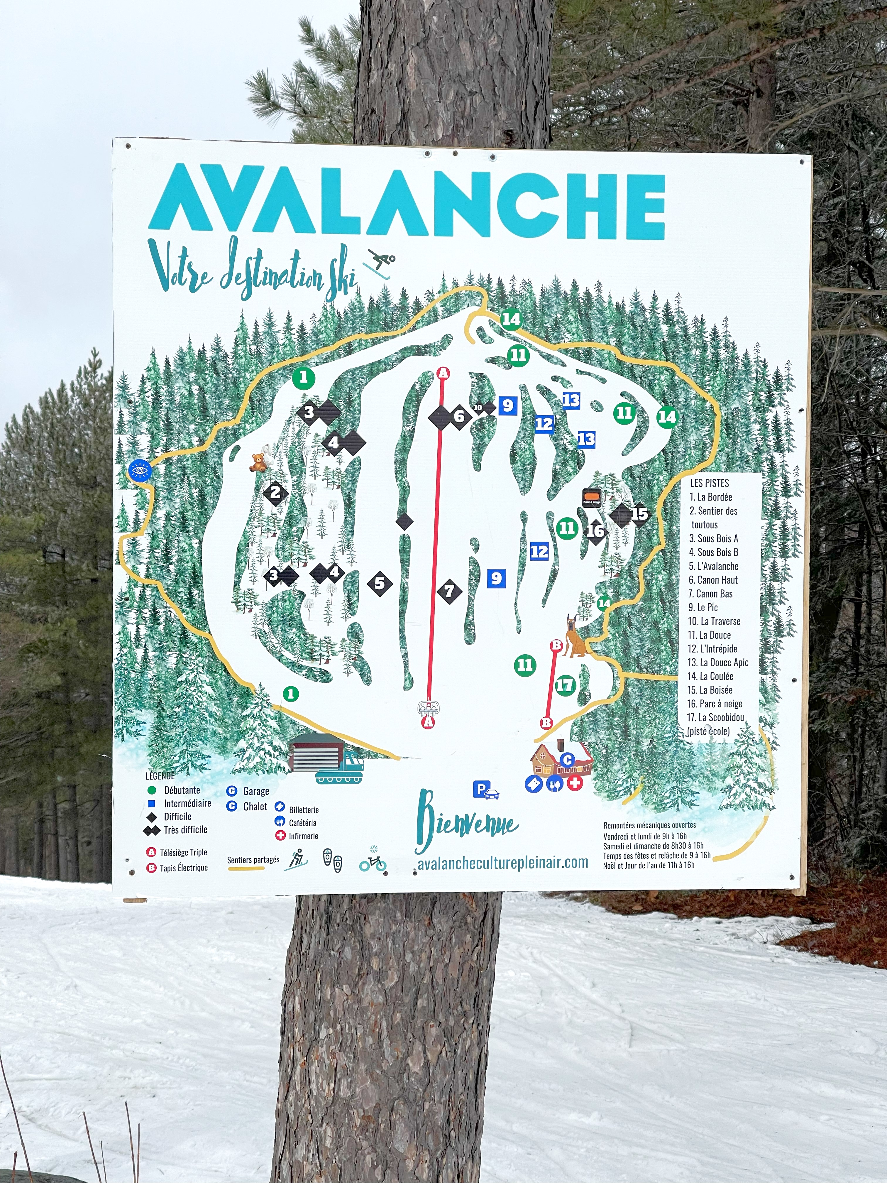
Skking trails of the Mont-Avalanche ski resort (March 2024)
Summary
[edit]
| Description |
Français : Cartes des pistes (mars 2024) de la station Mont-Avalanche à Saint-Adolphe-d'Howard au Québec
English: Skiing trails of the Mont-Avalanche ski resort in Saint-Adolphe-d'Howard, Quebec |
| Date | |
| Source | Own work |
| Author | Nicolas Pellemans |
| Camera location | | View this and other nearby images on: OpenStreetMap |
|---|
La publication de la carte des pistes de la station sur Wikipédia a été autorisée par la directrice des communications lors d'un entretien téléphonique le 29 mars 2024.
Licensing
[edit]
I, the copyright holder of this work, hereby publish it under the following license:
This file is licensed under the Creative Commons Attribution 4.0 International license.
- You are free:
- to share – to copy, distribute and transmit the work
- to remix – to adapt the work
- Under the following conditions:
- attribution – You must give appropriate credit, provide a link to the license, and indicate if changes were made. You may do so in any reasonable manner, but not in any way that suggests the licensor endorses you or your use.
File history
Click on a date/time to view the file as it appeared at that time.
| Date/Time | Thumbnail | Dimensions | User | Comment | |
|---|---|---|---|---|---|
| current | 15:18, 30 March 2024 | | 3,024 × 4,032 (3.26 MB) | Nicolas Pellemans (talk | contribs) | Uploaded own work with UploadWizard |
You cannot overwrite this file.
File usage on Commons
The following page uses this file:
File usage on other wikis
The following other wikis use this file:
- Usage on en.wikipedia.org
- Usage on fr.wikipedia.org